Yukon and Far Northwestern British Columbia: Alaska Hwy 1, Klondike Hwy 2, Cassiar Hwy 37 Corridor ..
|
Dawson City Front Street Webcam, on Hwy 2 in central Yukon
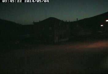
Elevation: 320 m / 1050 ft
|
|
Lake Laberge, north of Whitehorse, Yukon, on Hwy 2

Elevation: 660 m / 2170 ft
|
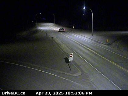
Main Street in Whitehorse, Yukon, on Hwy 1

Elevation: 660 m / 2170 ft
|
White Pass & Yukon Route Railroad Depot in Whitehorse, Yukon, on Hwy 1

Elevation: 660 m / 2170 ft
|
CBC Cam in Whitehorse, Yukon, on Hwy 1

Elevation: 660 m / 2170 ft
|
|
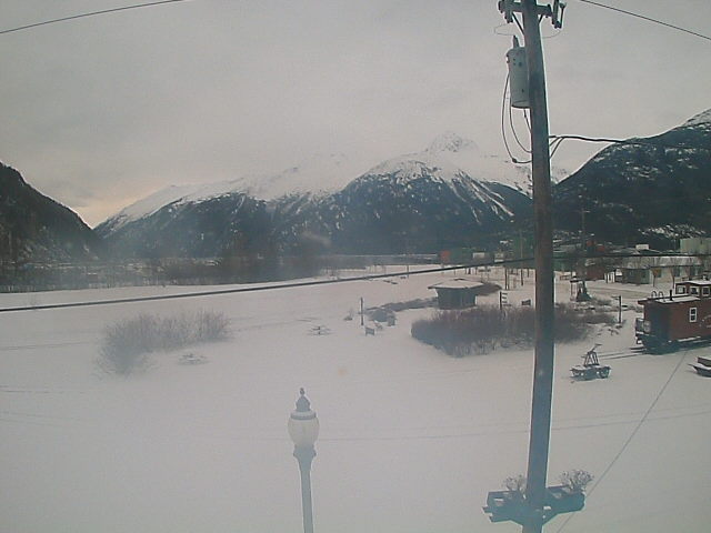
White Pass & Yukon Route Railroad Depot in Carcross, Yukon, on Hwy 2

Elevation: 660 m / 2170 ft
|
Carcross Cam, on Hwy 2 in Yukon, looking north

Elevation: 660 m / 2170 ft
|
Fraser Camp WeatherCam, on Hwy 2 in BC, looking north

Elevation: 850 m / 2800 ft
|
Fraser Camp WeatherCam, on Hwy 2 in BC, looking south

Elevation: 850 m / 2800 ft
|
|
Watson Lake, Yukon, on Hwy 1, looking ?

Elevation: 700 m / 2300 ft
|
Watson Lake, Yukon, on Hwy 1, looking west

Elevation: 700 m / 2300 ft
|
Watson Lake, Yukon, on Hwy 1, looking northeast

Elevation: 700 m / 2300 ft
|
Watson Lake, Yukon, on Hwy 1, looking southeast

Elevation: 700 m / 2300 ft
|
|
Junction of Hwy 37 and Commercial Drive in Dease Lake, BC, looking north on Hwy 37 (BCMOT)

Elevation: 800 m / 2600 ft
|
Alaska Panhandle: Northern Portion, Haines Hwy 7, Klondike Hwy 98, and Inside Passage Corridor ..
|
Cape Spencer, at the southern tip of Glacier Bay National Park, looking north (FAA)
![]()
Elevation: 24 ft
|
Cape Spencer, at the southern tip of Glacier Bay National Park, looking NE (FAA)
![]()
Elevation: 24 ft
|
Cape Spencer, at the southern tip of Glacier Bay National Park, looking SE (FAA)
![]()
Elevation: 24 ft
|
Gustavus, in Glacier Bay National Park, looking SW (FAA)
![]()
Elevation: 30 ft
|
Gustavus, in Glacier Bay National Park, looking NW (FAA)
![]()
Elevation: 30 ft
|
Hoonah, on Chichagof Isalnd, 20 miles SE of Gustavus across Icy Strait, looking west (FAA)
![]()
Elevation: 9 ft
|
Sisters Island, 6 miles NE of Hoonah in Icy Strait, looking SW (FAA)
![]()
Elevation: 53 ft
|
Sisters Island, 6 miles NE of Hoonah in Icy Strait, looking NW (FAA)
![]()
Elevation: 53 ft
|
Sisters Island, 6 miles NE of Hoonah in Icy Strait, looking NE (FAA)
![]()
Elevation: 53 ft
|
|
Haines Hwy 7 @ Klehini MP 36.6, northwest of Haines, looking west (AKDOT)

Elevation: 600 ft
|
Haines Hwy 7 @ Klehini MP 36.6, northwest of Haines, looking east (AKDOT)
Elevation: 600 ft
|
Haines Hwy 7 @ Chilkat River Bridge MP 23.8, northwest of Haines, looking NW (AKDOT)
Elevation: 150 ft
|
Haines Hwy 7 @ Chilkat River Bridge MP 23.8, northwest of Haines, looking west (AKDOT)
Elevation: 150 ft
|
Haines Hwy 7 @ Chilkat River Bridge MP 23.8, northwest of Haines, looking SW (AKDOT)
Elevation: 150 ft
|
Haines FAA Weathercam, looking south
![]()
Elevation: 265 ft
|
Haines FAA Weathercam, looking west
![]()
Elevation: 265 ft
|
Haines FAA Weathercam, looking north
![]()
Elevation: 265 ft
|
|
Skagway FAA Weathercam, looking NE
![]()
Elevation: 16 ft
|
Skagway FAA Weathercam, looking south
![]()
Elevation: 16 ft
|
Skagway FAA Weathercam, looking SW
![]()
Elevation: 16 ft
|
White Pass & Yukon Route Railroad Cam in Skagway, AK
Elevation: 50 ft
|
Skagway Loading Dock, Alaska Marine Lines Webcam

Elevation: 50 ft
|
|
Alaska Panhandle: Central Portion, north of Juneau along Glacier Hwy 7 Corridor ..
|
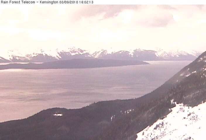
Kensington Ridge Webcam, NW of Berners Bay, looking SE at Berners Bay
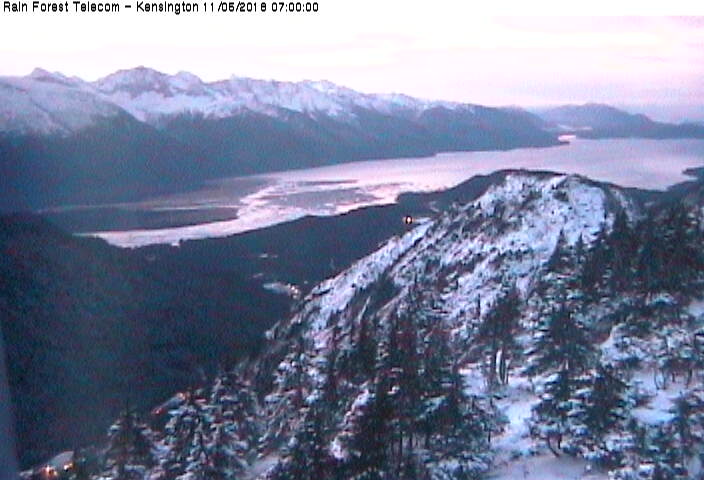
Elevation: 2800 ft
|
Kensington Ridge Webcam, NW of Berners Bay, looking south
Elevation: 2800 ft
|
Kensington Ridge Webcam, NW of Berners Bay, looking SW at Lynn Canal

Elevation: 2800 ft
|
Kensington Ridge Webcam, NW of Berners Bay, looking west at Point Sherman

Elevation: 2800 ft
|
Kensington Ridge Webcam, NW of Berners Bay, looking NW at Lynn Canal
Elevation: 2800 ft
|
Berners Bay, north of Juneau on Glacier Hwy 7 @ MP 40, looking west (FAA)
![]()
Elevation: 29 ft
|
Berners Bay, north of Juneau on Glacier Hwy 7 @ MP 40, looking NW (FAA)
![]()
Elevation: 29 ft
|
Berners Bay, north of Juneau on Glacier Hwy 7 @ MP 40, looking north (FAA)
![]()
Elevation: 29 ft
|
Glacier Hwy 7 @ Cohen Drive MP 21, north of Juneau, looking south (AKDOT)
Elevation: 200 ft
|
Lena Point, north of Juneau on Glacier Hwy 7 @ MP 17, looking south (FAA)
![]()
Elevation: 170 ft
|
Lena Point, north of Juneau on Glacier Hwy 7 @ MP 17, looking SW (FAA)
![]()
Elevation: 170 ft
|
Lena Point, north of Juneau on Glacier Hwy 7 @ MP 17, looking NW (FAA)
![]()
Elevation: 170 ft
|
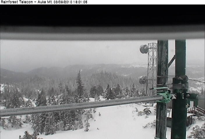
Auke Mountain Webcam, NW of Juneau on Glacier Hwy 7 @ MP 16, looking east at Mendenhall Glacier
Elevation: 1900 ft
|
Auke Mountain Webcam, NW of Juneau on Glacier Hwy 7 @ MP 16, looking SE towards Juneau
Elevation: 1900 ft
|
Auke Mountain Webcam, NW of Juneau on Glacier Hwy 7 @ MP 16, looking SE towards Fritz Cove
Elevation: 1900 ft
|
Auke Mountain Webcam, NW of Juneau on Glacier Hwy 7 @ MP 16, looking south towards Outer Point
Elevation: 1900 ft
|
Auke Mountain Webcam, NW of Juneau on Glacier Hwy 7 @ MP 16, looking SW
Elevation: 1900 ft
|
Auke Mountain Webcam, NW of Juneau on Glacier Hwy 7 @ MP 16, looking west towards Lynn Canal
Elevation: 1900 ft
|
Pedersen Hill, north of Juneau on Glacier Hwy 7 @ MP 11, looking NE (FAA)
![]()
Elevation: 189 ft
|
Pedersen Hill, north of Juneau on Glacier Hwy 7 @ MP 11, looking SW (FAA)
![]()
Elevation: 189 ft
|
Pedersen Hill, north of Juneau on Glacier Hwy 7 @ MP 11, looking SW (FAA)
![]()
Elevation: 189 ft
|
Pedersen Hill, north of Juneau on Glacier Hwy 7 @ MP 11, looking west (FAA)
![]()
Elevation: 189 ft
|
Mendenhall Glacier Visitor Center, north of Juneau, east of Glacier Hwy 7 @ MP 10

Elevation: 200 ft
|
Alaska Panhandle: Central Portion, Juneau and Vicinity, Glacier Hwy 7 Corridor ..
|
Glacier Highway/Egan Drive @ MP 3, in Juneau, looking NW towards airport (AKDOT)
Elevation: 50 ft
|
Glacier Highway/Egan Drive @ MP 3, in Juneau, looking SE (AKDOT)
Elevation: 50 ft
|
Glacier Highway/Egan Drive @ MP 3, in Juneau, looking SE at bridge (AKDOT)
Elevation: 50 ft
|
Juneau National Weather Service Webcam, looking NW

Elevation: 100 ft
|
Juneau National Weather Service Webcam, looking NE

Elevation: 100 ft
|
Juneau National Weather Service Webcam, looking SE

Elevation: 100 ft
|
City and Borough Of Juneau Cams, looking north from library

Elevation: 100 ft
|
City and Borough Of Juneau Cams, looking south from library

Elevation: 100 ft
|
City and Borough Of Juneau Cams, looking at roundabout

Elevation: 100 ft
|
Juneau Loading Dock, Alaska Marine Lines Webcam

Elevation: 50 ft
|
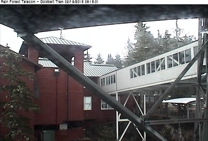
Goldbelt Mt Roberts Tram Webcam, just south of Juneau, looking NW up-valley from aerial tramway top station
Elevation: 1800 ft
|
Goldbelt Mt Roberts Tram Webcam, just south of Juneau, looking down at Juneau from aerial tramway top station

Elevation: 1800 ft
|
Goldbelt Mt Roberts Tram Webcam, just south of Juneau, looking down at aerial tramway base station

Elevation: 1800 ft
|
Goldbelt Mt Roberts Tram Webcam, just south of Juneau, looking at aerial tramway top station
Elevation: 1800 ft
|
|
The Highlands, south of Juneau on Douglas Island, looking towards Juneau

Elevation: 200 ? ft
|
Eaglecrest Ski Area Platter Cam (base), south of Juneau on Douglas Island

Elevation: 1200 ft
|
Eaglecrest Ski Area Ptarmigan Cam (top), south of Juneau on Douglas Island

Elevation: 2600 ft
|
|
Taku Inlet, 10 miles east of Juneau, looking NE (FAA)
![]()
Elevation: 42 ft
|
Taku Inlet, 10 miles east of Juneau, looking east (FAA)
![]()
Elevation: 42 ft
|
Taku Inlet, 10 miles east of Juneau, looking south (FAA)
![]()
Elevation: 42 ft
|
Alaska Panhandle: Southern Portion, Mitkof Hwy 7, Tongass Hwy 7 and Inside Passage Corridor ..
|
Sitka Airport, just west of the City of Sitka, looking south (FAA)
![]()
Elevation: 3 ft
|
Sitka Airport, just west of the City of Sitka, looking NW (FAA)
![]()
Elevation: 3 ft
|
City of Sitka South Cam, looking south

Elevation: 100 ft
|
City of Sitka West Cam, looking west at Mt Edgecumbe

Elevation: 100 ft
|
Sitka Loading Dock, Alaska Marine Lines Webcam

Elevation: 50 ft
|
Angoon, on the west coast of Admiralty Island, looking SE (FAA)
![]()
Elevation: 34 ft
|
|
Petersburg Loading Dock, Alaska Marine Lines Webcam, at north end of Mitkof Island

Elevation: 50 ft
|
Lindenberg Peak, Kupreanof Island west of Petersburg, looking west over Duncan Canal

Elevation: 2600 ft
|
Level Island, in Sumner Strait SE of Kupreanof Island, looking NE (FAA)
![]()
Elevation: 85 ft
|
Mitkof Hwy 7 @ Blaquiere Point MP 33, on the southeast tip of Mitkof Island, looking SE towards Wrangell (AKDOT)
Elevation: 50 ft
|
Wrangell, at the northern tip of Wrangell Island, looking NW (FAA)
![]()
Elevation: 167 ft
|
Wrangell, at the northern tip of Wrangell Island, looking north (FAA)
![]()
Elevation: 167 ft
|
Wrangell, at the northern tip of Wrangell Island, looking east (FAA)
![]()
Elevation: 167 ft
|
Etolin Island communication site, looking north from 18 miles south of Wrangell

Elevation: 3600 ft
|
|
Klawock, north of Craig on Prince of Wales Island, looking NW (FAA)
![]()
Elevation: 53 ft
|
View looking NW at Sunnahae (Sunny Hay) Mtn, east of Craig on Prince of Wales Island

Elevation: 500 ? ft
|
|
High Mountain, on Gravina Island west of Ketchikan, looking west

Elevation: 1000 ft
|
Ketchikan Airport, on Gravina Island west of Ketchikan, looking NW (FAA)
![]()
Elevation: 32 ft
|
Ketchikan Airport, on Gravina Island west of Ketchikan, looking NE (FAA)
![]()
Elevation: 32 ft
|
Ketchikan Airport, on Gravina Island west of Ketchikan, looking SE (FAA)
![]()
Elevation: 32 ft
|
Ketchikan Airport, on Gravina Island west of Ketchikan, looking south (FAA)
![]()
Elevation: 32 ft
|
Ketchikan Loading Dock, Alaska Marine Lines Webcam

Elevation: 50 ft
|
Metlakatla, on Annette Island, looking NE (FAA)
![]()
Elevation: 32 ft
|
Northeastern British Columbia: Alaska Hwy 97, John Hart Hwy 97 Corridor ..
|
|
|
Hwy 97 at Fort Nelson weigh scale, looking north (BCMOT)
Elevation: 350 m / 1150 ft
|
|
Hwy 97 at Beatton Airport Rd, 44 km north of Fort St. John, looking north (BCMOT)

Elevation: 850 m / 2800 ft
|
City of Fort St. John on Hwy 97, Enerplex Webcam

Elevation: 700 m / 2300 ft
|
Hwy 97 at South Taylor Hill, 20 km south of Fort St John, looking north (BCMOT)

Elevation: 630 m / 2070 ft
|
Dawson Creek Airport WeatherCam, on Hwy 2, looking west

Elevation: 655 m / 2150 ft
|
Dawson Creek Airport WeatherCam, on Hwy 2, looking east

Elevation: 655 m / 2150 ft
|
Hwy 2 south of Dawson Creek, 2 km west of BC/Alberta border, facing east (BCMOT)

Elevation: 850 m / 2800 ft
|
Tumbler Ridge, Hwy 29 at Hwy 52, looking west on Hwy 29 (BCMOT)

Elevation: 850 m / 2800 ft
|
Hwy 97 at Wabi Estates Road, east of Chetwynd, looking east (BCMOT)

Elevation: 760 m / 2500 ft
|
|
Pine Pass, Hwy 97, north of Mackenzie Junction at Powder King access road, looking north (BCMOT)

Elevation: 935 m / 3070 ft
|
Mackenzie Airport WeatherCam, on Hwy 39 north of Hwy 97, looking north

Elevation: 690 m / 2265 ft
|
Mackenzie Airport WeatherCam, on Hwy 39 north of Hwy 97, looking SE

Elevation: 690 m / 2265 ft
|
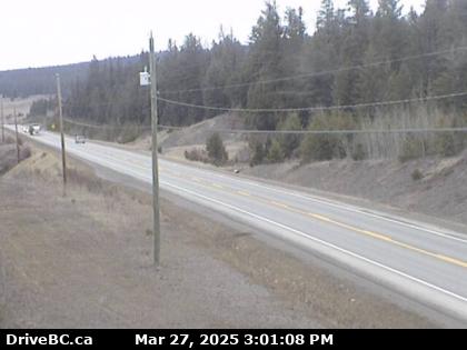
Hwy 97 at Summit Lake Rd, about 33 km north of Prince George, looking north (BCMOT)

Elevation: 716 m / 2350 ft
|
Peden Hill, Hwy 16 at Vance Rd in Prince George, looking westbound (BCMOT)
Elevation: 585 m / 1920 ft
|
Peden Hill, Hwy 16 at Davis Rd in Prince George, looking eastbound (BCMOT)

Elevation: 640 m / 2100 ft
|
University of Northern British Columbia in Prince George

Elevation: 760 m / 2500 ft
|
Northwestern British Columbia: Yellowhead Hwy 16, Hwy 35, Hwy 37 Corridor ..
|
Prince Rupert Airport WeatherCam, looking east

Elevation: 35 m / 120 ft
|
Prince Rupert Airport WeatherCam, looking SW

Elevation: 35 m / 120 ft
|
Prince Rupert Airport WeatherCam, looking NW

Elevation: 35 m / 120 ft
|
Prince Rupert, Seal Cove, looking north

Elevation: 10 m / 30 ft
|
Hwy 16 at Port Edward arterial road, looking west (BCMOT)

Elevation: 30 ? m / 100 ? ft
|
Hwy 16, at Kasiks resort area, 60 km west of Terrace, looking west (BCMOT)

Elevation: 12 m / 40 ft
|
Hwy 37 at Hwy 16 near Terrace, looking east (BCMOT)

Elevation: 100 ? m / 300 ? ft
|
Terrace on Hwy 16, looking east

Elevation: 100 ? m / 300 ? ft
|
Terrace on Hwy 16, looking SE

Elevation: 100 ? m / 300 ? ft
|
Terrace on Hwy 16, looking ?

Elevation: 100 ? m / 300 ? ft
|
Lakelse Lake, on Hwy 37, about 10 km south of Terrace, looking west?

Elevation: 100 ? m / 300 ? ft
|
Onion Lake on Hwy 37, about 28 km south of Terrace, looking north (BCMOT)

Elevation: 220 m / 700 ft
|
Hwy 37 at Oolichan Avenue, 5 km north of Kitimat, looking north (BCMOT)

Elevation: 30 ? m / 100 ? ft
|
Junction of Hwy 16 and Hwy 37, near Kitwanga, looking west on Hwy 16 (BCMOT)

Elevation: 180 m / 600 ft
|
Smithers, Hwy 16 at Main Street, looking west (BCMOT)

Elevation: 500 m / 1650 ft
|
Hudson Bay Mtn, west of Smithers on Hwy 16, looking SE from Panorama Lodge

Elevation: 1430 m / 4700 ft
|
Hudson Bay Mtn, west of Smithers on Hwy 16, looking SE

Elevation: 1520 m / 5000 ft
|
Hudson Bay Mtn, west of Smithers on Hwy 16, looking SW

Elevation: 1520 m / 5000 ft
|
Hwy 16 at Anderson Road, 14 km NW of Houston, looking east (BCMOT)
Elevation: 790 m / 2600 ft
|
Hwy 35 at Southbank ferry landing on Francois Lake, looking north (BCMOT)

Elevation: 715 m / 2350 ft
|
Savory Rest Area, Hwy 16, 48 km east of Burns Lake, looking west (BCMOT)
Elevation: 700 m / 2300 ft
|
Looking over the south end of Stuart Lake, Fort St James, on Hwy 27

Elevation: 700 m / 2300 ft
|
Hwy 16 at Bednesti between Prince George and Vanderhoof, looking west (BCMOT)
Elevation: 780 m / 2560 ft
|
West-Central British Columbia: Queen Charlotte Islands, Coastal Islands and Hwy 20, Cariboo Hwy 97 Corridor ..
|
Sandspit Airport WeatherCam, Queen Charlotte Islands, looking west

Elevation: 10 m / 30 ft
|
Sandspit Airport WeatherCam, Queen Charlotte Islands, looking south

Elevation: 10 m / 30 ft
|
South Moresby Air Charters, Queen Charlotte Islands

Elevation: 10 m / 30 ft
|
Hartley Bay School in Hartley Bay, 145 km south of Prince Rupert

Elevation: 30 m / 100 ft
|
Boat Bluff Lightstation, Sarah Island 5 km north of Klemtu, looking south

Elevation: 30 m / 100 ft
|
Bella Bella (Campbell Island) Airport WeatherCam, looking north

Elevation: 45 m / 150 ft
|
Bella Bella (Campbell Island) Airport WeatherCam, looking SE

Elevation: 45 m / 150 ft
|
Addenbroke Island WeatherCam, looking NW

Elevation: 50 ? m / 150 ? ft
|
Addenbroke Island WeatherCam, looking south

Elevation: 50 ? m / 150 ? ft
|
|
Hwy 20, near Anahim Lake, about 140 km east of Bella Coola, looking west (BCMOT)
Elevation: 1100 m / 3600 ft
|
Tatla Lake, on Hwy 20, southeast of Anahim Lake

Elevation: 920 m / 3000 ft
|
|
Quesnel Airport WeatherCam, looking NW

Elevation: 550 m / 1800 ft
|
Quesnel Airport WeatherCam, looking west

Elevation: 550 m / 1800 ft
|
Quesnel Airport WeatherCam, looking SE

Elevation: 550 m / 1800 ft
|
Dragon Lake, Hwy 97, 10.5km south of Quesnel, looking south (BCMOT)

Elevation: 660 m / 2170 ft
|
Williams Lake Golf and Tennis Club, on Hwy 20 west of Williams Lake

Elevation: 640 m / 2100 ft
|
Enterprise, Hwy 97, 37km south of Williams Lake, looking north (BCMOT)
Elevation: 730 m / 2400 ft
|
South Cariboo Regional Airport, 108 Mile Ranch on Hwy 97, looking north

Elevation: 960 m / 3150 ft
|
100 Mile House on Hwy 97, view from 100 Mile Netshop

Elevation: 950 m / 3100 ft
|
100 Mile House on Hwy 97, view from 100 Mile Netshop

Elevation: 950 m / 3100 ft
|
Begbie Summit, Hwy 97 south of 100 Mile House, looking north (BCMOT)

Elevation: 1240 m / 4070 ft
|
Sheridan Lake, Hwy 24, 63 km west of Little Fort, looking west (BCMOT)

Elevation: 1130 m / 3700 ft
|
Lookout Tower in Bridge Lake, on Hwy 24 east of Hwy 97

Elevation: 1200 m / 4000 ft
|
Lookout Tower in Bridge Lake, on Hwy 24 east of Hwy 97

Elevation: 1200 m / 4000 ft
|
|
| Map of Camera Sites: (each corridor is enclosed in a gray box) |
NOTE: Webcams in the rest of Alaska are shown on the adjacent
Alaska Mountain WebCams page.
|
 |
| Yukon and Far Northwestern British Columbia: Alaska Hwy 1, Klondike Hwy 2, Cassiar Hwy 37 Corridor |
|
|
|
|
|
|
|
|
|
|
|
|
|
|
|
|
|
|
14 |
|
| Alaska Panhandle: Northern Portion, Haines Hwy 7, Klondike Hwy 98, and Inside Passage Corridor |
![]() |
![]() |
![]() |
![]() |
![]() |
![]() |
![]() |
![]() |
![]() |
|
|
|
|
|
|
![]() |
![]() |
![]() |
|
![]() |
![]() |
![]() |
|
|
|
22 |
| Alaska Panhandle: Central Portion, north of Juneau along Glacier Hwy 7 Corridor |
|
|
|
|
|
![]() |
![]() |
![]() |
|
![]() |
![]() |
![]() |
|
|
|
|
|
|
![]() |
![]() |
![]() |
![]() |
|
23 |
| Alaska Panhandle: Central Portion, Juneau and Vicinity, Glacier Hwy 7 Corridor |
|
|
|
|
|
|
|
|
|
|
|
|
|
|
|
|
|
|
|
![]() |
![]() |
![]() |
20 |
| Alaska Panhandle: Southern Portion, Mitkof Hwy 7, Tongass Hwy 7 and Inside Passage Corridor |
![]() |
![]() |
|
|
|
![]() |
|
|
|
![]() |
|
![]() |
![]() |
![]() |
|
|
![]() |
|
|
|
![]() |
![]() |
![]() |
![]() |
|
![]() |
23 |
|
| Northeastern British Columbia: Alaska Hwy 97, John Hart Hwy 97 Corridor |
|
|
|
|
|
|
|
|
|
|
|
|
|
|
|
|
|
|
|
|
16 |
| Northwestern British Columbia: Yellowhead Hwy 16, Hwy 35, Hwy 37 Corridor |
|
|
|
|
|
|
|
|
|
|
|
|
|
|
|
|
|
|
|
|
|
|
|
23 |
| West-Central British Columbia: Queen Charlotte Islands, Coastal Islands and Hwy 20, Cariboo Hwy 97 Corridor |
|
|
|
|
|
|
|
|
|
|
|
|
|
|
|
|
|
|
|
|
|
|
|
|
|
|
24 |
|
|
|
| Page History: |
|
|
|
Page Statistics: |
| November 2008 | Original version with 124 camera views in 7 corridors (rows), based on the
Washington Mountain WebCams webpage; includes a PHP script to allow changing the image size
Also includes a regional map with a table of mini camera images (including row counts),
and the option to show pixel rulers along the bottom and right edges of the page
Note that some of these images are multiple directional views from a single camera
Later added "Page Statistics" to the right
|
Page loaded at 8:02 AM PDT on Sunday, October 26, 2025
Total camera images: 165
FAA Weather Cams: 41
Alaska DOT Highway Cams: 10
National Weather Service: 3
US Forest Service: 1
Rainforest Telecom: 15
BCMOT Highway Cams: 27
WeatherOffice WeatherCams: 18
WeatherBug InstaCams: 2
Approximate page width: 9300 pixels 9204
Approximate page height: 4000 pixels 3912
|
| December 2008 | Expanded to 147 camera views, and split Juneau area webcams into two corridors (rows)
Updated links to all BCMOT Highway Cams
Optimized and improved the PHP code which extracts FAA Weathercam image URLs
|
| April 2009 | Expanded to 148 camera views
Fixed all BCMOT camera links which had changed
|
| December 2009 | Fixed some camera links which had changed |
| January 2010 | Expanded to 165 camera views, fixed several camera links which had changed
Updated the site navigation bars to include the various other Mountain WebCams pages
Added direct links to camera pages for all FAA Weather Cams,
since "Site Page Bookmarking" was enabled at long last in October 2009
Finally added webcams and corridors to the previously empty map
|
|