| SR 168 Corridor via Shaver Lake and Huntington Lake, Sierra National Forest |
|||||||||||||||||||||||||||||||||||||||
| Sierra Remote Observatories, Alder Springs north of SR 168 (boring buildings by day, but roofs roll off at night to reveal telescopes)  Elevation: 4610 ft |
Sierra Remote Observatories, Alder Springs north of SR 168 (boring buildings by day, but roofs roll off at night to reveal telescopes)  Elevation: 4610 ft |
Sierra Remote Observatories, Alder Springs north of SR 168 (boring building by day, but roof rolls off at night to reveal telescopes)  Elevation: 4610 ft |
Sunrock at Shaver Lake, just west of SR 168, 1.3 miles SW of Shaver Lake, looking south Elevation: 5600 ft |
Sierra Marina at northernmost end of Shaver Lake on SR 168  Elevation: 5400 ft |
Sierra Marina at northernmost end of Shaver Lake on SR 168  Elevation: 5400 ft |
Sierra Marina at northernmost end of Shaver Lake on SR 168  Elevation: 5400 ft |
China Peak Mountain Resort, bottom of Summit lift, on SR 168, just SE of Huntington Lake Elevation: 7030 ft |
||||||||||||||||||||||||||||||||
| SR 180 Corridor, Sequoia National Forest and Kings Canyon National Park |
|||||||||||||||||||||||||||||||||||||||
| Sierra Wildland Fire Cam, Delilah Lookout, north of SR 180, looking north  Elevation: 5150 ft |
Sierra Wildland Fire Cam, Delilah Lookout, north of SR 180, looking east  Elevation: 5150 ft |
Sierra Wildland Fire Cam, Delilah Lookout, north of SR 180, looking SE  Elevation: 5150 ft |
Sierra Wildland Fire Cam, Delilah Lookout, north of SR 180, looking SE  Elevation: 5150 ft |
Hume Lake, south of SR 180 and NE of Grant Grove Village, looking NE  Elevation: 5200 ft |
Hume Lake, south of SR 180 and NE of Grant Grove Village  Elevation: 5200 ft |
Hume Lake, south of SR 180 and NE of Grant Grove Village  Elevation: 5200 ft |
|||||||||||||||||||||||||||||||||


| SR 198 Corridor, Sequoia National Park |
|||||||||||||||||||||||||||||||||||||||
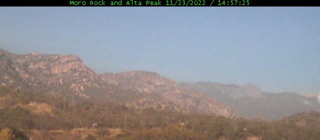
| Sequoia NP, Air Quality Webcam, looking SW from Giant Forest on SR 198  Elevation: 6400 ft |
Sierra Wildland Fire Cam, Milk Ranch Peak, SE of SR 198, looking NNE to Moro Rock  Elevation: 6250 ft |
Sierra Wildland Fire Cam, Milk Ranch Peak, SE of SR 198, looking ENE to Castle Rocks  Elevation: 6250 ft |
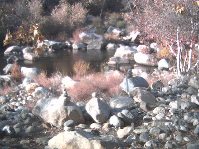
Silver City Webcam, Sequoia NP, 21 miles east of SR 198 on Mineral King Rd  Elevation: 6950 ft |
Mineral King, Faculty Flat Webcam, Sequoia NP, 24 miles east of SR 198  Elevation: 7440 ft |
Mineral King Webcam, Sequoia NP, 25 miles east of SR 198, looking north  Elevation: 7830 ft |
Mineral King, Farewell Gap Webcam, Sequoia NP, 25 miles east of SR 198, looking south 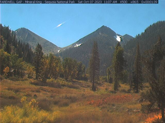 Elevation: 7830 ft |
|||||||||||||||||||||||||||||||||


| SR 190 and Sherman Pass Road Corridor, Sequoia National Forest and Giant Sequoia National Monument |
|||||||||||||||||||||||||||||||||||||||
| Alpine Village NetCam, on the SW slopes of Jordan Peak, north of Camp Nelson on SR 190, looking south at Slate Mtn  Elevation: 6600 ft |
Sierra Wildland Fire Cam, Jordan Peak, north of Camp Nelson on SR 190, looking north  Elevation: 9120 ft |
Sierra Wildland Fire Cam, Jordan Peak, north of Camp Nelson on SR 190, looking east  Elevation: 9120 ft |
Sierra Wildland Fire Cam, Jordan Peak, north of Camp Nelson on SR 190, looking SE  Elevation: 9120 ft |
Sierra Wildland Fire Cam, Jordan Peak, north of Camp Nelson on SR 190, looking west  Elevation: 9120 ft |
Sierra Wildland Fire Cam, Jordan Peak, north of Camp Nelson on SR 190, looking west  Elevation: 9120 ft |
Sierra Wildland Fire Cam, Jordan Peak, north of Camp Nelson on SR 190, looking NW  Elevation: 9120 ft |
Sierra Wildland Fire Cam, Jordan Peak, north of Camp Nelson on SR 190, looking NW  Elevation: 9120 ft |
||||||||||||||||||||||||||||||||
| Sierra Wildland Fire Cam, Mule Peak, south of SR 190, looking west  Elevation: 8150 ft |
Sierra Wildland Fire Cam, Mule Peak, south of SR 190, looking NW  Elevation: 8150 ft |
Sierra Wildland Fire Cam, Mule Peak, south of SR 190, looking SE  Elevation: 8150 ft |
Sierra Wildland Fire Cam, Mule Peak, south of SR 190, looking SW  Elevation: 8150 ft |
Sierra Wildland Fire Cam, Sherman Peak, west of US 395, looking NW  Elevation: 9920 ft |
Sierra Wildland Fire Cam, Sherman Peak, west of US 395, looking north  Elevation: 9920 ft |
Sierra Wildland Fire Cam, Sherman Peak, west of US 395, looking NE  Elevation: 9920 ft |
Sierra Wildland Fire Cam, Sherman Peak, west of US 395, looking east  Elevation: 9920 ft |
Sierra Wildland Fire Cam, Sherman Peak, west of US 395, looking SE  Elevation: 9920 ft |
Sierra Wildland Fire Cam, Sherman Peak, west of US 395, looking SW  Elevation: 9920 ft |
Sierra Wildland Fire Cam, Sherman Peak, west of US 395, looking west  Elevation: 9920 ft |
| Sierra Wildland Fire Cam, Bald Mtn Lookout, west of US 395, looking NW  Elevation: 9380 ft |
Sierra Wildland Fire Cam, Bald Mtn Lookout, west of US 395, looking NE  Elevation: 9380 ft |
Sierra Wildland Fire Cam, Bald Mtn Lookout, west of US 395, looking east  Elevation: 9380 ft |
Sierra Wildland Fire Cam, Bald Mtn Lookout, west of US 395, looking south  Elevation: 9380 ft |
Sierra Wildland Fire Cam, Bald Mtn Lookout, west of US 395, looking west  Elevation: 9380 ft |
Sierra Wildland Fire Cam, Tobias Peak, north of SR 155, looking SE  Elevation: 8300 ft |
Sierra Wildland Fire Cam, Tobias Peak, north of SR 155, looking south  Elevation: 8300 ft |
Sierra Wildland Fire Cam, Tobias Peak, north of SR 155, looking SW  Elevation: 8300 ft |
Sierra Wildland Fire Cam, Tobias Peak, north of SR 155, looking NW  Elevation: 8300 ft |
Sierra Wildland Fire Cam, Tobias Peak, north of SR 155, looking NE  Elevation: 8300 ft |
| SR 155 and SR 178 Corridor, Alta Sierra Ski Area, Isabella Lake, Sequoia National Forest |
|||||||||||||||||||||||||||||||||||||||
| Alta Sierra on SR 155, NW of Isabella Lake, 1 mile SE of Greenhorn Summit Elevation: 5700 ft |
Alta Sierra Ski Area at Shirley Meadows, 2 miles south of SR 155, Ridge Cam  Elevation: 6700 ft |
Alta Sierra Ski Area at Shirley Meadows, 2 miles south of SR 155, Lake View Cam  Elevation: 6700 ft |
Alta Sierra Ski Area at Shirley Meadows, 2 miles south of SR 155, WebCam  Elevation: 6700 ft |
Alta Sierra Ski Area at Shirley Meadows, 2 miles south of SR 155, WebCam  Elevation: 6700 ft |
Alta Sierra Ski Area at Shirley Meadows, 2 miles south of SR 155, WebCam  Elevation: 6700 ft |
||||||||||||||||||||||||||||||||||


| Show telemetry | Hide telemetry | |||||||||||||||||||||||||||
|
|||||||||||||||||||||||||||