Northern Sierra Nevada: I-80 Hwy Corridor ..
|
Applegate on I-80 @ MP 128, looking south (Caltrans)
![]()
Elevation: 2050 ft
|
Colfax on I-80 @ MP 135, looking north (Caltrans)
![]()
Elevation: 2400 ft
|
Dutch Flat on I-80 @ MP 145, looking west (Caltrans)
![]()
Elevation: 3350 ft
|
Crystal Springs on I-80 @ MP 148, looking NE (Caltrans)
![]()
Elevation: 3900 ft
|
Whitmore Grade on I-80 @ MP 154, looking NE (Caltrans)
![]()
Elevation: 5000 ft
|
Kingvale on I-80 @ MP 171, looking east (Caltrans)
![]()
Elevation: 6150 ft
|
Sugar Bowl, south of I-80 @ MP 174

Elevation: 7000 ft
|
Sugar Bowl, south of I-80 @ MP 174

Elevation: 7000 ft
|
Sugar Bowl, south of I-80 @ MP 174

Elevation: 7000 ft
|
Sugar Bowl, south of I-80 @ MP 174

Elevation: 7000 ft
|
Sugar Bowl, south of I-80 @ MP 174

Elevation: 7000 ft
|
Donner Ski Ranch, south of I-80 @ MP 174

Elevation: 7050 ft
|
Boreal on I-80 @ MP 176, looking south

Elevation: 7150 ft
|
Tahoe Donner Ski Area, north of I-80 @ MP 184

Elevation: 6750 ft
|
Donner Lake on I-80 @ MP 184, looking west

Elevation: 5940 ft
|
Donner Pass Road on I-80 @ MP 184, looking west

Elevation: 6000 ft
|
Downtown Truckee on I-80 @ MP 186, looking north

Elevation: 5800 ft
|
Truckee Scales on I-80 @ MP 191, looking east (Caltrans)
![]()
Elevation: 5800 ft
|
Floriston on I-80 @ MP 199, looking SW (Caltrans)
![]()
Elevation: 5320 ft
|
Robert McQueen High School, I-80 @ MP 9, west of Reno

Elevation: 5000 ft
|
KTVN Cloud Cam in downtown Reno, usually looking west

Elevation: 4500 ft
|
Desert Research Institute, north of I-80 and US 395 junction in Reno, looking SSW
Elevation: 5000 ft
|
NWS Reno Office, north of I-80 and US 395 junction, looking SW

Elevation: 5000 ft
|
North Valleys High School, east of US 395 in northern Reno

Elevation: 5100 ft
|
Pleasant Valley Elementary School, on US 395 south of Reno, looking west

Elevation: 4850 ft
|
I-580 Galena Creek Bridge North Webcam, west of US 395 at Pleasant Valley, looking south
Elevation: 5200 ft
|
I-580 Galena Creek Bridge South Webcam, west of US 395 at Pleasant Valley, looking NE
Elevation: 5200 ft
|
I-580 Galena Creek Bridge East Webcam, Pleasant Valley on US 395, looking west
Elevation: 4850 ft
|
I-580 Galena Creek Bridge Arch Webcam, Pleasant Valley on US 395, looking west

Elevation: 4850 ft
|
Northern Lake Tahoe Region: SR 267, SR 28, SR 431 Hwy Corridor ..
|
Northstar-at-Tahoe Village on SR 267

Elevation: 6330 ft
|
Northstar-at-Tahoe Village on SR 267

Elevation: 6330 ft
|
Northstar-at-Tahoe Village on SR 267

Elevation: 6330 ft
|
Northstar-at-Tahoe Village on SR 267

Elevation: 6330 ft
|
Northstar-at-Tahoe Village on SR 267

Elevation: 6330 ft
|
Northstar-at-Tahoe Village on SR 267

Elevation: 6330 ft
|
Northstar-at-Tahoe on SR 267, mid-mountain

Elevation: 6950 ft
|
Northstar-at-Tahoe on SR 267, mid-mountain

Elevation: 6950 ft
|
Northstar-at-Tahoe on SR 267, mid-mountain

Elevation: 6950 ft
|
Northstar-at-Tahoe on SR 267, mid-mountain

Elevation: 6950 ft
|
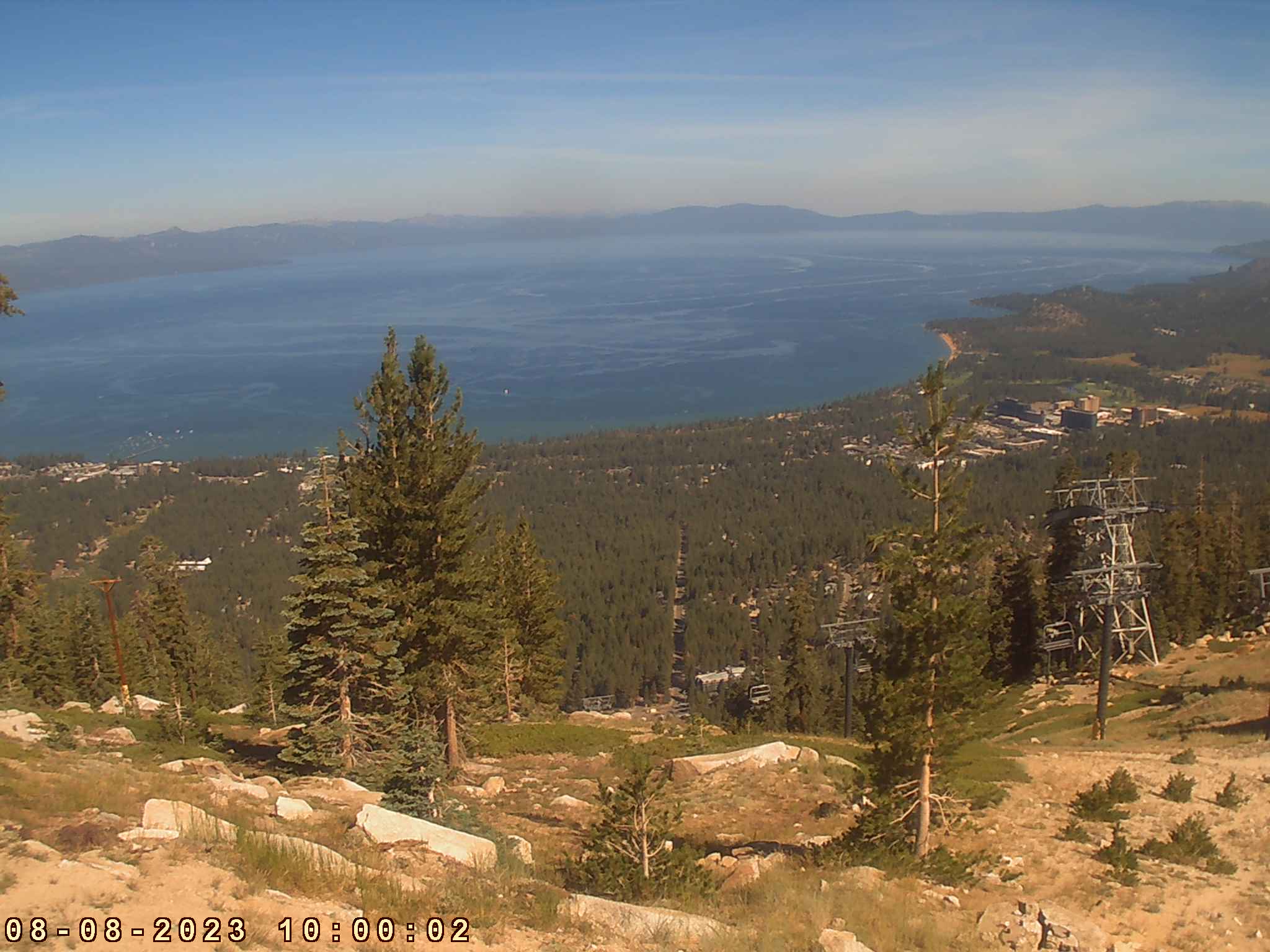
Northstar-at-Tahoe on SR 267, summit of Mt Pluto, looking north

Elevation: 8610 ft
|
Northstar-at-Tahoe on SR 267, summit of Mt Pluto, looking NW

Elevation: 8610 ft
|
Northstar-at-Tahoe on SR 267, summit of Mt Pluto, looking SW

Elevation: 8610 ft
|
Northstar-at-Tahoe on SR 267, summit of Mt Pluto, looking south

Elevation: 8610 ft
|
Northstar-at-Tahoe on SR 267, summit of Mt Pluto

Elevation: 8610 ft
|
Northstar-at-Tahoe on SR 267, summit of Mt Pluto

Elevation: 8610 ft
|
Mourelatos Lakeshore Resort, Tahoe Vista on SR 28, looking SE

Elevation: 6250 ft
|
Tahoe Mountain Sports Webcam, Kings Beach on SR 28, looking south

Elevation: 6250 ft
|
Ski Beach Boat Launch Web Cam, Incline Village on SR 28, looking SW

Elevation: 6770 ft
|
Diamond Peak Ski Resort on SR 28, Base Lodge Cam

Elevation: 6770 ft
|
Diamond Peak Ski Resort on SR 28, Ski School Cam

Elevation: 6770 ft
|
Diamond Peak Ski Resort on SR 28, Snowflake Lodge Cam

Elevation: 7440 ft
|
Diamond Peak Ski Resort on SR 28, Ridge Run Cam

Elevation: 7440 ft
|
Diamond Peak Ski Resort on SR 28, Mountain Cam atop Crystal Express

Elevation: 8540 ft
|
Mt Rose on SR 431, Main Lodge Cam

Elevation: 8260 ft
|
Western Lake Tahoe Region: SR 89 and SR 28 Hwy Corridor ..
|
Squaw Valley, west of SR 89, base area

Elevation: 6200 ft
|
Squaw Valley Lodge, west of SR 89

Elevation: 6200 ft
|
Squaw Valley SuperCam, west of SR 89

Elevation: 6200 ft
|
Squaw Valley SuperCam, west of SR 89

Elevation: 6200 ft
|
Squaw Valley SuperCam, west of SR 89

Elevation: 6200 ft
|
Squaw Valley SuperCam, west of SR 89

Elevation: 6200 ft
|
Squaw Valley SuperCam, west of SR 89

Elevation: 6200 ft
|
Squaw Valley SuperCam, west of SR 89

Elevation: 6200 ft
|
Squaw Valley SuperCam, west of SR 89

Elevation: 6200 ft
|
Squaw Valley SuperCam, west of SR 89

Elevation: 6200 ft
|
Squaw Valley SuperCam, west of SR 89

Elevation: 6200 ft
|
Squaw Valley SuperCam, west of SR 89

Elevation: 6200 ft
|
Squaw Valley SuperCam, west of SR 89

Elevation: 6200 ft
|
Squaw Valley, west of SR 89, High Camp

Elevation: 8200 ft
|
Squaw Valley, west of SR 89, High Camp

Elevation: 8200 ft
|
Squaw Valley, west of SR 89, High Camp

Elevation: 8200 ft
|
Squaw Valley, west of SR 89, High Camp

Elevation: 8200 ft
|
Squaw Valley, west of SR 89, High Camp

Elevation: 8200 ft
|
Squaw Valley, west of SR 89, High Camp

Elevation: 8200 ft
|
Squaw Valley, west of SR 89, High Camp

Elevation: 8200 ft
|
Squaw Valley, west of SR 89, High Camp

Elevation: 8200 ft
|
Sunnyside Resort Cam on SR 89, looking SE

Elevation: 6280 ft
|
USGS Truckee River at Tahoe City Webcam, junction of SR 89 and SR 28

Elevation: 6230 ft
|
Tahoe City Wye Traffic Cam, junction of SR 89 and SR 28, looking SW

Elevation: 6250 ft
|
Jake's on the Lake Cam, Tahoe City on SR 28, looking SE

Elevation: 6250 ft
|
Dollar Point Beach on SR 28, looking SW

Elevation: 6250 ft
|
Gar Woods Grill & Pier, Carnelian Bay on SR 28, looking south

Elevation: 6250 ft
|
Southern and Eastern Lake Tahoe Region: US 50, SR 88, US 395 Hwy Corridor ..
|
Sierra-at-Tahoe on US 50

Elevation: 7300 ft
|
Sierra-at-Tahoe on US 50

Elevation: 8800 ft
|
Sierra-at-Tahoe on US 50

Elevation: 7300 ft
|
Sierra-at-Tahoe on US 50

Elevation: 7300 ft
|
Sierra-at-Tahoe on US 50

Elevation: 7300 ft
|
Sierra-at-Tahoe on US 50

Elevation: 7300 ft
|
Sierra-at-Tahoe on US 50

Elevation: 7300 ft
|
Sierra-at-Tahoe on US 50

Elevation: 7300 ft
|
Sierra-at-Tahoe on US 50

Elevation: 8800 ft
|
Sierra-at-Tahoe on US 50

Elevation: 7300 ft
|
Sierra-at-Tahoe on US 50

Elevation: 7300 ft
|
Sierra-at-Tahoe on US 50

Elevation: 7300 ft
|
Sierra-at-Tahoe on US 50

Elevation: 7300 ft
|
Sierra-at-Tahoe on US 50

Elevation: 8800 ft
|
Meyers Rd and US 50 @ MP 67, looking north? (Caltrans)
![]()
Elevation: 7100 ft
|
Kirkwood on SR 88, base area
(static image unavailable as of fall 2008)

Elevation: 7800 ft
|
KGO-TV Tahoe Cam, Heavenly on US 50, top of Gunbarrel, looking north

Elevation: 8250 ft
|
Heavenly on US 50, top of tram, looking north
Elevation: 8250 ft
|
Heavenly on US 50, top of Dipper Express

Elevation: 9800 ft
|
Heavenly on US 50, base of Comet Express

Elevation: 8650 ft
|
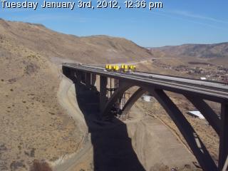
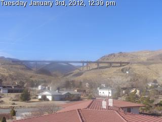
Ski Run Blvd and US 50 @ MP 79, looking east (Caltrans)
![]()
Elevation: 6250 ft
|
Ice Rink at Heavenly Village, South Lake Tahoe on US 50

Elevation: 6300 ft
|
Gondola at Heavenly Village, South Lake Tahoe on US 50

Elevation: 6300 ft
|
Heavenly Village, South Lake Tahoe on US 50

Elevation: 6300 ft
|
KCRA Tahoe Sky Cam, atop Harveys Resort & Casino in Stateline on US 50

Elevation: 6500 ? ft
|
Edgewood Tahoe Golf Course Cam, Stateline on US 50, looking NW

Elevation: 4720 ft
|
Spooner Lake XC Trailhead, junction of US 50 and SR 28

Elevation: 6970 ft
|
Carson Valley Weather Cam, Minden on US 395, looking WSW

Elevation: 4720 ft
|
Western Nevada College, Carson City, NW of junction of US 50 and 395

Elevation: 4900 ft
|
Central Sierra Nevada: SR 4, SR 108, SR 120, SR 140, SR 168 Hwy Corridor ..
|
Arnold on SR 4

Elevation: 4000 ft
|
Dorrington on SR 4

Elevation: 5000 ft
|
Bear Valley Snowmobile, on SR 4

Elevation: 7100 ft
|
Bear Valley Ski Area on SR 4, Base Lodge

Elevation: 7750 ft
|
Bear Valley Ski Area on SR 4, Polar Express Cam

Elevation: 8500 ft
|
Columbia Airport, north of SR 108, looking west

Elevation: 2150 ft
|
Columbia Airport, north of SR 108, looking north

Elevation: 2150 ft
|
Sierra Wildland Fire Cam, Bald Mtn Helibase on SR 108, looking north

Elevation: 5760 ft
|
Dodge Ridge on SR 108, Summit

Elevation: 8200 ft
|
Dodge Ridge on SR 108, Base Lodge

Elevation: 6600 ft
|
Pine Mountain Lake Airport, north of SR 120 near Groveland
Elevation: 2950 ft
|
Yosemite NP, Tioga Pass on SR 120, looking SW

Elevation: 9950 ft
|
Yosemite NP on SR 140, looking west from Turtleback Dome

Elevation: 5266 ft
|
Yosemite NP on SR 140, looking east from Turtleback Dome

Elevation: 5266 ft
|
Yosemite NP on SR 140, looking NE from Sentinel Dome

Elevation: 8100 ft
|
Yosemite NP on SR 140, looking east from Ahwahnee Meadow

Elevation: 3980 ft
|
Bass Lake, east of SR 41, looking SE

Elevation: 3380 ft
|
Bass Lake, east of SR 41, looking SW

Elevation: 3380 ft
|
Sierra Remote Observatories, Alder Springs north of SR 168, looking SE

Elevation: 4610 ft
|
Sierra Marina at Shaver Lake on SR 168

Elevation: 5400 ft
|
Sierra Summit on SR 168, Base Area Cam

Elevation: 7000 ft
|
KFSN-TV Skycam at Sierra Summit on SR 168, Top of Chair 1

Elevation: 8700 ft
|
Eastern Sierra Nevada: US 395, SR 158, SR 203, SR 168 Hwy Corridor ..
|
Mono Lake, Mill Creek WebCam on US 395 near SR 167 junction, looking SE

Elevation: 6800 ft
|
Mono Lake WebCam on US 395, looking NE from visitor center

Elevation: 6720 ft
|
Mono Lake, Lee Vining WebCam on US 395, looking NE

Elevation: 6800 ft
|
Mono Lake DustCam on SR 120, west of US 395, looking NE

Elevation: 6900 ft
|
Gull Lake on SR 158, looking west

Elevation: 7610 ft
|
June Lake on SR 158, looking west

Elevation: 7650 ft
|
Main Lodge Cam, Mammoth Mtn on SR 203

Elevation: 8900 ft
|
Main Lodge Cam, Mammoth Mtn on SR 203

Elevation: 8900 ft
|
Main Lodge Cam, Mammoth Mtn on SR 203

Elevation: 8900 ft
|
Main Lodge Cam, Mammoth Mtn on SR 203

Elevation: 8900 ft
|
McCoy Station Cam, Mammoth Mtn on SR 203

Elevation: 9630 ft
|
McCoy Station Cam, Mammoth Mtn on SR 203

Elevation: 9630 ft
|
McCoy Station Cam, Mammoth Mtn on SR 203

Elevation: 9630 ft
|
McCoy Station Cam, Mammoth Mtn on SR 203

Elevation: 9630 ft
|
Canyon Lodge Cam, Mammoth Mtn on SR 203

Elevation: 8350 ft
|
Canyon Lodge Cam, Mammoth Mtn on SR 203

Elevation: 8350 ft
|
Canyon Lodge Cam, Mammoth Mtn on SR 203

Elevation: 8350 ft
|
Canyon Lodge Cam, Mammoth Mtn on SR 203

Elevation: 8350 ft
|
Village Cam, Mammoth Mtn on SR 203

Elevation: 8100 ft
|
Village Cam, Mammoth Mtn on SR 203

Elevation: 8100 ft
|
Village Cam, Mammoth Mtn on SR 203

Elevation: 8100 ft
|
Village Cam, Mammoth Mtn on SR 203

Elevation: 8100 ft
|
Mammoth Mtn, looking west from Mammoth Lakes on SR 203

Elevation: 7900 ft
|
Mammoth Mtn, looking west from Mammoth Lakes on SR 203

Elevation: 7900 ft
|
Sierra Impressions Webcam, looking west from Bishop on US 395

Elevation: 4200 ft
|
Owens Valley VLBA Radio Telescope Site, north of Big Pine off SR 168

Elevation: 4000 ft
|
Southern Sierra Nevada: SR 180, SR 198, SR 190 Hwy Corridor ..
|
Sierra Wildland Fire Cam, Park Ridge south of SR 180, looking east

Elevation: 7400 ? ft
|
Sierra Wildland Fire Cam, Park Ridge south of SR 180, looking SE

Elevation: 7400 ? ft
|
Sierra Wildland Fire Cam, Park Ridge south of SR 180, looking west

Elevation: 7400 ? ft
|
Sierra Wildland Fire Cam, Park Ridge south of SR 180, looking NW

Elevation: 7400 ? ft
|
Hume Lake, south of SR 180

Elevation: 5200 ft
|
Sierra Wildland Fire Cam, Buck Rock Lookout north of SR 198, looking NE

Elevation: 8500 ft
|
Sierra Wildland Fire Cam, Buck Rock Lookout north of SR 198, looking NW

Elevation: 8500 ft
|
Sequoia NP on SR 198, looking SW from Giant Forest

Elevation: 6400 ft
|
Ash Peaks Webcam, outside Sequoia NP on SR 198, looking north
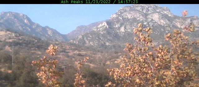
Elevation: 1400 ft
|
Kaweah River Webcam, Pumpkin Hollow on SR 198, looking north
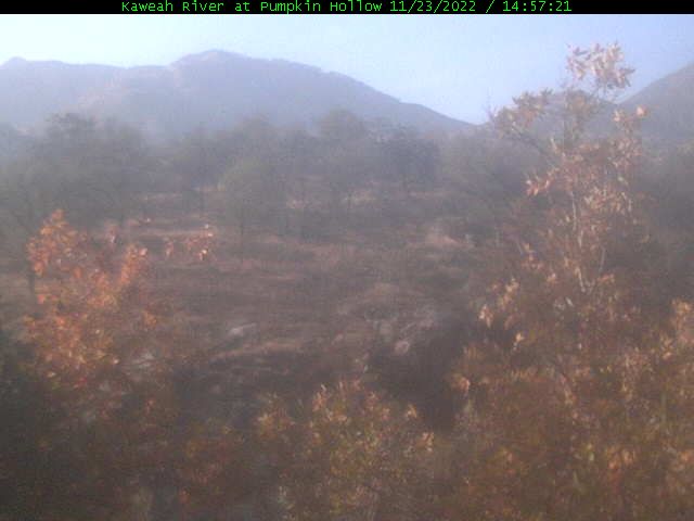
Elevation: 1200 ft
|
Kaweah Kam, Three Rivers on SR 198, looking north

Elevation: 850 ft
|
Silver City Webcam, Sequoia NP east of SR 198 on Mineral King Rd

Elevation: 6900 ft
|
Mineral King Webcam, Sequoia NP east of SR 198, looking north

Elevation: 7830 ft
|
Mineral King, Faculty Flat Webcam, Sequoia NP east of SR 198

Elevation: 7440 ft
|
Sierra Wildland Fire Cam, Springville on SR 190, looking east

Elevation: 1050 ft
|
Sierra Wildland Fire Cam, Springville on SR 190, looking SW

Elevation: 1050 ft
|
Sierra Wildland Fire Cam, Jordan Peak, north of Camp Nelson on SR 190, looking north

Elevation: 9120 ft
|
Sierra Wildland Fire Cam, Jordan Peak, north of Camp Nelson on SR 190, looking east

Elevation: 9120 ft
|
Sierra Wildland Fire Cam, Jordan Peak, north of Camp Nelson on SR 190, looking SE

Elevation: 9120 ft
|
Sierra Wildland Fire Cam, Jordan Peak, north of Camp Nelson on SR 190, looking west

Elevation: 9120 ft
|
Sierra Wildland Fire Cam, Jordan Peak, north of Camp Nelson on SR 190, looking west

Elevation: 9120 ft
|
Sierra Wildland Fire Cam, Jordan Peak, north of Camp Nelson on SR 190, looking NW

Elevation: 9120 ft
|
Owens Lake DustCam, Dolomite on SR 136, looking south

Elevation: 3800 ? ft
|
Owens Lake DustCam, Dolomite on SR 136, looking SW

Elevation: 3800 ? ft
|
Owens Lake DustCam, Keeler on SR 136, looking SW

Elevation: 3800 ? ft
|
Owens Lake DustCam, Microwave, looking NW

Elevation: 3800 ? ft
|
Owens Lake DustCam, Cartago on US 395, looking east

Elevation: 3800 ? ft
|
Owens Lake DustCam, Cartago on US 395, looking NE

Elevation: 3800 ? ft
|
Death Valley Webcam, SR 190 at Furnace Creek, looking east

Elevation: -150 ft
|
Southernmost Sierra Nevada: SR 155, SR 178, SR 58 Hwy Corridor ..
|
Sierra Wildland Fire Cam, Sherman Peak west of US 395, looking NW

Elevation: 9920 ft
|
Sierra Wildland Fire Cam, Sherman Peak west of US 395, looking north

Elevation: 9920 ft
|
Sierra Wildland Fire Cam, Sherman Peak west of US 395, looking NE

Elevation: 9920 ft
|
Sierra Wildland Fire Cam, Sherman Peak west of US 395, looking east

Elevation: 9920 ft
|
Sierra Wildland Fire Cam, Sherman Peak west of US 395, looking SE

Elevation: 9920 ft
|
Sierra Wildland Fire Cam, Sherman Peak west of US 395, looking SW

Elevation: 9920 ft
|
Sierra Wildland Fire Cam, Bald Mtn Lookout west of US 395, looking NW

Elevation: 9380 ft
|
Sierra Wildland Fire Cam, Bald Mtn Lookout west of US 395, looking NE

Elevation: 9380 ft
|
Sierra Wildland Fire Cam, Bald Mtn Lookout west of US 395, looking east

Elevation: 9380 ft
|
Sierra Wildland Fire Cam, Bald Mtn Lookout west of US 395, looking south

Elevation: 9380 ft
|
Sierra Wildland Fire Cam, Bald Mtn Lookout west of US 395, looking west

Elevation: 9380 ft
|
Sierra Wildland Fire Cam, Tobias Peak north of SR 155, looking SE

Elevation: 8300 ft
|
Sierra Wildland Fire Cam, Tobias Peak north of SR 155, looking south

Elevation: 8300 ft
|
Sierra Wildland Fire Cam, Tobias Peak north of SR 155, looking SW

Elevation: 8300 ft
|
Sierra Wildland Fire Cam, Tobias Peak north of SR 155, looking NW

Elevation: 8300 ft
|
Sierra Wildland Fire Cam, Tobias Peak north of SR 155, looking NE

Elevation: 8300 ft
|
Alta Sierra at Shirley Meadows on SR 155, Ridge Cam

Elevation: 6700 ft
|
Alta Sierra at Shirley Meadows on SR 155, Lake View Cam

Elevation: 6700 ft
|
Alta Sierra at Shirley Meadows on SR 155, WebCam

Elevation: 6700 ft
|
Alta Sierra at Shirley Meadows on SR 155, WebCam

Elevation: 6700 ft
|
Alta Sierra at Shirley Meadows on SR 155, WebCam

Elevation: 6700 ft
|
Alta Sierra at Shirley Meadows on SR 155, WebCam

Elevation: 6700 ft
|
Sierra Wildland Fire Cam, Breckenridge Mtn Lookout south of SR 178, looking NW

Elevation: 7550 ft
|
Sierra Wildland Fire Cam, Breckenridge Mtn Lookout south of SR 178, looking NE

Elevation: 7550 ft
|
Sierra Wildland Fire Cam, Breckenridge Mtn Lookout south of SR 178, looking NE

Elevation: 7550 ft
|
Sierra Wildland Fire Cam, Breckenridge Mtn Lookout south of SR 178, looking ENE

Elevation: 7550 ft
|
Sierra Wildland Fire Cam, Breckenridge Mtn Lookout south of SR 178, looking east

Elevation: 7550 ft
|
Sierra Wildland Fire Cam, Breckenridge Mtn Lookout south of SR 178, looking south

Elevation: 7550 ft
|
|
| Map of Camera Sites: (each corridor is enclosed in a gray box) |
NOTE: Webcams in the northern half of Northern California (including the northernmost part of the Sierra Nevada)
are shown on the adjacent Northernmost California Mountain WebCams page.
|
 |
| Northern Sierra Nevada: I-80 Hwy Corridor |
![]() |
![]() |
![]() |
![]() |
![]() |
![]() |
|
|
|
|
|
|
|
|
|
|
|
![]() |
![]() |
|
|
|
|
|
|
|
|
|
|
29 |
| Northern Lake Tahoe Region: SR 267, SR 28, SR 431 Hwy Corridor |
|
|
|
|
|
|
|
|
|
|
|
|
|
|
|
|
|
|
|
|
|
|
|
|
|
25 |
| Western Lake Tahoe Region: SR 89 and SR 28 Hwy Corridor |
|
|
|
|
|
|
|
|
|
|
|
|
|
|
|
|
|
|
|
|
|
|
|
|
|
|
|
27 |
| Southern and Eastern Lake Tahoe Region: US 50, SR 88, US 395 Hwy Corridor |
|
|
|
|
|
|
|
|
|
|
|
|
|
|
![]() |
|
|
|
|
|
![]() |
|
|
|
|
|
|
|
|
29 |
| Central Sierra Nevada: SR 4, SR 108, SR 120, SR 140, SR 168 Hwy Corridor |
|
|
|
|
|
|
|
|
|
|
|
|
|
|
|
|
|
|
|
|
|
|
22 |
|
| Eastern Sierra Nevada: US 395, SR 158, SR 203, SR 168 Hwy Corridor |
|
|
|
|
|
|
|
|
|
|
|
|
|
|
|
|
|
|
|
|
|
|
|
|
|
|
26 |
|
| Southern Sierra Nevada: SR 180, SR 198, SR 190 Hwy Corridor |
|
|
|
|
|
|
|
|
|
|
|
|
|
|
|
|
|
|
|
|
|
|
|
|
|
|
|
|
|
29 |
|
| Southernmost Sierra Nevada: SR 155, SR 178, SR 58 Hwy Corridor |
|
|
|
|
|
|
|
|
|
|
|
|
|
|
|
|
|
|
|
|
|
|
|
|
|
|
|
|
28 |
|
|
|
|
| Page History: |
|
|
|
Page Statistics: |
| February 2008 | Original version with 78 camera views in 6 corridors (rows), based on the
Washington Mountain WebCams webpage; includes a PHP script to allow changing the image size
Also includes a map of camera sites and corridors, with a table of mini camera images beside the map,
and the option to show pixel rulers along the bottom and right edges of the page
Note that many of these images are multiple directional views from a single camera
Later expanded to 147 camera views in 8 corridors (rows)
|
Page loaded at 10:45 AM PDT on Saturday, October 25, 2025
Total camera images: 215
Caltrans Highway Cams: 10
National Park Service: 5
US Geological Survey and Forest Service: 38
Sugar Bowl Ski Resort: 5
Northstar-at-Tahoe Ski Resort: 16
Squaw Valley Ski Resort: 9
Diamond Peak Ski Resort: 5
Sierra-at-Tahoe Ski Resort: 14
Mammoth Mtn Ski Resort: 16
Alta Sierra at Shirley Meadows: 6
WeatherBug InstaCams: 4
Approximate page width: 10300 pixels 10266
Approximate page height: 4300 pixels 4212
|
| March 2008 | Expanded to 150 camera views |
| August 2008 | Expanded to 152 camera views, fixed several camera links which had changed |
| November 2008 | Expanded to 173 camera views, removed several defunct cameras,
rearranged several cameras, fixed several camera links which had changed
Added row counts to table of mini camera images, and "Page Statistics" to the right
|
| December 2008 | Expanded to 197 camera views, fixed several camera links which had changed
Later expanded to 214 camera views, removed more defunct cameras, fixed more camera links which had changed
|
| January 2009 | Improved several image captions |
| March 2009 | Expanded to 215 camera views |
| January 2010 | Updated the site navigation bars to include the various other Mountain WebCams pages,
fixed several camera links which had changed |
|