| SR 4 and SR 89 Corridor via Ebbets Pass and Monitor Pass, US 395 Corridor |
|||||||||||||||||||||||||||||||||||||||
| Bear Valley Snowmobile, on SR 4 Elevation: 7200 ft |
Bear Valley Ski Area on SR 4, Base Lodge Elevation: 7750 ft |
Bear Valley Ski Area on SR 4, Polar Express Cam  Elevation: 8500 ft |
Topaz Lake on US 395 on the California/Nevada border, north of the SR 89 junction, 4 miles east of Monitor Pass  Elevation: 5050 ft |
||||||||||||||||||||||||||||||||||||
Dorrington on SR 4  Elevation: 4900 ft |
Big Trees VIllage, Dorrington on SR 4 Elevation: 5200 ft |
Big Trees VIllage, Dorrington on SR 4 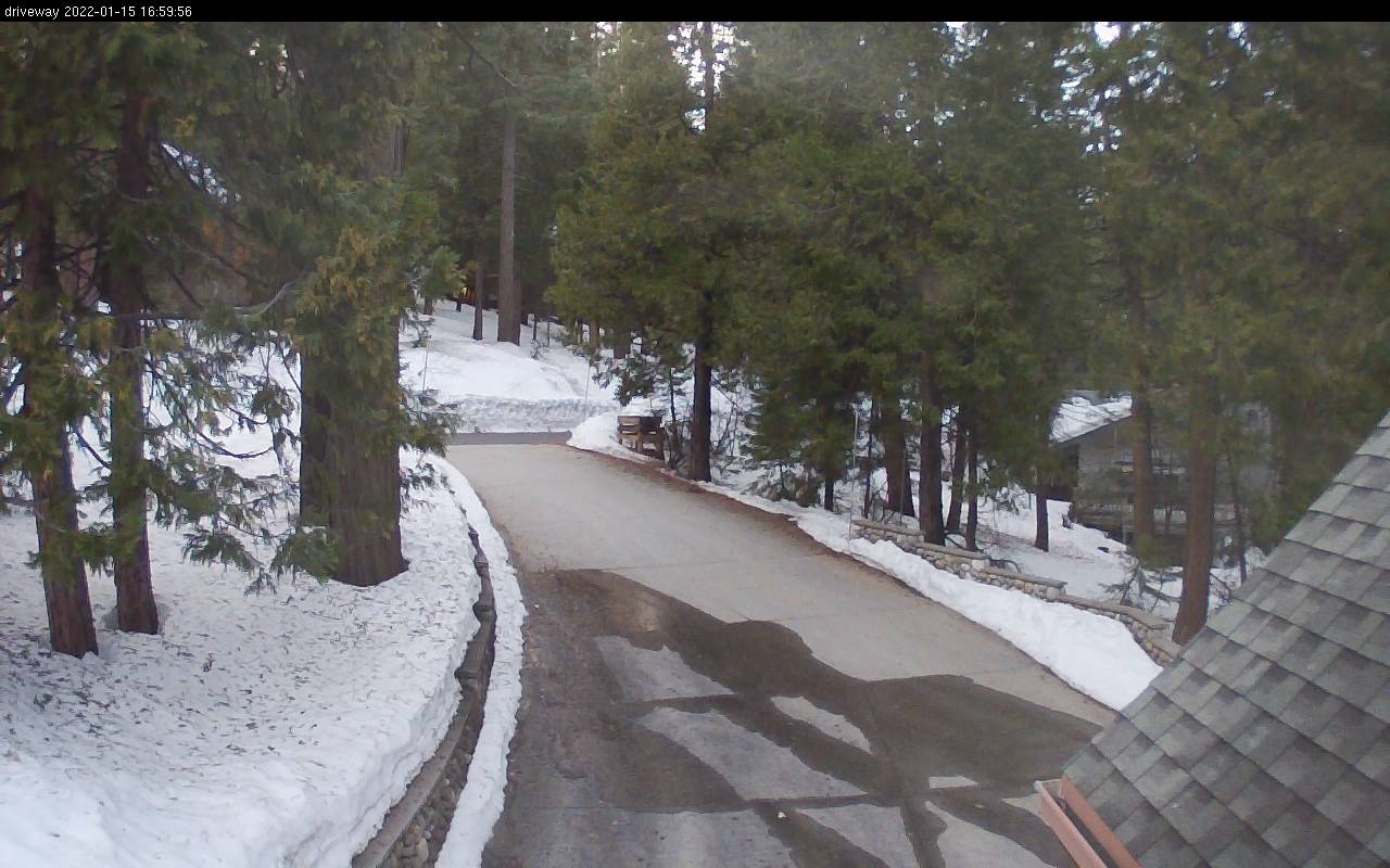 Elevation: 5200 ft |
Big Trees VIllage, Dorrington on SR 4  Elevation: 5200 ft |
Big Trees VIllage, Dorrington on SR 4  Elevation: 5200 ft |
| Angels Camp, just south of the junction of SR 4 & SR 49, looking west Elevation: 1500 ft |
Indian Rock Vineyards, Murphys on SR 4, looking NE Elevation: 2150 ft |
Forest Meadows, NE of Murphys on SR 4, looking north Elevation: 3350 ft |
Arnold on SR 4 Elevation: 4000 ft |
Arnold on SR 4  Elevation: 4050 ft |
| SR 108 Corridor via Sonora Pass |
|||||||||||||||||||||||||||||||||||||||
| Confidence, NE of Twain Harte on SR 108 Elevation: 4000 ft |
Confidence, NE of Twain Harte on SR 108  Elevation: 4000 ft |
Confidence, NE of Twain Harte on SR 108 Elevation: 4000 ft |
Sierra Wildland Fire Cam, Bald Mtn Helibase on SR 108, looking north  Elevation: 5760 ft |
Dodge Ridge Ski Area on SR 108, Base Lodge, looking south Elevation: 6600 ft |
Dodge Ridge Ski Area on SR 108, Summit, looking NW Elevation: 8200 ft |
||||||||||||||||||||||||||||||||||
| Washington Street in Sonora, NE of junction of SR 49 & SR 108, looking north Elevation: 1800 ft |
Columbia Airport, off SR 49 north of Sonora, looking south  Elevation: 2150 ft |
Columbia Airport, off SR 49 north of Sonora, looking west  Elevation: 2150 ft |
Columbia Airport, off SR 49 north of Sonora, looking north  Elevation: 2150 ft |
Columbia Airport, off SR 49 north of Sonora, looking east  Elevation: 2150 ft |
Cedar Ridge Ranch, north of SR 108, NE of Sonora  Elevation: 3900 ft |


| Show telemetry | Hide telemetry | |||||||||||||||||||||||||||
|
|||||||||||||||||||||||||||