 | Mount Cleveland from the west, July 1994 (photo by M. Harbin) <click to enlarge> |
Mount Cleveland
5675 ft (1730 m) . |
||
| Location: | Western tip of Chuginadak Island in the Aleutian Islands, Alaska | ||
| Lat / Long: | 52.8° N, 169.9° W | ||
| Volcanic Type: | Stratovolcano | ||
| Volcanic Status: | Active, last eruption 2001 | ||
| First Ascent: | |||
| First Ski Descent: | |||
| Skiable Vertical: | over 5600 ft (1700 m) | ||
| Administration: | Alaska Maritime National Wildlife Refuge | ||
| Mount Cleveland is a spectacular and symmetrical stratocone which forms the western portion of Chuginadak Island. It is a near twin to Carlisle which is located just to the northwest across a strait only 2 miles (3 km) wide. Mount Cleveland is very active, with constant steaming from its summit crater and more than a dozen recorded eruptions over the past century. The eruption of 1944 killed an Army serviceman based at a small station on Chuginadak, the only known fatality from an Aleutian eruption. Due to the remote location of the island, the best access is by boat or possibly floatplane, from the nearest city which is Dutch Harbor on Unalaska Island, about 150 miles (250 km) to the northeast. | |||
 |
Some useful links: Global Volcanism Program: Mount Cleveland Alaska Volcano Observatory Alaska Maritime National Wildlife Refuge |
||
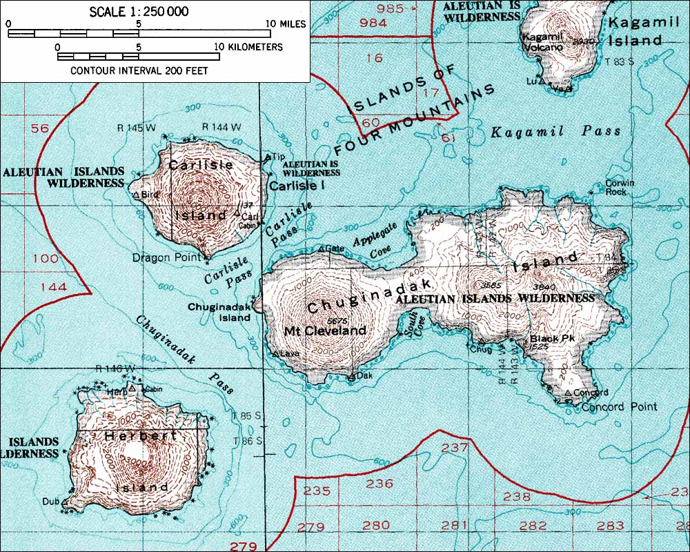
| Topographic map of Mount Cleveland and vicinity (1:250,000 scale) from USGS Amukta and Samalga island <click to enlarge> |
|||
More photos and info about routes, access, etc. may be added in the future ... |
|||