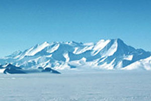
 | Vinson Massif from the west (photographer unknown) |
Vinson Massif
16066 ft (4897 m) Highest point in Antarctica . |
||
| Location: | Sentinel Range, Ellsworth Land, Antarctica | ||
| Lat / Long: | 78.5° S, 85.7° W | ||
| Volcanic Type: | Non-volcanic | ||
| First Ascent: | W. Long, P. Schoening, B. Corbet, and J. Evans, 1966 | ||
| First Ski Descent: | Pat Morrow and Martyn Williams, 1985 | ||
| Skiable Vertical: | over 10000 ft (3000 m) from the west side, possibly over 13000 ft (4000 m) from the east side! | ||
| Vinson Massif is the highest point in Antarctica, an immense block of uplifted rock on the western edge of the Sentinel Range in the Ellsworth Mountains. This range is situated near the base of the Antarctic Peninsula, just west of the Ronne Ice Shelf. As one of the "Seven Summits", Vinson has become somewhat of a popular climb in recent years despite the expense and difficulty of reaching it, and several companies now offer guided expeditions. The standard ascent route climbs the Branscomb Glacier on the west side of the peak, starting from an aircraft landing at about 7000 ft (2100 m). The first climb from the east side of the range was recently completed and filmed for NOVA (see link below). Several ski and snowboard descents of Mount Vinson have also been done in the past few years. | |||
 |
Some useful links: NOVA: Mountain of Ice (film of first ascent from east side of Vinson) United States Antarctic Resource Center USGS Atlas of Antarctic Research (online maps & photos) Adventure Network International (private aircraft operations and tours) |
||
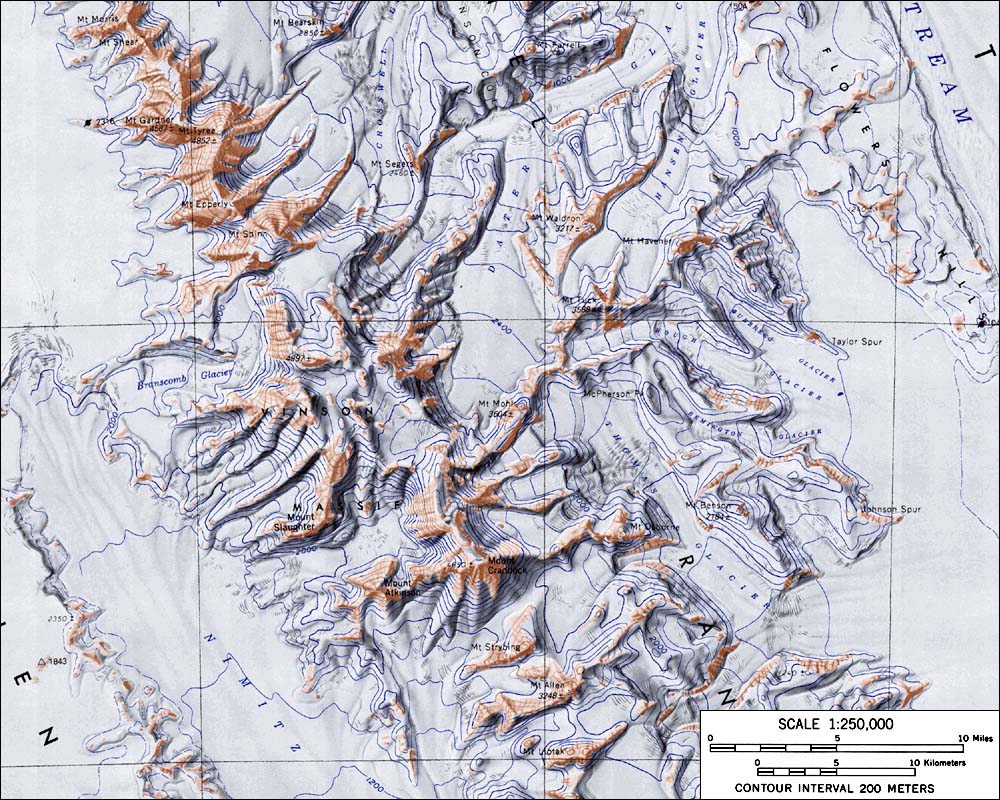
| Topographic map of Vinson Massif (1:250,000 scale) from USGS Vinson Massif <click to enlarge> |
|||
More photos and info about routes, access, etc. may be added in the future ... |
|||