| Page History: |
|
| December 2009 | Original version with 4 camera views,
designed based on the Mount Rainier Paradise WebCams webpage,
with cameras from the Southwestern British Columbia Mountain WebCams
and Washington Mountain WebCams webpages
Includes the option to show the last 24 hours of NWAC and
SNOTEL telemetry data from Mount Baker below the webcams
Later added code to error-check for missing SNOTEL data
|
| January 2010 | Added the distance of each camera from Mount Baker in the photo captions |
| March 2010 | Fixed broken links to SNOTEL website |
| May 2010 | Fixed unwanted line breaks in SNOTEL telemetry dates on narrow screens |
| June 2010 | Fixed one camera link which had changed |
| September 2010 |
Expanded to 5 camera views, adding the low-resolution version of Ferndale image, since the high-res version is very unreliable |
| November 2010 |
Fixed a minor bug in the SNOTEL data display, which only occurred between 11pm and midnight and showed the previous day's date for the 0000 hour's data row |
| March 2011 |
Fixed a minor quirk in the SNOTEL data display, which only occurred when SNOTEL data is not available at a given site for the previous 24 hours |
| February 2012 | Updated the URLs from which to download the SNOTEL data, which had recently been changed slightly |
| September 2012 | Added the newly-installed air quality webcam from Ferndale, which had been offline since March 2011 due to construction |
| October 2012 | Expanded to 7 camera views, adding the Mount Constitution and Bluenose webcams, and rearranged images into 2 rows |
| November 2012 | Updated the caption and elevation info for the Ferndale air quality webcam, which had been moved to a very different location |
| December 2012 |
Expanded to 8 camera views, adding the Anacortes Middle School webcam, and updated one WSDOT camera URL which had changed
Added more code to properly handle the new HTTP Status 404 errors from the SNOTEL server, and other unknown SNOTEL errors
|
| January 2013 |
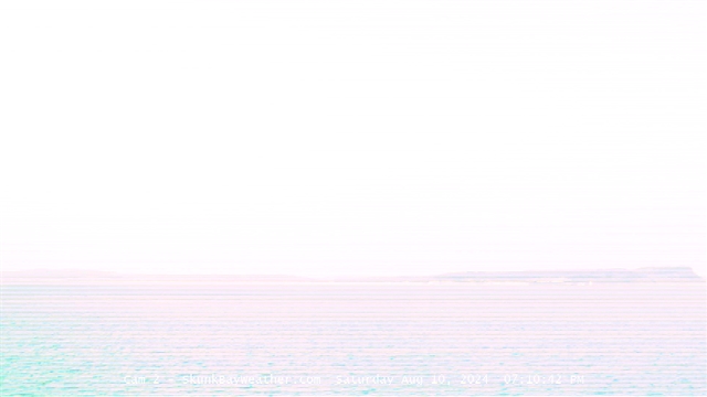
Expanded to 9 camera views, adding the new Skunk Bay Weather webcam 2 from Hansville
Revised the page layout to use separate tables for each row, to better accommodate the very different widths of images
|
| March 2013 |
Forced to write a new external script to grab SNOTEL data,
after the long-existing SNOTEL data programs on the NWCC website were suddenly redirected to a beta-version report generator
The new script is a major improvement, it displays wind and solar data for any SNOTEL sites which have those sensors, mostly installed within the last few years
|
| November 2013 | Expanded to 10 camera views, adding the Saturna Island East Point webcam in BC |
| December 2013 |
Expanded to 18 camera views, adding 6 more WSDOT cams in Bellingham and 2 WSDOT cams in Sumas
Reduced image sizes from 480-360-240 to 400-300-200 pixels high for large-medium-small options
|
| April 2014 | Fixed one camera link which had changed |
| August 2014 | Fixed one camera link which had changed |
| November 2014 |
Remained at 18 camera views and rearranged several images, adding a new view from Ferndale and removing the long-defunct Friday Harbor cam |
| December 2014 |
Expanded to 27 camera views in 4 rows, adding a new view of Baker from Coupeville, a panoramic cam in downtown Bellingham,
and 7 WSDOT cams in Lynden, Sumas, and Bellingham
|
| January 2015 | Fixed one camera link which had improved to a higher-resolution image |
| April 2015 | Fixed one camera link which had changed |
| September 2015 |
Fixed the Abbotsford Airport visibility image, which had gone offline last year and changed to a completely different website,
moving from http://visibility.pyr.ec.gc.ca/ to http://www.clearairbc.ca/,
it took repeated efforts over many months to even find out where the visibility images had eventually moved to,
and then required writing a new internal script in order to detect the well-hidden URL of the current image
|
| December 2015 |
Remained at 27 camera views, adding the West Vancouver Nav Canada cam's east view (which was already on the
Mount Garibaldi WebCams page)
and removing the defunct New Westminster cam (the seafoam.net webcam site has been retired and gone offline permanently)
|
| January 2016 |
Expanded to 31 camera views, adding views of Baker from Camano Island and Edmonds, a cam at Mt Baker Rim in Glacier,
and another WSDOT cam in Bellingham, and also fixed one WSDOT camera link which had changed
Reduced image sizes slightly from 400-300-200 to 360-270-180 pixels high for large-medium-small options
Improved the script which grabs the latest Abbotsford Airport visibility image, to handle situations where the most recent image is over 24 hours old
Since there are only a few snow telemetry sites on and near Mount Baker, added 3 nearby
RAWS hourly telemetry sites in the foothills
which have precip, wind, solar, and other sensors (but not snowdepth)
Wrote a new external script to grab data from MesoWest (such as the data from
the RAWS telemetry sites), which downloads the data as a CSV file and formats it to match the style of the SNOTEL data
Updated the external script which grabs NWAC data to generate an HTML table
which matches the style of the SNOTEL and MesoWest data, so these WebCams pages can now show an arbitrary mix of NWAC, SNOTEL, and MesoWest telemetry sites in any order
|
| February 2016 |
Major internal PHP code cleanup, updating and/or deleting legacy code left over from very long ago, from the
Mount Rainier Paradise WebCams webpage (March 2009) on which all of these "Webcams + Telemetry Pages" are based,
and even from the original Washington Mountain WebCams webpage (December 2004) on which the Rainier page was based
Added the Sedro-Woolley and Marblemount RAWS telemetry sites, located along SR 20 to the SW and SE of Mount Baker
|
| March 2016 | Fixed all Weather Underground camera URLs, which now apparently need "?time()" appended in order to update properly |
| April 2016 |
Improved the script which grabs the latest Abbotsford Airport visibility image, to avoid this page hanging due to certain error conditions on their website |
| December 2016 |
Fixed one webcam URL which had changed, and rearranged images in the first row into geographic order, which also moves currently offline images to the right end |
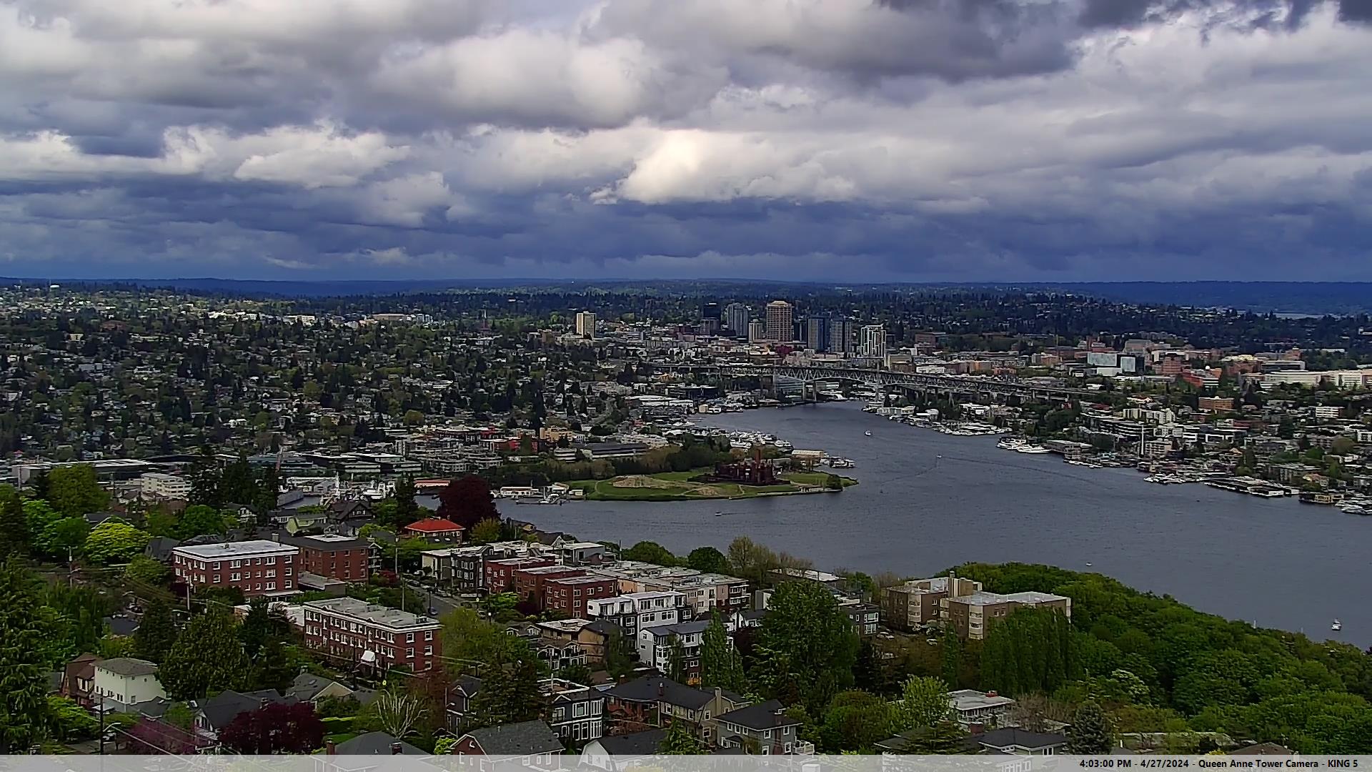
| January 2017 |
Expanded to 32 camera views, adding the KING-TV Queen Anne Tower Cam, which is sometimes zoomed in on Mt Baker |


