Lake Crescent, Olympic NP, Air Quality Webcam,
off US 101 @ MP 232

Elevation: 590 ft
|
Hurricane Ridge, Olympic NP,
15 miles NE of Mount Olympus, looking SW

Elevation: 5250 ft
|
Hurricane Ridge Parking Lot, Olympic NP,
11 miles south of US 101 @ MP 248, looking NE

Elevation: 5250 ft
|
New Dungeness Lighthouse,
north of US 101 @ MP 265, looking south

Elevation: 20 ft
|
New Dungeness Lighthouse,
north of US 101 @ MP 265, looking north
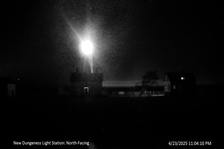
Elevation: 20 ft
|
Olympic Rain Shadow Cam in Sequim,
north of US 101 @ MP 265, looking north
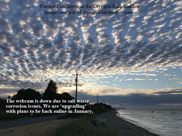
Elevation: 20 ft
Image modification time: Sun Jan 28, 2018 17:23:09
|
John Wayne Marina in Sequim, east of US 101 @ MP 267,
looking south towards Olympic Mountains

Elevation: 20 ft
|
View of the Olympic Mountains, looking southwest
from just above Ledgewood Beach on Whidbey Island

Elevation: 250 ft
|
SR 112 @ Burnt Mt

Elevation: 200 ft
|
Heckelville Shed on US 101 @ MP 214

Elevation: 930 ft
|
Indian Valley on US 101 @ MP 237.2

Elevation: 380 ft
|
NPS Elwha River Restoration Project,
Lake Aldwell Delta, north of US 101 @ MP 239
Elevation: 200 ft
|
NPS Elwha River Restoration Project,
Lower Lake Aldwell, north of US 101 @ MP 239
Elevation: 200 ft
|
NPS Elwha River Restoration Project,
Lake Mills Delta, south of US 101 @ MP 239
Elevation: 550 ft
|
NPS Elwha River Restoration Project,
Glines Canyon Dam, south of US 101 @ MP 239
Elevation: 550 ft
|
NPS Elwha River Restoration Project,
Lower Lake Mills, south of US 101 @ MP 239
Elevation: 550 ft
|
NPS Elwha River Restoration Project,
Former Lake Mills, south of US 101 @ MP 239
Elevation: 550 ft
|
Port Angeles Airport,
1 mile north of US 101 at MP 245, looking south

Elevation: 300 ft
|
Port Angeles Airport,
1 mile north of US 101 at MP 245, looking west

Elevation: 300 ft
|
Port Angeles Airport,
1 mile north of US 101 at MP 245, looking NW

Elevation: 300 ft
|
Port Angeles Airport,
1 mile north of US 101 at MP 245, looking NE

Elevation: 300 ft
|
Port Angeles Harbor View, 2 miles south of US 101 at MP 247,
0.8 miles west of Hurricane Ridge Rd, looking north

Elevation: 950 ft
|
Port Angeles Webcam, ferry landing off US 101 at MP 248, looking north

Elevation: 50 ft
|
Siebert on US 101 @ MP 256

Elevation: 290 ft
|
Bell Hill, south of Sequim and US 101 @ MP 265,
180° panoramic view looking south across Happy Valley towards Olympic Mountains
Elevation: 1100 ft (link to full-size 2560x960 image)
|
Sequim Valley Airport, off US 101 @ MP 260, looking south

Elevation: 150 ft
|
Diamond Point on US 101 @ MP 275

Elevation: 320 ft
|
Port Townsend Airport, SR 20 @ MP 7, looking SSW

Elevation: 110 ft
|
Port Townsend Airport, SR 20 @ MP 7, looking west

Elevation: 110 ft
|
Port Townsend Airport, SR 20 @ MP 7, looking north

Elevation: 110 ft
|
Port Townsend Airport, SR 20 @ MP 7, looking east

Elevation: 110 ft
|
Jefferson County Courthouse, Port Townsend,
SR 20 @ MP 12, looking SW towards Olympic Mtns

Elevation: 200 ft
|
Port Townsend Ferry, Water St / SR 20 @ MP 12,
looking west

Elevation: 50 ft
|
Port Townsend Ferry, Water St / SR 20 @ MP 12,
looking north

Elevation: 50 ft
|
Hood Canal Bridge, SR 104 @ MP 14, looking west

Elevation: 40 ft
|
Hood Canal Bridge, SR 104 @ MP 14, looking east

Elevation: 40 ft
|
Mueller's Hood Canal Webcam, east of SR 3
just south of Hood Canal Bridge, looking NW
Elevation: 200 ft
|
Hood Canal in Hansville, north of SR 104,
looking WSW at Hood Canal Bridge and Mt Constance

Elevation: 50 ft
|
WeatherOLA Cam in Indianola, south of SR 104,
looking southwest at Agate Passage

Elevation: 100 ft
|
Frank Raab Park in Poulsbo, east of SR 305,
looking west at The Brothers, Mt Jupiter, and Mt Constance

Elevation: 450 ft
|
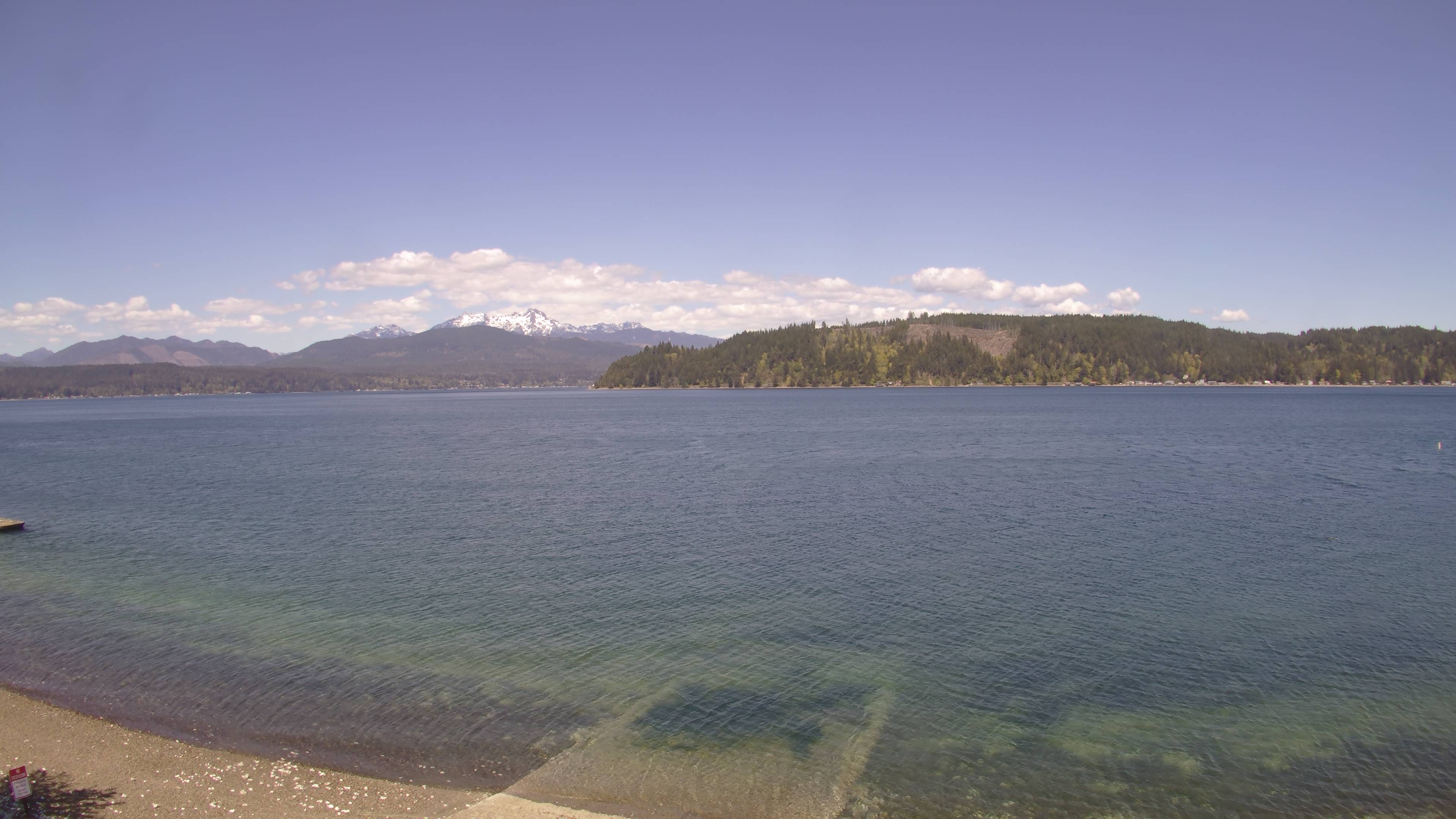
Union on SR 106, looking NW at Olympic Mountains
Elevation: 400? ft
|
Hood Canal, Union on SR 106, looking NW
Elevation: 20 ft
|
| Show telemetry | Hide telemetry |
|
| Page History: |
|
| October 2012 | Original version with 11 camera views,
designed based on the Mount Rainier Paradise WebCams webpage,
with cameras from the Washington Mountain WebCams webpage
Includes the option to show the last 24 hours of NWAC and
SNOTEL telemetry data from the Olympic Mountains below the webcams
Includes code to error-check for missing SNOTEL data
Later expanded to 12 camera views
|
| November 2012 |
Expanded to 22 camera views in 4 rows, adding several WSDOT and Elwha River Restoration Project cameras plus Dungeness Lighthouse
Reduced image sizes from 480-360-240 to 360-270-180 pixels high for large-medium-small options, rearranged several camera images
|
| December 2012 | Added more code to properly handle the new HTTP Status 404 errors from the SNOTEL server, and other unknown SNOTEL errors |
| March 2013 |
Forced to write a new external script to grab SNOTEL data,
after the long-existing SNOTEL data programs on the NWCC website were suddenly redirected to a beta-version report generator
The new script is a major improvement, it displays wind and solar data for any SNOTEL sites which have those sensors, mostly installed within the last few years
|
| November 2013 | Fix links to Elwha River Restoration Project images, which had switched to annoying variable URLs in October 2013 |
| December 2013 | Expanded to 25 camera views, adding 3 WSDOT cams
Revised the page layout to use separate tables for each row, to better accommodate the very different widths of images
|
| January 2014 | Fix links to Elwha River Restoration Project images, which had a small change in website URL |
| March 2014 |
Fixed one camera link which had changed
Added an option to disable the NPS Air Quality Webcam (by appending "&aq=off" to the URL) if this page is not loading properly,
as server issues on that website are often the cause of such problems
|
| November 2014 |
Expanded to 33 camera views rearranged in 5 rows, adding 4 WSDOT cams, the Olympic Rain Shadow cam, a 2nd Dungeness Lighthouse cam,
a wide view of the Olympics from Poulsbo, a view of Mt Constance from Hood Canal, and the UW Atmospheric Sciences West Webcam
Removed the long-defunct Silverdale cam, plus fixed one camera link which had changed
|
| December 2014 |
Added an option to disable all NPS Elwha River Restoration Project cams (by appending "&el=off" to the URL) if this page is not loading properly,
as server issues on that website have been the cause of such problems
Improved the location info for all 4 SNOTEL sites
|
| March 2015 | Fixed one WSDOT camera link which had changed |
| July 2015 | Fixed Dungeness Lighthouse camera links which had changed |
| December 2015 |
Expanded to 43 camera views rearranged in 6 rows, adding 6 more WSDOT cams on the western and southern sides of the Olympic Peninsula,
3 more new WSDOT cams at Jefferson County International Airport in Port Townsend plus 1 more at the ferry dock, and the Port Angeles Webcam installed in the summer of 2013,
while removing the UW Atmospheric Sciences West Webcam looking west from Seattle towards the Olympic Mountains which was discontinued due to lack of funding
Reduced image sizes slightly from 360-270-180 to 320-240-160 pixels high for large-medium-small options
|
| January 2016 |
Expanded to 50 camera views, adding the Port Angeles Harbor View, John Wayne Marina, Bell Hill, Whidbey Island, Jefferson County Courthouse,
Hood Canal, and Indianola cams
Since there are so few snow telemetry sites in the entire Olympic Mountains, added all 9 of the
RAWS hourly telemetry sites on the Olympic Peninsula,
6 located in the foothills and 3 in the lowlands, which have precip, wind, solar, and other sensors (but not snowdepth)
Wrote a new external script to grab data from MesoWest (such as the data from
the RAWS telemetry sites), which downloads the data as a CSV file and formats it to match the style of the SNOTEL data
This fixes several major annoyances with the previous data format copied directly from MesoWest,
particularly the large amount of wasted space including an ungainly header table, unwanted derived data columns (like wet bulb temperature and multiple pressure values),
and especially the reverse chronological order, in contrast to the SNOTEL's normal order
Updated the external script which grabs NWAC data to generate an HTML table
which matches the style of the SNOTEL and MesoWest data, so these WebCams pages can now show an arbitrary mix of NWAC, SNOTEL, and MesoWest telemetry sites in any order
|
| February 2016 |
Expanded to 46 camera views, adding cams at Lake Quinault and Humptulips
Major internal PHP code cleanup, updating and/or deleting legacy code left over from very long ago, from the
Mount Rainier Paradise WebCams webpage (March 2009) on which all of these "Webcams + Telemetry Pages" are based,
and even from the original Washington Mountain WebCams webpage (December 2004) on which the Rainier page was based
|
| March 2016 |
Added the very windy Destruction Island, Tatoosh Island, Buoy 46087, and Buoy 46041 telemetry sites off the Olympic Coast, 3 National Water Level Observation Network sites
at seaside in La Push, Port Angeles, and Port Townsend, and 2 AirNow air quality sites near Neah Bay, all of which have wind data,
along with 3 precip sites in the very rainy southern Olympic foothills,
all with data available via MesoWest
Completely rearranged all of the now total telemetry sites in a more logical geographic order,
and improved the location info for all SNOTEL, NWAC, and RAWS sites
Fixed all Weather Underground camera URLs, which now apparently need "?time()" appended in order to update properly
|
| October 2017 |
Fixed several camera URLs which had changed, but numerous now-defunct cameras are still pending removal from this page,
including all 6 NPS Elwha River Restoration Project cams which went permanently offline in September 2016, about
8-9 WSDOT cameras which have apparently been removed from service (why??) and no longer appear on their website, plus several other privately-owned cams
|
|
|


