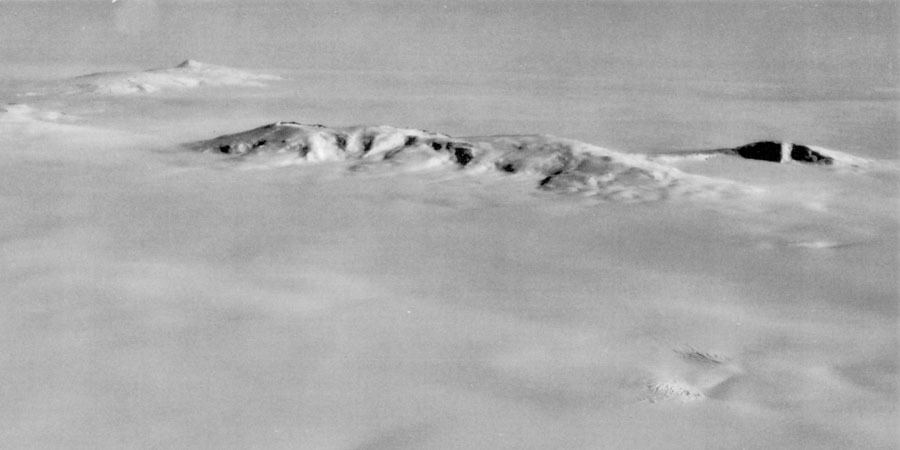
 | Aerial view of the Ames Range from the east, with Mounts Andrus, Kosciusko, and Kauffman from left to right; visible in the far distance at left is Mount Berlin (U.S. Navy photo) <click to enlarge> |
Mount Andrus
9770 ft (2978 m) . |
||
| Location: | Ames Range of western Marie Byrd Land, Antarctica | ||
| Lat / Long: | 75.8° S, 132.3° W | ||
| Volcanic Type: | Shield volcano | ||
| Volcanic Status: | Dormant / extinct | ||
| First Ascent: | Geological party, 1967 | ||
| First Ski Descent: | |||
| Skiable Vertical: | over 4500 ft (1400 m) | ||
| Mount Andrus is the highest and oldest of three overlapping shield volcanoes which form the Ames Range, located about 60 miles (100 km) northeast of Mount Berlin. The other volcanoes are Mounts Kosciusko and Kauffman, which are several million years younger than the roughly 11 million year old Mount Andrus. Despite their age, both Andrus and Kosciusko have well preserved summit calderas about 3 miles (5 km) and 2 miles (3 km) in diameter respectively. Even more surprisingly, there is a small parasitic cone just west of the rim of the Andrus caldera which has been dated to less than 100,000 years. This is an exceptionally long gap of over 10 million years since the main shield of Mount Andrus was constructed. The entire Ames Range is completely surrounded by the West Antarctic Ice Sheet, with an exposure above ice level of about 4500 ft (1400 m) on the west side and 4000 ft (1200 m) on the south and east sides. | |||
 |
Some useful links: Global Volcanism Program: Mount Andrus United States Antarctic Resource Center USGS Atlas of Antarctic Research (online maps & photos) |
||
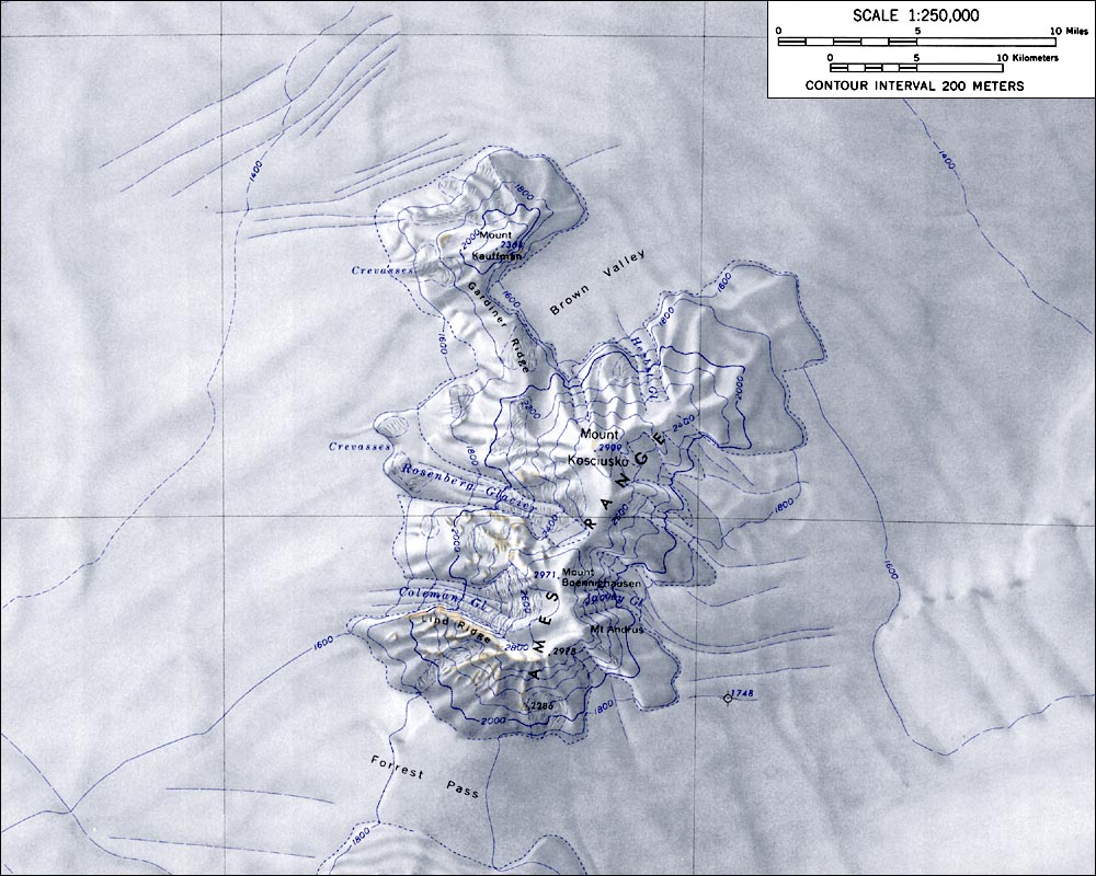
| Topographic map of the Ames Range (1:250,000 scale) from USGS Mount Kosciusko <click to enlarge> |
|||
More photos and info about routes, access, etc. may be added in the future ... |
|||