Kauai: SR 50, SR 56, SR 550 Hwy Corridor ..
|
|
Oahu: H1, H2, H3, SR 72, SR 83, SR 93 Hwy Corridor ..
|
KauaiCam, Makai Woods Golf Course, Princeville on SR 56 along the northern shore
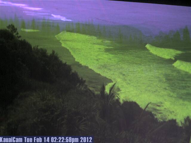
Elevation: 200 ft
|
Chiefess Kamakahelei Middle School, on SR 50 in Lihue, looking west towards mountains

Elevation: 300 ft
|
|
|
Waialua High and Intermediate School, on SR 930 in Waialua, looking south

Elevation: 100 ft
|
Ka Waihona O Ka Na Auao School, on SR 93 in Waianae, looking east

Elevation: 100 ft
|
|
Mililani Ike Elementary School, in Mililani east of Interstate H2 at exit 5, looking east towards mountains

Elevation: 1000 ft
|
|
Kapolei High School, in Kapolei south of Interstate H1 at exit 2, looking north towards mountains

Elevation: 100 ft
|
|
Diamond Head Oahu Webcam, looking ESE from Makakilo City on H1 @ MP 2

Elevation: 600 ? ft
|
|
KITV Ala Moana Webcam, looking NW from downtown Honolulu on H1 @ MP 23

Elevation: 300 ? ft
|
Waikiki Beach Live Camera, looking east towards Diamond Head
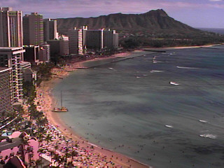
Elevation: 300 ft
|
Aina Haina Elementary School, on SR 72 in Honolulu, looking north towards mountains

Elevation: 100 ft
|
Niu Valley Middle School, on SR 72 in Honolulu, looking north towards mountains

Elevation: 100 ft
|
Maui, Molokai, and Lanai: Haleakala, SR 30, SR 31, SR 37, SR 450, SR 440 Hwy Corridor ..
|
North Kihei Webcam, in Kihei on SR 31, looking west towards the West Maui Mountains

Elevation: 30 ft
|
Charley Young Beach at Kamaole 1 Beach in Kihei on SR 31, looking west towards the flank of the West Maui Mountains
Elevation: 100 ft
|
|
Blue Hawaiian Kahului Heliport Webcam, near the junction of SR 36 and 37, looking west towards the West Maui Mountains

Elevation: 60 ft
|
Maui Windcam, looking at mountains along the northern coast

Elevation: 30 ft
|
Akaku Maui Community Television, looking at West Maui mountains from Kahului

Elevation: 200 ft
|
|
Haleakala Crater Live Camera, near the summit of Haleakala, looking east from the crater rim

Elevation: 9800 ft
|
Haleakala Observatories Camera, near the summit of Haleakala

Elevation: 10000 ft
|
Haleakala Observatories, Los Cumbres Observatory, Faulkes Telescope North Camera, near the summit of Haleakala

Elevation: 10000 ft
|
Haleakala Observatories, Los Cumbres Observatory All Sky Cam, view of entire sky from near the summit of Haleakala

Elevation: 10000 ft
|
Haleakala Observatories All Sky Cam, view of entire sky from near the summit of Haleakala

Elevation: 10000 ft
|
Big Island of Hawaii: Mauna Kea, SR 200 (Saddle Rd) Hwy Corridor ..
|
University of Hawaii Hilo Physics and Astronomy Webcam, looking SW near summit of Mauna Kea

Elevation: 13750 ft
|
United Kingdom Infra-Red Telescope (UKIRT) Webcam, looking SW near summit of Mauna Kea, with flank of Mauna Loa in the distance

Elevation: 13750 ft
|
Canada France Hawaii Telescope (CFHT) Webcam, looking NW from near the summit of Mauna Kea
Elevation: 13700 ft
|
Canada France Hawaii Telescope (CFHT) Webcam, looking NE at cinder cones near the summit of Mauna Kea

Elevation: 13700 ft
|
Canada France Hawaii Telescope (CFHT) Cloud Cam, looking NE from near the summit of Mauna Kea

Elevation: 13700 ft
|
Canada France Hawaii Telescope (CFHT) Webcam, looking north at the CFHT atop a cinder cone at the summit of Mauna Kea
Elevation: 13700 ft
|
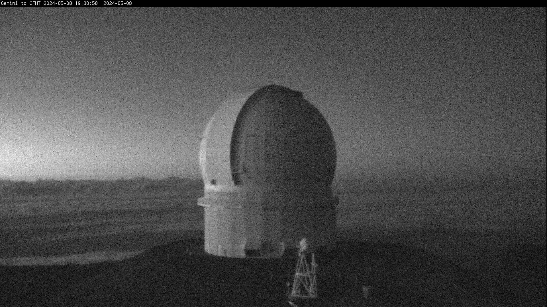
Canada France Hawaii Telescope (CFHT) Webcam, looking south at the Gemini Telescope atop a cinder cone at the summit of Mauna Kea
Elevation: 13700 ft
|
Canada France Hawaii Telescope (CFHT) ASIVA Webcam

Elevation: 13700 ft
|
NASA Infrared Telescope Facility (IRTF) Webcam, near the summit of Mauna Kea

Elevation: 13650 ft
|
NASA Infrared Telescope Facility (IRTF) Webcam, looking south at Mauna Loa from near the summit of Mauna Kea

Elevation: 13650 ft
|
NASA Infrared Telescope Facility (IRTF) Webcam, looking west at the Subaru and Keck Telescopes near the summit of Mauna Kea

Elevation: 13650 ft
|
NASA Infrared Telescope Facility (IRTF) Webcam, looking east at IRTF near the summit of Mauna Kea

Elevation: 13650 ft
|
Keck Telescope Webcam 1, looking NE at the IRTF anf CFHT near the summit of Mauna Kea
Elevation: 13600 ft
|
Keck Telescope Webcam 2, looking north at the Keck 2 dome near the summit of Mauna Kea

Elevation: 13600 ft
|
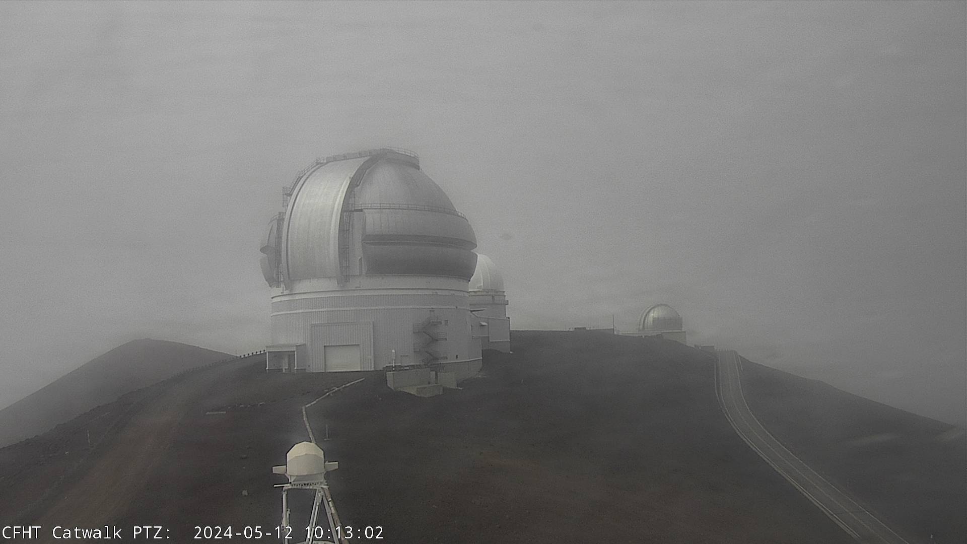
Subaru Telescope Catwalk Camera, looking north from near the summit of Mauna Kea

Elevation: 13550 ft
|
Subaru Telescope Catwalk Camera, looking east at the Keck Telescopes near the summit of Mauna Kea

Elevation: 13550 ft
|
Subaru Telescope Catwalk Camera, looking SE at several other telescopes near the summit of Mauna Kea

Elevation: 13550 ft
|
Subaru Telescope Catwalk Camera, looking south at cinder cones near the summit of Mauna Kea

Elevation: 13550 ft
|
James Clerk Maxwell Telescope (JCMT) Webcam, looking east (?) near the summit of Mauna Kea

Elevation: 13400 ft
|
Mauna Kea Camera, looking south from the Smithsonian Institute Observatory (Submillimeter Array) near the summit of Mauna Kea

Elevation: 13400 ft
|
Submillimeter Array (SMA) Webcam

Elevation: 13400 ft
|
Caltech Submillimeter Observatory parking lot, near the summit of Mauna Kea

Elevation: 13400 ft
|
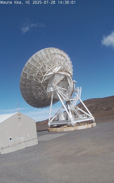
Very Long Baseline Array (VLBA) Webcam, located 3 miles below the summit of Mauna Kea
Elevation: 12200 ft
|
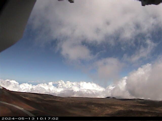
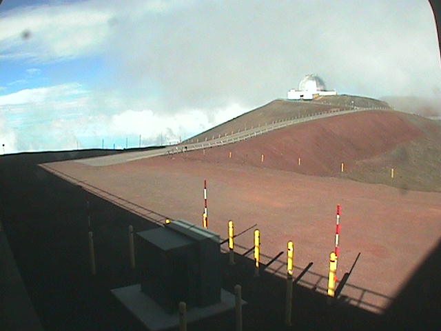
Mauna Kea Visitor Information Station, 6 miles N of SR 200 (Saddle Rd)

Elevation: 9200 ft
|
Mauna Kea Visitor Information Station, All Sky Cam, 6 miles N of SR 200 (Saddle Rd)

Elevation: 9200 ft
|
Big Island of Hawaii: Western coast and Mauna Loa, SR 200 (Saddle Rd), SR 19, SR 190 Hwy Corridor ..
|
Hualalai Academy, on SR 190 in Kailua Kona, looking west

Elevation: 800 ft
|
Blue Hawaiian Wailkoloa Heliport Webcam, on SR 19 at Waikoloa Road, looking SW towards Kona

Elevation: 120 ft
|
|
Waimea Elementary School, near junction of SR 19 and SR 190 in Waimea, looking south towards Mauna Kea and Mauna Loa

Elevation: 2700 ft
|
|
Hawaiian Volcano Observatory, panorama of Mokuaweoweo, the summit caldera of Mauna Loa Volcano, NE view

Elevation: 13650 ft
|
Hawaiian Volcano Observatory, panorama of Mokuaweoweo, the summit caldera of Mauna Loa Volcano, east view

Elevation: 13650 ft
|
Hawaiian Volcano Observatory, panorama of Mokuaweoweo, the summit caldera of Mauna Loa Volcano, SE view

Elevation: 13650 ft
|
Hawaiian Volcano Observatory, panorama of Mokuaweoweo, the summit caldera of Mauna Loa Volcano, south view

Elevation: 13650 ft
|
Hawaiian Volcano Observatory, panorama of Mokuaweoweo, the summit caldera of Mauna Loa Volcano, SW view

Elevation: 13650 ft
|
Hawaiian Volcano Observatory, thermal image of Mokuaweoweo, the summit caldera of Mauna Loa Volcano, SW view

Elevation: 13650 ft
|
Mauna Loa Observatory, North Camera, looking north at Mauna Kea from the north flank of Mauna Loa

Elevation: 11100 ft
|
Mauna Loa Observatory, Southwest Camera, looking SW from the north flank of Mauna Loa

Elevation: 11100 ft
|
Mauna Loa Observatory, Deck Camera, looking east from the north flank of Mauna Loa

Elevation: 11100 ft
|
Mauna Loa Observatory, Kona Camera, looking SW from the north flank of Mauna Loa

Elevation: 11100 ft
|
Mauna Loa Observatory, Gate Camera, looking NE from the north flank of Mauna Loa

Elevation: 11100 ft
|
Mauna Loa Observatory, Tower Camera, looking east from the north flank of Mauna Loa

Elevation: 11100 ft
|
Big Island of Hawaii: Kilauea and eastern coast, SR 11, SR 19 Hwy Corridor ..
|
Hawaii Volcanoes National Park, view of Kilauea caldera and Halema`uma`u crater, looking SW

Elevation: 4000 ft
|
Hawaiian Volcano Observatory, panorama of Kilauea caldera and Halema`uma`u crater, east view

Elevation: 4100 ft
|
Hawaiian Volcano Observatory, panorama of Kilauea caldera and Halema`uma`u crater, SE view

Elevation: 4100 ft
|
Hawaiian Volcano Observatory, panorama of Kilauea caldera and Halema`uma`u crater, south view

Elevation: 4100 ft
|
Hawaiian Volcano Observatory, Halema`uma`u overlook vent on Kilauea Volcano, SSE view

Elevation: 4100 ft
|
Hawaiian Volcano Observatory, lava lake inside Halema`uma`u crater on Kilauea Volcano

Elevation: 3600 ft
|
Hawaiian Volcano Observatory, thermal image of lava lake inside Halema`uma`u crater

Elevation: 3600 ft
|
Hawaiian Volcano Observatory, 4x2 grid panorama of Pu`u `O`o vent from its north rim, on SE flank of Kilauea Volcano

Elevation: 2400 ft
|
Hawaiian Volcano Observatory, 4x2 grid panorama of Pu`u `O`o vent from its north rim, on SE flank of Kilauea Volcano

Elevation: 2400 ft
|
Hawaiian Volcano Observatory, 4x2 grid panorama of Pu`u `O`o vent from its north rim, on SE flank of Kilauea Volcano

Elevation: 2400 ft
|
Hawaiian Volcano Observatory, 4x2 grid panorama of Pu`u `O`o vent from its north rim, on SE flank of Kilauea Volcano

Elevation: 2400 ft
|
Hawaiian Volcano Observatory, thermal image of Pu`u `O`o vent from its north rim, on SE flank of Kilauea Volcano

Elevation: 2400 ft
|
Hawaiian Volcano Observatory, temporary research camera on Pu`u `O`o looking west, on SE flank of Kilauea Volcano

Elevation: 2400 ? ft
|
Hawaiian Volcano Observatory, thermal image from temporary research camera on Pu`u `O`o looking west, on SE flank of Kilauea Volcano

Elevation: 2400 ? ft
|
Hawaiian Volcano Observatory, temporary research camera east of Pu`u `O`o looking west, on SE flank of Kilauea Volcano

Elevation: 2000 ? ft
|
Hawaiian Volcano Observatory, thermal image from temporary research camera east of Pu`u `O`o looking west, on SE flank of Kilauea Volcano

Elevation: 2000 ? ft
|
Hawaiian Volcano Observatory, mobile camera 2, west of the flows looking towards the east, on SE flank of Kilauea Volcano

Elevation: 1000 ? ft
|
Hawaiian Volcano Observatory, mobile camera 3, east of Royal Gardens, looking SW over coastal plain flow field, on SE flank of Kilauea Volcano

Elevation: 1000 ? ft
|
Hawaiian Volcano Observatory, temporary research camera on Holei Pali, looking east towards Pulama Pali and coastal flow field, on SE flank of Kilauea Volcano

Elevation: 2000 ? ft
|
|
University of Hawaii at Hilo, Wailoa State Park, in Hilo off SR 11

Elevation: 50 ft
|
University of Hawaii at Hilo, Hilo Lagoon Center, Mauka View, in Hilo off SR 11

Elevation: 50 ft
|
Pacific Tsunami Museum Hilo Bay Webcam, in Hilo on SR 19

Elevation: 50 ft
|
|
|
|
|
|
|
|

Elevation: 2400 ft
|

Elevation: 2400 ft
|

Elevation: 2400 ft
|

Elevation: 2400 ft
|
|
| Map of Camera Sites: (each corridor is enclosed in a gray box) |
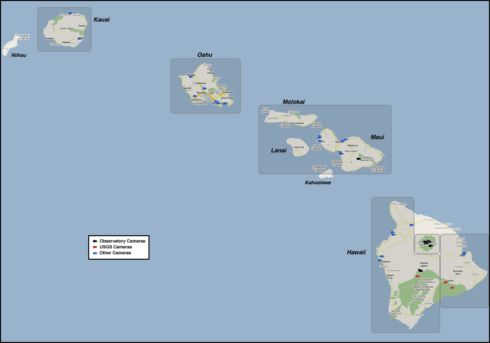 |
| Kauai: SR 50, SR 56, SR 550 Hwy Corridor |
|
|
2 |
|
| Oahu: H1, H2, H3, SR 72, SR 83, SR 93 Hwy Corridor |
|
|
|
|
|
|
|
|
|
|
|
|
|
9 |
|
| Maui, Molokai, and Lanai: Haleakala, SR 30, SR 31, SR 37, SR 450, SR 440 Hwy Corridor |
|
|
|
|
|
|
|
|
|
|
|
|
10 |
|
| Big Island of Hawaii: Mauna Kea, SR 200 (Saddle Rd) Hwy Corridor |
|
|
|
|
|
|
|
|
|
|
|
|
|
|
|
|
|
|
|
|
|
|
|
|
|
25 |
|
| Big Island of Hawaii: Western coast and Mauna Loa, SR 200 (Saddle Rd), SR 19, SR 190 Hwy Corridor |
|
|
|
|
|
|
|
|
|
|
|
|
|
|
|
|
|
15 |
|
| Big Island of Hawaii: Kilauea and eastern coast, SR 11, SR 19 Hwy Corridor |
|
|
|
|
|
|
|
|
|
|
|
|
|
|
|
|
|
|
|
|
|
|
|
22 |
|
|
|
|
|
|
|
|
|
|
|
|
4 |
|
|
|
| Page History: |
|
|
|
Page Statistics: |
| December 2008 | Original version with 58 camera views in 6 corridors (rows), based on the
Washington Mountain WebCams webpage; includes a PHP script to allow changing the image size
Also includes a map of camera sites and corridors, with a table of mini camera images beside the map,
and the option to show pixel rulers along the bottom and right edges of the page
Note that some of these images are multiple directional views from a single camera
Modified page layout code to place the first two corridors (which have very few cameras) side-by-side instead of in consecutive table rows
Later expanded to 62 camera views, rearranged several cameras
|
Page loaded at 3:15 AM PDT on Monday, June 22, 2026
Total camera images: 87
National Park Service: 1
US Geological Survey: 28
Mauna Loa Observatory (NOAA): 7
WeatherBug InstaCams: 9
Approximate page width: 8900 pixels 8850
Approximate page height: 3300 pixels 3298
|
| January 2009 | Minor fixes |
| March 2009 | Expanded to 63 camera views |
| May 2009 | Expanded to 71 camera views, including new HVO cams, rearranged several cameras |
| December 2009 | Expanded to 73 camera views, fixed several camera links which had changed including all Mauna Loa Observatory cams |
| January 2010 | Updated the site navigation bars to include the various other Mountain WebCams pages |
| October 2010 | Fixed some camera links which had changed |
| January 2011 | Expanded to 74 camera views, fixed several camera links which had changed |
| June 2011 | Expanded to 78 camera views, fixed several camera links which had changed |
| December 2011 |
Reduced to 75 camera views, removing several defunct camera images, adding several new camera images
Fixed several camera links which had changed, including all Hawaiian Volcano Observatory cams
Added an extra row to better display the 4x2 grid panorama of Pu`u `O`o vent from its north rim
|
| November 2012 |
Expanded to 82 camera views, removing some defunct camera images, adding several new camera images including Hawaiian Volcano Observatory thermal images
Fixed several camera links which had changed, including all Hawaiian Volcano Observatory and Instacam images
|
| December 2012 | Expanded to 83 camera views, adding the new FTN telescope camera on Haleakala |
| March 2013 | Expanded to 84 camera views, adding the Mauna Kea Visitor Information Station, All Sky Cam |
| November 2013 |
Expanded to 88 camera views, adding LCO All Sky, CSO parking lot, Akaka Maui, and Waianae school cams
Fixed several camera links which had changed, including all Subaru Telescope images
|
| December 2013 | Reduced to 87 camera views, removing 1 defunct cam, and fixed several camera links which had changed |
| December 2014 | Fixed some camera links which had changed |
| March 2015 | Fixed some camera links (UKIRT and JCMT) which had changed due to closure of the Joint Astronomy Centre |
|