Timberline Lodge and Mount Hood Meadows
|
Distant view of Mt Jefferson from 45 miles north
on Mt Hood, Timberline Lodge USFS Cam, off US 26

Elevation: 5900 ft
|
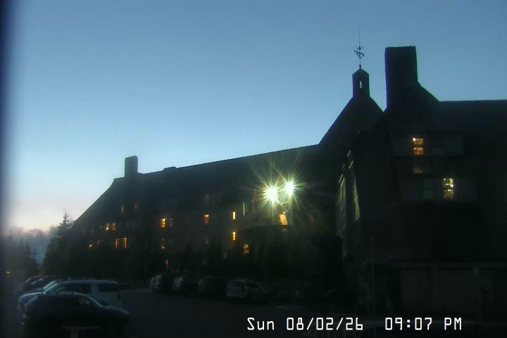
Mt Hood, Timberline Lodge KGW-TV Webcam, off US 26

Elevation: 5900 ft
|
Mt Hood, Timberline Lodge Webcam, off US 26
Elevation: 5900 ft
|
Mt Hood, Timberline Lodge Ski Area,
parking lot at top of Brunos
Elevation: 5900 ft
|
Mt Hood, Timberline Lodge Ski Area,
snow stake cam
Elevation: 5900 ft
|
Mt Hood, Timberline Lodge Ski Area,
looking at Jeff Flood Express and bottom of Magic Mile

Elevation: 6000 ft
|
Mt Hood, Timberline Lodge Ski Area,
looking at Magic Mile from bottom of Palmer Lift
Elevation: 7000 ft
|
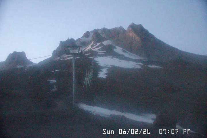
Mt Hood, Timberline Lodge Ski Area,
looking at Palmer Snowfield from Midway

Elevation: 7770 ft
|
Mt Hood Meadows, off ORE 35, top of Cascade Express

Elevation: 7300 ft
|
Mt Hood Meadows, off ORE 35, top of Blue Chair

Elevation: 6600 ft
|
Mt Hood Meadows, off ORE 35, top of Vista Express

Elevation: 6600 ft
|
Mt Hood Meadows, off ORE 35, top of Heather Canyon lift

Elevation: 6000 ft
|
Mt Hood Meadows, off ORE 35, bottom of of Vista Express

Elevation: 5250 ft
|
Mt Hood Meadows, off ORE 35, base area

Elevation: 5250 ft
|
Mt Hood Meadows, off ORE 35, KOIN-TV webcam

Elevation: 5250 ft
|
Government Camp and US 26 Corridor
|
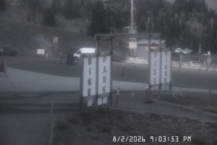
KPTV Mt Hood Ski Bowl Cam, movable cam atop Upper Bowl,
south of US 26 at MP 52.5

Elevation: 5000 ft
|
Mt Hood Ski Bowl, Upper Bowl, movable cam,
south of US 26 at MP 52.5

Elevation: 5000 ft
|
Mt Hood Ski Bowl, West Base, south of US 26 at MP 52.5

Elevation: 3650 ft
|
Mt Hood Ski Bowl, East Base, movable cam,
south of US 26 at MP 53.5

Elevation: 3850 ft
|
Located on Mt Hood,
6 miles SW of the summit

|
Mt Hood, Charlie's Mountain View Restaurant
in Government Camp on US 26 at MP 53.5

Elevation: 3900 ft
|
Located on Mt Hood,
5.5 miles SSW of the summit

|
Located on Mt Hood,
5.5 miles SSW of the summit

|
Distant Views of Mount Hood
|
Underwood WA Webcam, looking south at Mt Hood
from 26 miles north across Columbia River

Elevation: 600 ft
|
Underwood Mountain WA Webcam, looking south at
Mt Hood from 25 miles north across Columbia River

Elevation: 1250 ft
|
Sandbar Cam in White Salmon WA, looking south at Mt Hood
from 26 miles north across Columbia River

Elevation: 550 ft
|
Distant HD view of Mt Hood (and Larch Mtn)
from Washougal, WA, 34 miles NW across Columbia River

Elevation: 960 ft
|
USFS Columbia Gorge Cam, Wishram WA on SR 14 @ MP 93,
looking SW at Mt Hood from 40 miles NE

Elevation: 400 ft
(link to full-size 1600x1200 image)
|
KPTV Shriners Hospital Cam, Marquam Hill in Portland, I-5 @ MP 299,
movable cam, distant view of Mt Hood from 49 miles WNW,
or Mt St Helens from 52 miles SSW

Elevation: 500 ft
|
KGW-TV Wells Fargo Center in Portland, I-5 @ MP 300,
movable cam, distant view of Mt Hood from 49 miles WNW,
or Mt St Helens from 52 miles SSW, or Mt Adams from 74 miles SW

Elevation: 600 ft
|
OHSU TramCam, Marquam Hill in Portland, I-5 @ MP 299,
distant view of Mt Hood from 49 miles WNW

Elevation: 500 ft
|
| Show telemetry | Hide telemetry |
|
| Page History: |
|
| November 2009 | Original version with 13 camera views,
designed based on the Mount Rainier Paradise WebCams webpage,
with cameras from the Oregon Mountain WebCams webpage
Includes the option to show the last 24 hours of NWAC and
SNOTEL telemetry data from Mount Hood below the webcams
|
| December 2009 | Added code to error-check for missing SNOTEL data |
| January 2010 | Expanded to 14 camera views, adding view from Mt Hood Ski Bowl, and improved the links for the ODOT webcams
Added camera image modification times from webserver for the Timberline Lodge webcams and note about Mt Hood Ski Bowl webcam |
| March 2010 | Fixed broken links to SNOTEL website |
| May 2010 | Fixed unwanted line breaks in SNOTEL telemetry dates on narrow screens |
| July 2010 | Fixed one camera link which had changed |
| November 2010 |
Fixed a minor bug in the SNOTEL data display, which only occurred between 11pm and midnight and showed the previous day's date for the 0000 hour's data row
Fixed one camera URL which had changed
|
| December 2010 |
Expanded to 15 camera views, removing the defunct Ski Bowl webcam and adding another Govy and Mt Hood Meadows webcam
|
| March 2011 |
Expanded to 16 camera views, adding another Mt Hood Meadows webcam
Fixed a minor quirk in the SNOTEL data display, which only occurred when SNOTEL data is not available at a given site for the previous 24 hours
|
| November 2011 |
Expanded to 20 camera views and rearranged several images, adding several new ODOT webcams
Reduced image sizes slightly from 360-270-180 to 320-240-160 pixels high
|
| January 2012 | Expanded to 21 camera views, adding a new ODOT webcam |
| February 2012 | Updated the URLs from which to download the SNOTEL data, which had recently been changed slightly |
| May 2012 | Expanded to 24 camera views, adding 3 new Timberline Lodge webcams |
| August 2012 | Fixed 4 camera URLs which had changed |
| September 2012 | Expanded to 26 camera views, adding 2 views from across the Columbia River |
| November 2012 |
Reduced and expanded to 26 camera views, removing the defunct 5-view Timberline camera and adding ODOT and Ski Bowl cameras |
| December 2012 |
Expanded to 29 camera views and rearranged several images,
adding ODOT cameras farther west along US 26 and the USFS Columbia River Gorge cam
Revised the page layout to use separate tables for each row, to better accommodate the very different widths of images
Added the Top of Mt Hood Meadows NWAC site, plus the nearby Red Hill, Mud Ridge, and Blazed Alder SNOTEL sites, and moved all SNOTEL sites to a second row
Added more code to properly handle the new HTTP Status 404 errors from the SNOTEL server, and other unknown SNOTEL errors
|
| January 2013 | Expanded to 30 camera views, adding ODOT Warm Springs cam |
| March 2013 |
Forced to write a new external script to grab SNOTEL data,
after the long-existing SNOTEL data programs on the NWCC website were suddenly redirected to a beta-version report generator
The new script is a major improvement, it displays wind and solar data for any SNOTEL sites which have those sensors, mostly installed within the last few years
Added the nearby Clear Lake SNOTEL site, and improved the layout of the SNOTEL sites below the NWAC by using a separate table
|
| September 2013 |
Expanded to 32 camera views, adding the Palmer Snowfield and Ski Bowl East cams, and improved vertical alignment of several images |
| December 2013 | Fixed 2 ODOT camera URLs which had changed, and added the somewhat-nearby Clackamas Lake and Greenpoint SNOTEL sites |
| January 2014 | Fixed all Timberline Lodge camera URLs which had changed |
| July 2014 |
Expanded to 33 camera views, adding 2 new Timberline Lodge cameras and removing 1 defunct cam
Fixed all Timberline Lodge camera URLs which had changed AGAIN, along with all Ski Bowl camera URLs
|
| August 2014 | Fixed all Mt Hood Meadows camera URLs which had changed |
| November 2014 |
Expanded to 35 camera views in 5 rearranged rows, adding the Underwood Mountain webcam and OHSU Tram Cam, and
fixed several camera links and URLs which had changed
|
| December 2014 | Added the nearby North Fork and South Fork Bull Run SNOTEL sites, and fixed one camera URL which had changed |
| February 2015 | Fixed all Timberline Lodge camera URLs, which now apparently need "?nocache=time()" appended in order to update properly |
| November 2015 | Fixed one Mt Hood Ski Bowl camera URL which had changed |
| December 2015 |
Expanded to 38 camera views, adding 4 more actual views of Mount Hood from the KOIN-TV Mt Hood Meadows cam,
the KGW-TV Portland Wells Fargo Center cam, the Sandbar Cam in White Salmon, and a distant view from Washougal, WA, while removing the long-defunct KATU-TV Gorge Cam
|
| January 2016 |
Expanded to 39 camera views, adding the KPTV Mt Hood Ski Bowl Cam, and added distances from Mount Hood to each of the ODOT webcams
Added location info for all NWAC sites, improved the location info for many of the SNOTEL sites, and
updated the external script which grabs NWAC data to generate an HTML table
which matches the style of the SNOTEL and MesoWest data, so these WebCams pages can now show an arbitrary mix of NWAC, SNOTEL, and MesoWest telemetry sites in any order
Wrote a new external script to grab data from MesoWest (such as the data from
the RAWS telemetry sites), which downloads the data as a CSV file and formats it to match the style of the SNOTEL data
Added 4 nearby RAWS hourly telemetry sites northwest, north, south, and southeast
of Mount Hood which have precip, wind, solar, and other sensors (but not snowdepth)
|
| February 2016 |
Major internal PHP code cleanup, updating and/or deleting legacy code left over from very long ago, from the
Mount Rainier Paradise WebCams webpage (March 2009) on which all of these "Webcams + Telemetry Pages" are based,
and even from the original Washington Mountain WebCams webpage (December 2004) on which the Rainier page was based
Added descriptive dividers between major subregions of the webcam images, to clarify the layout of this fairly large and complex page
Added 2 AgriMet telemetry sites near Parkdale, which have data available via
MesoWest and include precip, wind, solar, and other sensors (but not snowdepth)
|
| March 2016 |
Added 1 more RAWS hourly telemetry site on Wanderer's Peak,
with data available via MesoWest
Fixed all Weather Underground camera URLs, which now apparently need "?time()" appended in order to update properly
|
| January 2017 |
Expanded to 41 camera views, adding the new Timberline Lodge snow stake cam and the KPTV Shriners Hospital Cam |
| October 2017 | Fixed all Timberline Lodge camera URLs which had changed AGAIN, and rearramged the distant views in the last row |
|
|
100
 |
200
 |
300
|
400
|
500
|
600
|
700
|
800
|
900
|
1000
|
1100
|
1200
|
1300
|
1400
|
1500
|
1600
|
1700
|
1800
|
1900
|
2000
|
2100
|
2200
|
Amar Andalkar Seattle, WA, USA
<About the Author / Contact Me>
All material on this website is ©1997-2026 by Amar Andalkar unless otherwise noted.
Last modified Sunday, May 23, 2021
|
|
| 100 |
 |
| 200 |
 |
| 300 |
|
| 400 |
|
| 500 |
|
| 600 |
|
| 700 |
|
| 800 |
|
| 900 |
|
| 1000 |
|
| 1100 |
|
| 1200 |
|
| 1300 |
|
| 1400 |
|
| 1500 |
|
| 1600 |
|
| 1700 |
|
| 1800 |
|
| 1900 |
|
| 2000 |
|
|


