Mount Jefferson WebCams
        Amar Andalkar's Ski Mountaineering and Climbing Site
Ski Mountaineering Photos & Trip Reports Equipment & Info Cascade Volcanoes Ring of Fire Site Map Links

Mountain WebCams Pages:     Cascade Volcano     Ring of Fire and Beyond     |     Alaska (except SE)     SE Alaska, Yukon, & Northern BC     SW British Columbia     Washington     Oregon     N California     Sierra Nevada     S California     Hawaii     Antarctic     .
WebCams + Telemetry Pages:     Whistler    Garibaldi    BC Cascades    Baker    N Cascades    Chelan    Olympic    Stevens    Blewett    Snoqualmie    Crystal    Rainier    White Pass    Adams    St Helens    Hood    Jefferson    Santiam    Bachelor    Diamond    Crater Lake    McLoughlin    Shasta    Lassen    Feather    Donner    N Tahoe    S Tahoe    Sonora    Yosemite    Mammoth    Sequoia    Whitney    Yellowstone    .
Image Size:     Large (320 px high)     Medium (240 px high)     Small (160 px high)         Page loaded at 3:35 AM PDT on Thursday, March 28, 2024 .
Hoodoo Ski Area, summit of Hoodoo Butte, 19 miles SSW of Mt Jefferson,
HD view looking north toward Hogg Rock, Three Fingered Jack, and Mt Jefferson


Elevation: 5700 ft
Hoodoo Ski Area off US 20, zoomed view looking NNE
toward Hogg Rock, Three Fingered Jack and Mt Jefferson


Elevation: 5400 ft
Distant view of Mt Jefferson from 45 miles north
on Mt Hood, Timberline Lodge USFS Cam, off US 26


Elevation: 5900 ft
View of Mt Jefferson from 22 miles east at Lake Billy Chinook,
with top of Olallie Butte also barely visible at right from 25 miles SE


Elevation: 2500 ft
Camp Sherman Cam, view of Mt Jefferson
through the trees from 18 miles SSE


Elevation: 3020 ft
Distant view of Mt Jefferson from 46 miles ESE,
Six Springs Ranch Weather Cam, east of US 26 in Grizzly


Elevation: 3900 ft
Smith Rock, east of US 97 @ MP 115,
39 miles SE of Mt Jefferson


Elevation: 2700 ft
Located 24 miles ENE of Mt Jefferson

 
Located 45 miles ENE of Mt Jefferson

 
Located 51 miles ENE of Mt Jefferson

 
Located 65 miles NE of Mt Jefferson

 
Located in Madras, 33 miles east of Mt Jefferson

 
Located 32 miles ESE of Mt Jefferson

 
Located 36 miles SE of Mt Jefferson

 
Located 36 miles SE of Mt Jefferson

 
Located east of US 97 @ MP 118,
42 miles SE of Mt Jefferson


Located east of US 97 @ MP 118,
42 miles SE of Mt Jefferson


Located 70 miles ESE of Mt Jefferson

 
Located 87 miles east of Mt Jefferson

 
Located 38 miles west of Mt Jefferson

Located 38 miles west of Mt Jefferson

Located 19 miles west of Mt Jefferson

Located 16 miles west of Mt Jefferson

Located 18 miles SSW of Mt Jefferson

Located 18 miles SSW of Mt Jefferson

Located 17 miles south of Mt Jefferson

Located 28 miles SSE of Mt Jefferson

Located 41 miles SE of Mt Jefferson

View of Three Sisters from Redmond,
42 miles SE of Mt Jefferson


Located 61 miles SE of Mt Jefferson


Show telemetry | Hide telemetry

Page History:
December 2013Original version with 21 camera views, designed based on and split off from the Santiam Pass WebCams webpage, with other cameras from the Oregon Mountain WebCams webpage
Includes the option to show the last 24 hours of SNOTEL telemetry data from sites near Mount Jefferson below the webcams
Also includes code to error-check for missing SNOTEL data, plus more code to properly handle the new HTTP Status 404 errors from the SNOTEL server, and other unknown SNOTEL errors
Uses a new external script to grab SNOTEL data, after the long-existing SNOTEL data programs on the NWCC website were suddenly redirected to a beta-version report generator
February 2014Expanded to 23 camera views, adding 2 new ODOT cams along US 26 to the east
October 2014Fixed 3 ODOT cam URLs which had changed
December 2015 Expanded to 26 camera views, adding 2 new ODOT cams along ORE 22 to the west and 1 more on ORE 370
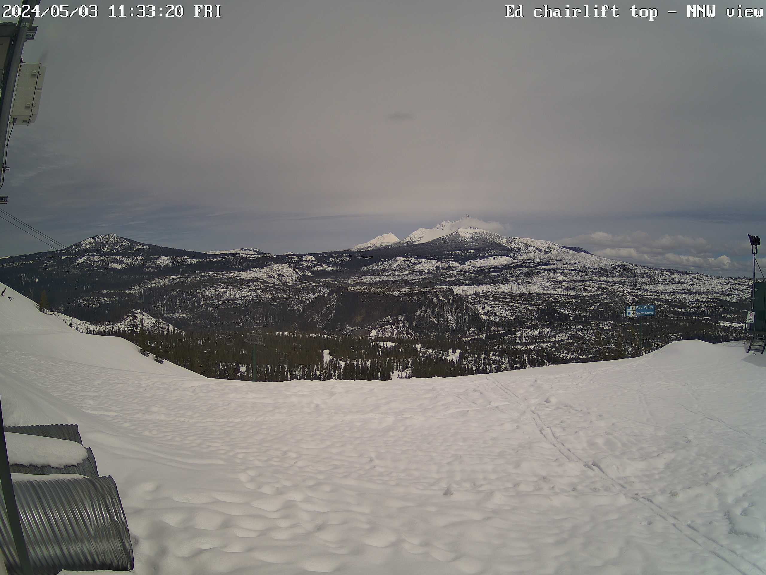
January 2016 Expanded to 27 camera views, adding the view from Camp Sherman
Improved the location info for all of the SNOTEL sites
Wrote a new external script to grab data from MesoWest (such as the data from the RAWS telemetry sites), which downloads the data as a CSV file and formats it to match the style of the SNOTEL data
Since there are only a few snow telemetry sites anywhere near Mount Jefferson, added 4 nearby RAWS hourly telemetry sites to the north, west, and east of Mount Jefferson which have precip, wind, solar, and other sensors (but not snowdepth)
February 2016 Major internal PHP code cleanup, updating and/or deleting legacy code left over from very long ago, from the Mount Rainier Paradise WebCams webpage (March 2009) on which all of these "Webcams + Telemetry Pages" are based, and even from the original Washington Mountain WebCams webpage (December 2004) on which the Rainier page was based
Added 1 more RAWS hourly telemetry site near Warm Springs, and also added 2 AgriMet telemetry sites near Detroit Lake and Madras, which have data available via MesoWest and include precip, wind, solar, and other sensors (but not snowdepth)
March 2016Fixed all Weather Underground camera URLs, which now apparently need "?time()" appended in order to update properly
November 2016Disable image modification time for one (probably defunct) camera link, which has been delaying this page from loading due to server non-response
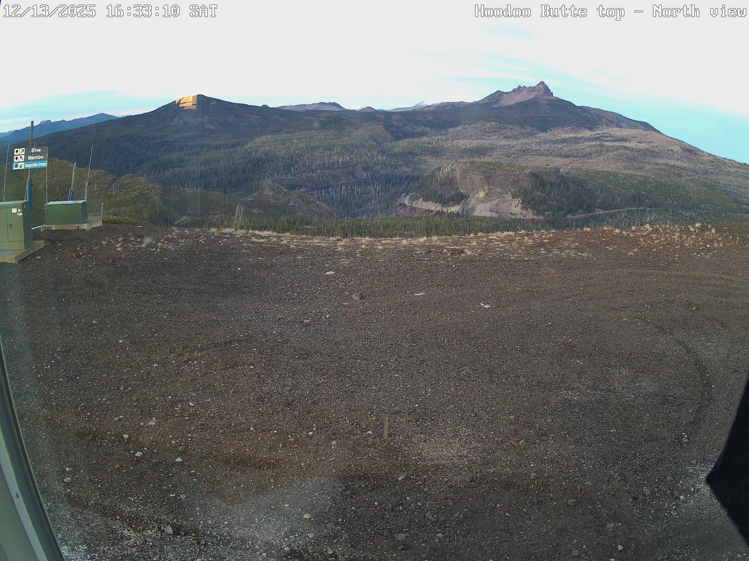
December 2016Expanded to 29 camera views, adding 2 new ODOT cams at Santiam Junction and Juniper Canyon
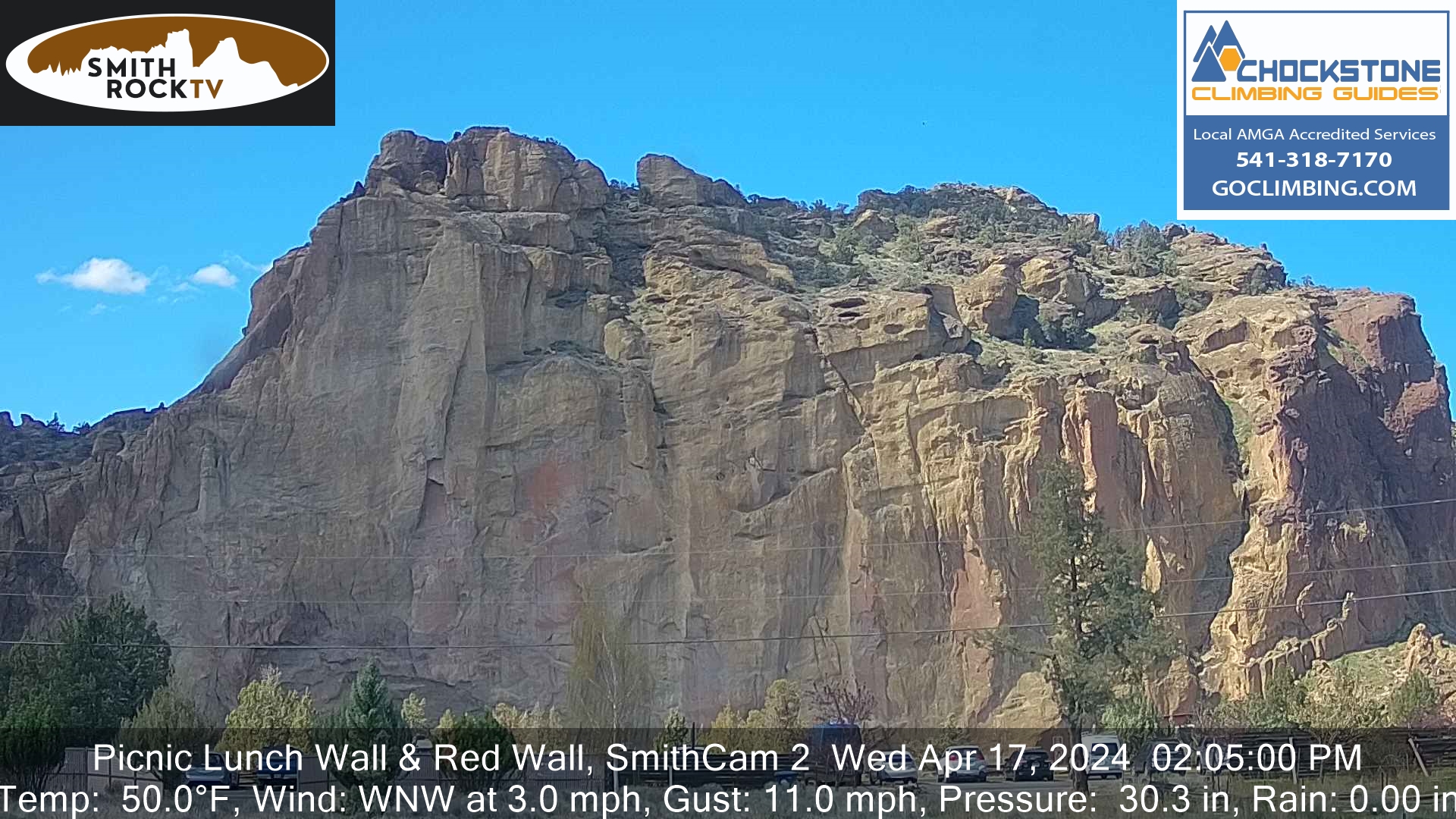
October 2017 Expanded to 30 camera views, adding 3 ODOT cams on US 97, while removing the long-defunct Black Butte Ranch north and Jefferson County Middle School cameras, and fixed the Smith Rock camera URL which had changed
Ski Mountaineering Photos & Trip Reports Equipment & Info Cascade Volcanoes Ring of Fire Site Map Links

Amar Andalkar   Seattle, WA, USA   <About the Author / Contact Me>
All material on this website is ©1997-2024 by Amar Andalkar unless otherwise noted.
Last modified Sunday, May 23, 2021