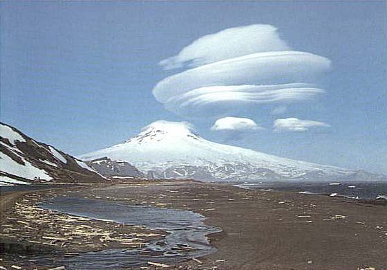
 | Beerenberg with a spectacular display of lenticular clouds (photo by Ernst Endresen) <click to enlarge> |
Beerenberg
7472 ft (2277 m) . |
||
| Location: | Jan Mayen Island, North Atlantic Ocean (territory of Norway) | ||
| Lat / Long: | 71.1° N, 8.2° W | ||
| Volcanic Type: | Stratovolcano | ||
| Volcanic Status: | Active, last eruption 1985 | ||
| First Ascent: | J. M. Wordie & party, 1921 | ||
| First Ski Descent: | |||
| Skiable Vertical: | over 7400 ft (2250 m) | ||
|
Beerenberg is the northernmost active volcano on land in the world, rising straight out of the Atlantic
on the northeast end of remote Jan Mayen Island, east of Greenland. Jan Mayen forms a part of the
Mid-Atlantic Ridge, having built up from the seafloor starting over 10000 ft (3000 m) below sea
level. The climate is relatively mild considering its location well north of the Arctic Circle,
but there is nearly constant cloudiness, fog, and drizzle throughout the year, averaging only about
three completely clear days per year. There is a small weather/radar station and airstrip near the
middle of the dumbbell-shaped island, and the only viable climbing/skiing route on Beerenberg is
from the south starting there. Access to the other sides is blocked by sheer cliffs and glaciers
which spill directly into the sea. |
|||
 |
More photos and info about routes, access, etc. may be added in the future ... |
||
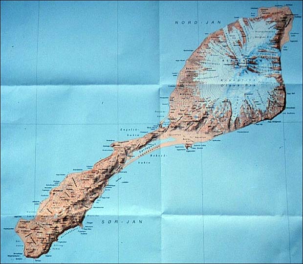
| Topographic map of Jan Mayen, with Beerenberg at upper right <click to enlarge> |
|||