 | Aerial view of Puy de Dome from the west (photographer unknown) |
Puy de Dôme
4803 ft (1464 m) . |
||
| Location: | Massif Central, Auvergne, central France | ||
| Lat / Long: | 45.5° N, 2.7° E | ||
| Volcanic Type: | Lava dome | ||
| Volcanic Status: | Dormant, possibly extinct | ||
| First Ascent: | Prehistoric | ||
| First Ski Descent: | |||
| Skiable Vertical: | over 1600 ft (500 m) | ||
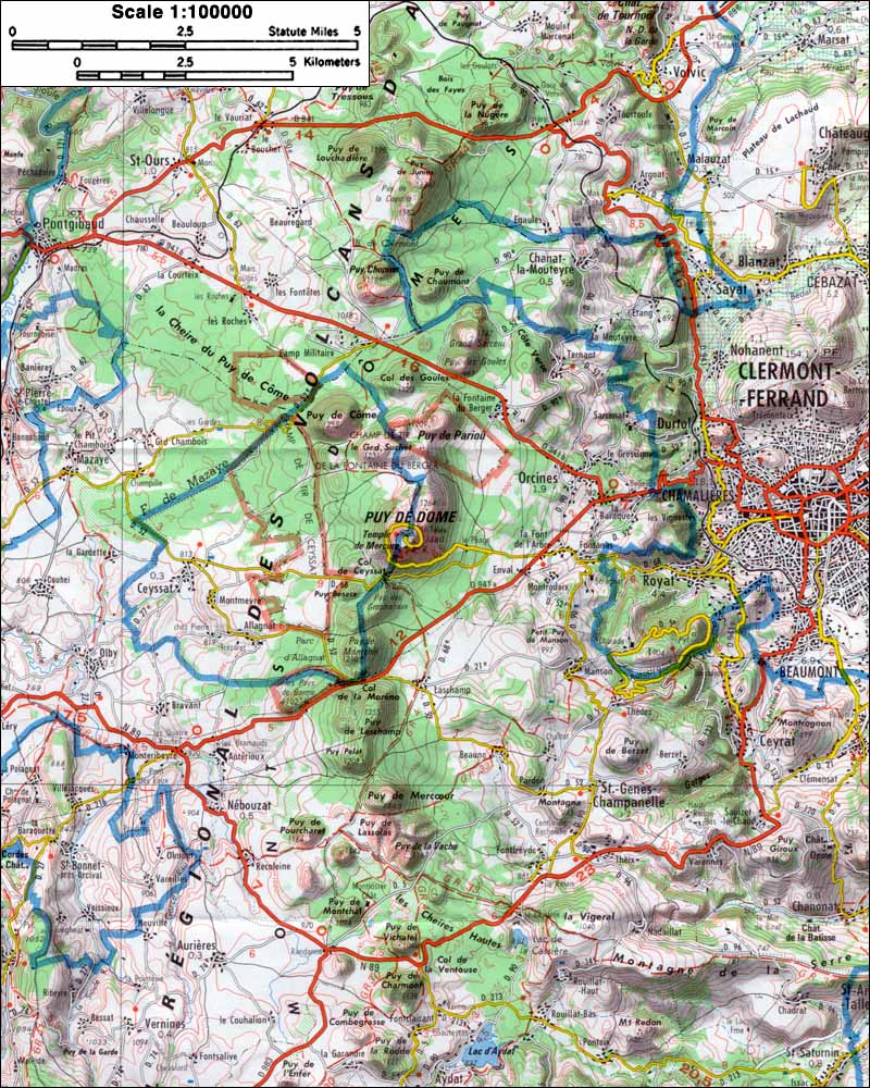
| Puy de Dome has been a prominent landmark in central France for many thousands of years, the highest of nearly a hundred lava domes and cinder cones which form the Chaine des Puys volcanic field just west of Clermont-Ferrand in Auvergne. The eruptions in the chain began about 100,000 years ago and continued until only 6000 years ago, with the climax from 12000 to 8000 years ago, so the chain as a whole must be considered dormant and not extinct. Most of the cones and domes are only a few hundred feet (about 100 m) high, but the Puy de Dome is exceptional, rising over 1600 ft (500 m) above its base. A road now leads to the summit of Puy de Dome, where modern communications towers along with the ruins of a Roman temple can be found. With adequate winter snowpack, there are a number of appealingly steep gullies dropping from the edges of the summit plateau which should be skiable. | |||
 |
Some useful links: Regional Nature Park of the Volcanoes of Auvergne (France's largest nature park) BRGM: Massif Central (geological information about the region) BRGM: La Chaîne des Puys (geological information about the Chaîne des Puys) 200 Volcans en 200 Randonnees (extensive hiking info for the region) More photos and info about routes, access, etc. may be added in the future ... |
||
| Topographic map of the Chaîne des Puys (1:100,000 scale) from IGN Cartes Touristiques 42 <click to enlarge> |
|||