Cascade Volcano WebCams, plus other North America Volcano WebCams
Page created May 2000, last updated December 2014,
loaded at 5:21 PM PDT (UTC-7) on Thursday, June 18, 2026
|
|
|
This page shows views of weather conditions throughout the Cascade Range from British Columbia to California, with a bonus section at the
end looking at other skiable volcanoes in North America plus Hawaii. It has grown enormously from its modest beginnings in May 2000, when only 8
webcams were shown. There are now 100 webcams shown on this page and well over 200 more webcams linked from it, along with over 1500 total camera
views shown on over 30 linked Mountain WebCams pages. In clear weather, this page regularly shows over 25 of the Cascade volcanoes (with several others
visible occasionally when cameras are aimed in alternate directions), plus over 40 other volcanoes in the rest of North America and Hawaii. This page
now covers about 1/4 of the Pacific Ring of Fire, extending from the Aleutian Islands of Alaska through the West Coast and down to Mexico. In addition,
the newer Volcano WebCams around the Pacific Ring of Fire and Beyond page (created in
November 2009) shows views of over 60 other skiable volcanoes around the rest of the Ring of Fire and throughout the world.
The regions shown on this page span a total of 5 time zones in winter and 6 time zones in summer, from the Hawaii-Aleutian TIme Zone
(UTC-10 year round in Hawaii, which does not observe DST) through Alaska Time, Pacific Time, and Mountain Time all the way east to central Mexico and
the Central Time Zone (UTC-6 in winter, UTC-5 in summer). The current time and time zone information are now displayed for each region.
The elevation of each camera is listed beside it (approximate in some cases). As of 2013, the highest webcam in the Cascade Range is
the Camp Muir webcam at 10100 ft on Mount Rainier, which was installed in May 2011. Prior to that installation, for many years the highest webcams in
the Cascades were on Mount Bachelor, including the two at Pine Marten Lodge (7700 ft) looking south at the summit and north at the Three Sisters, and
another at at the bottom of the Summit chairlift (7300 ft). Prior to those installations around 2004, the highest webcam in the Cascades had been the
Crater Lake Crater Cam at 7100 ft. However, the very highest webcams shown on this page are the 2 new webcams installed in September 2013 near the summit of
Sierra Negra in Mexico at just over 15000 ft, which are now the highest webcams in North America and apparently the highest in the world outside the
Mount Everest base camp region. Previously, the highest webcams shown had been those near the summit of Mauna Kea in Hawaii at over 13700
ft, followed by the Mauna Loa caldera cam at about 13650 ft, and a couple of the other Mexican volcano cams located at over 13000 ft. If you know of any other
webcams showing Cascade volcanoes or other North American volcanoes, please email me (thanks).
Note that all webcam links on this page are set to open in a single separate window. This page itself is not set to automatically update,
so please Refresh or Reload the page to update the webcam images.
Current weather data for the nearest cities can be optionally shown in the rightmost column (click here to show weather).
If this page is too wide for your monitor, it can be viewed in standard one-column mode.
|
| Image Size:
Large (150 px high)
Normal (110 px high)
Small (80 px high)
|
|
Fair Weather Image |
|
Most Recent Image |
|
| (click any image to enlarge in separate window) |
BRITISH COLUMBIA
Time Zone: PST (UTC-8)
Mar-Oct: PDT (UTC-7)
|
|
BC Ministry of Transportation: B.C. Highway Cams (100+ cameras),
or see my large SW BC Mountain WebCams page (170+ cameras)
|
|
|
|


|
|
|
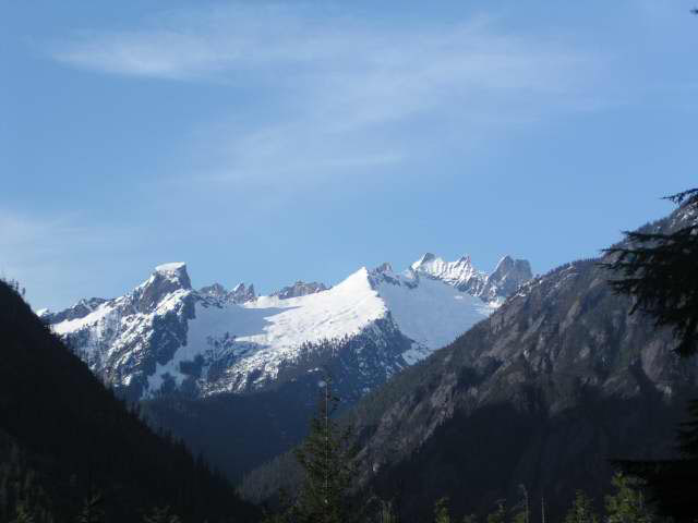
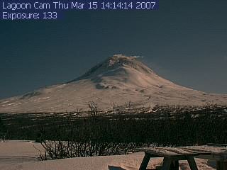
Mount Meager
8790 ft / 2679 m
50.6° N, 123.6° W |
Pemberton Airport WeatherCam
(700 ft)
Located 40 miles SE of Meager, views look west and east
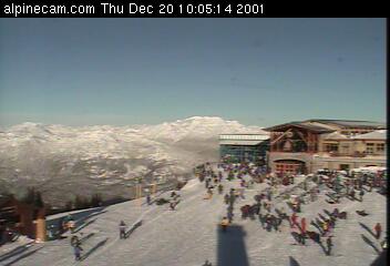
Whistler Alpine Webcam
(6100 ft)

View past lodge towards Meager (not visible) from 45 miles SE,
new wide-angle HD view as of late 2012
|
Mount Cayley
7854 ft / 2394 m
50.1° N, 123.3° W |
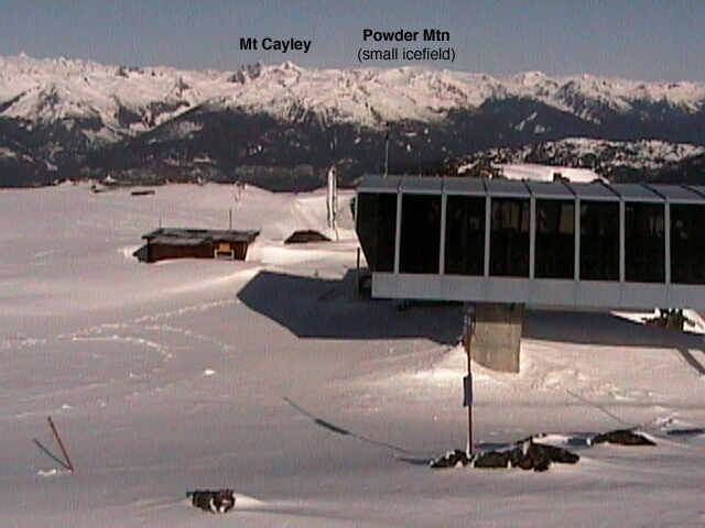
Whistler Peak WebCam
(7100 ft)
Nice view of Cayley and Powder Mtn icefield from 15 miles ESE,
new panoramic wide-angle HD view as of late 2013
Whistler Mid-Station WebCam
(4300 ft)
View across the valley towards Mt Cayley from 15 miles ESE
WhistlerLIVEwebcams.com
(2000 to 6000 ft)
Oven a dozen webcams located throughout Whistler village and the
surrounding area, including the summit of 6000 ft Sproatt Mtn
|
The Black Tusk
7598 ft / 2316 m
50.0° N, 123.0° W
Mount Garibaldi
8787 ft / 2678 m
49.8° N, 123.0° W
|
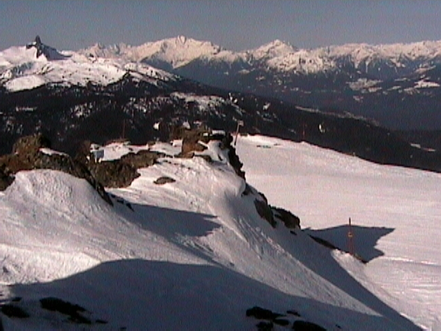
Whistler Peak WebCam
(7100 ft)
Pan far left for a nice view of The Black Tusk (the eroded core of a
stratovolcano in the Garibaldi Lake Volcanic Field) from 7 miles NE,
new wide-angle HD view as of late 2012
Skypilot Kiteboarding Squamish Webcam
(20 ft)
Live user-controlled camera with pan & zoom, excellent view
of Mt Garibaldi (Diamond Head) from about 10 miles SW of summit
(see example; default view looks away from Garibaldi at Howe Sound)
Blackcomb 7th Heaven WebCam
(7400 ft)
View looking south Mt Garibaldi and The Black Tusk
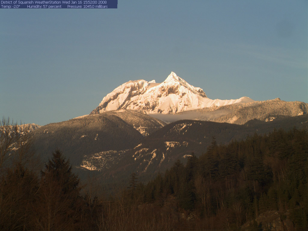
District of Squamish WebCam
(1000 ft ?)
Located on lower slopes of Garibaldi, about 5 miles SW of summit;
view looks away from Garibaldi SW at Squamish and Howe Sound
District of Squamish Garibaldi WebCam
(1000 ft ?)
Excellent closeup view of Garibaldi from about 5 miles SW of summit
|
|
|
|
|
WASHINGTON
Time Zone: PST (UTC-8)
Mar-Oct: PDT (UTC-7)
|
|
WSDOT: Statewide Cameras or
Mountain Pass Cameras (5 cameras),
or see my large Washington Mountain WebCams page (220+ cams)
|
|
|
|


|
|
|
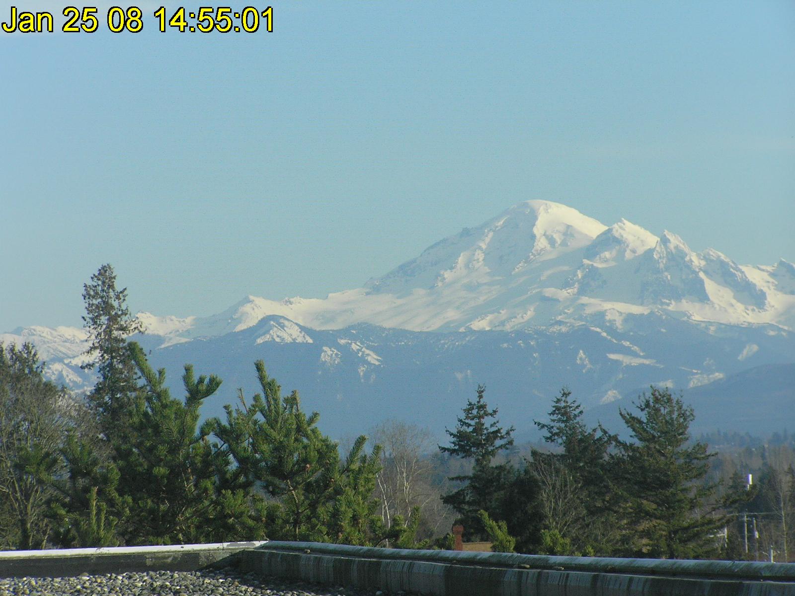
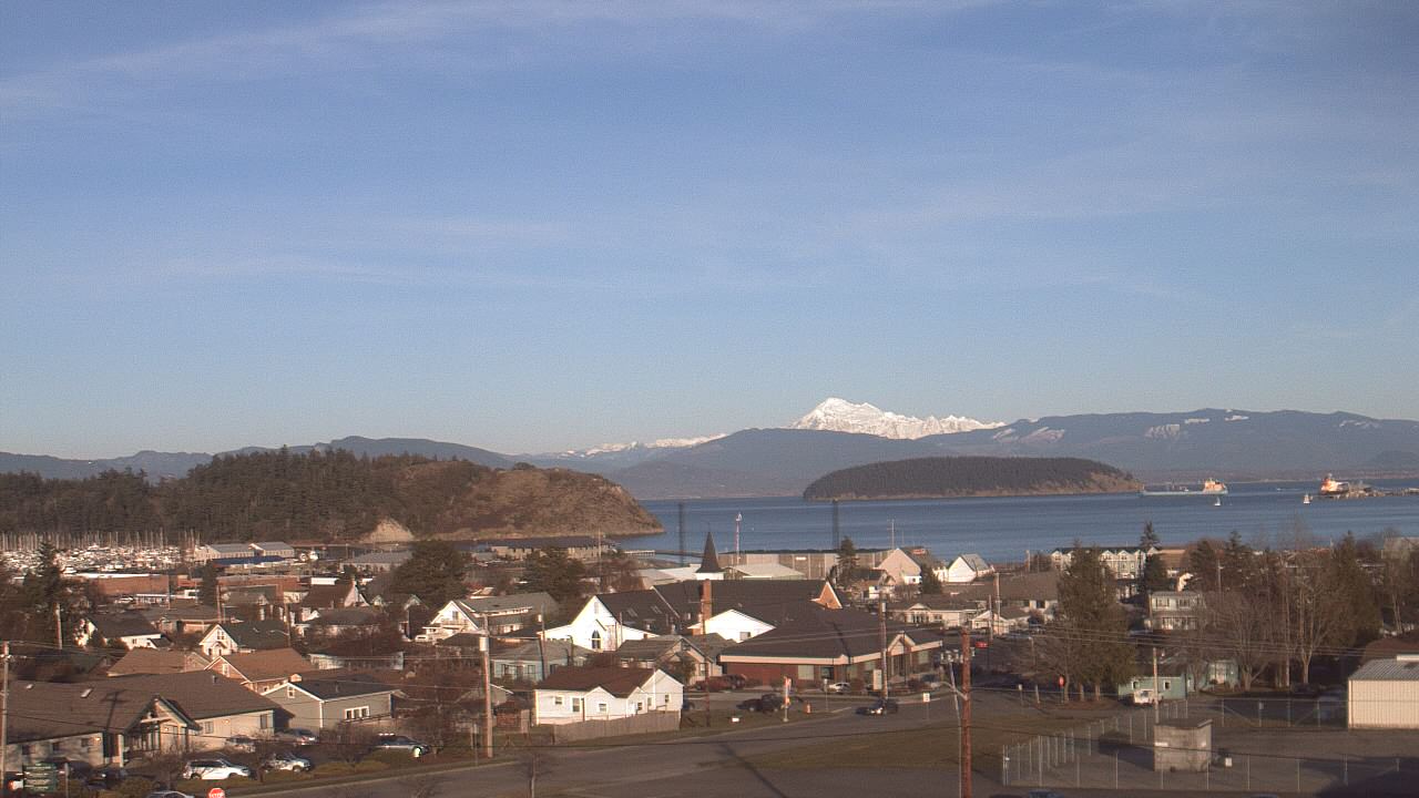
Mount Baker
10781 ft / 3286 m
48.8° N, 121.8° W |
Abbotsford Airport Visibility Camera
(200 ft)

Nice view of Mount Baker from 30 miles NW in Abbotsford, BC
BigWaveDave: Willows Beach Camera
(20 ft)
Distant view of Mount Baker from 70 miles WSW in Oak Bay, BC
Bluenose WebCam 2
(200 ft)
Distant panoramic view from 60 miles NW near Vancouver, BC;
Mount Baker is best visible around dawn and dusk
Northwest Clean Air Agency Mount Baker Cam
(50 ft)
Excellent zoomed view from 35 miles WNW in Ferndale
Island Cam Mount Baker Web Cam
(200 ft)
Zoomed view of Mount Baker from 55 miles WSW in Friday Harbor
(no longer shows Baker as of 2011 ?)
Anacortes Middle School Webcam
(100 ft)
Distant view of Mount Baker rising above the Twin Sisters
from 40 miles SW in Anacortes
|
Glacier Peak
10541 ft / 3213 m
48.1° N, 121.1° W |
North Cascades
National Park Air Quality Webcam (500 ft)

Located in Newhalem, 25 miles east of Mt Baker and 40 miles north
of Glacier Peak (no view of either; view looks NNW at Mount Terror)
Sun Mountain Lodge Sky Cam
(2800 ft)
Located 45 miles ENE (no view of Glacier Peak)
Darrington School District WebCam
(500 ft)
Located 25 miles northwest of Glacier Peak (no view of it),
looking south at Whitehorse Mountain (direct image link)
Stevens Pass US 2 WebCam (WSDOT)
(4000 ft)
Located 25 miles south (no view of Glacier Peak)
Stevens Pass Ski Area WebCams
(4000 ft)
Located 25 miles south (no view of Glacier Peak)
Seattle / Glacier Peak WebCam
(100 ft)
My own personal webcam!
Distant view of Glacier Peak from 70 miles WSW
|
|


|
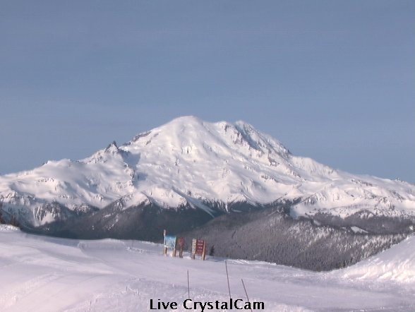
Mount Rainier
14411 ft / 4392 m
46.9° N, 121.8° W |
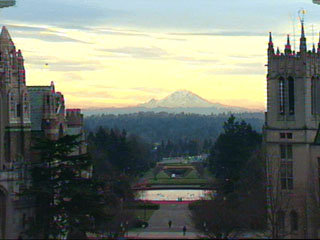
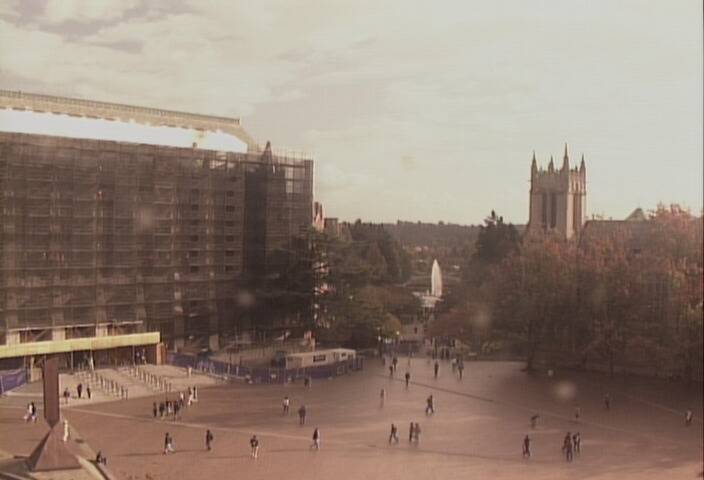
University of Washington Red Square Webcam
(200 ft)
Distant view of Rainier from Seattle (60 miles NW)
Seattle Space Needle Webcam
(700 ft)
360-degree pan-and-zoom webcam, with distant views of Mount
Rainier (from 60 miles NW) and Mount Baker (from 80 miles SSW)
Puget Sound Clean Air Agency: Seattle Visibility Cam
(500 ft)
Distant view of Rainier from Queen Anne Hill, Seattle (60 miles NW)
Queen Anne Hill Tower Cams (600 ft):
KING-5,
KIRO-7
Distant views of Rainier from Seattle (60 miles NW)
Rainier Nordwand Cam
(200 ft)
Distant zoomed infrared view of Rainier from Seattle (60 miles NW)
Crystal Mountain Ski Area
(6800 ft)
Close-up view of Rainier from 10 miles NE; unfortunately as of 2006,
this webcam was moved to Gold Hills (5000 ft) with no Rainier view;
at long last, in October 2011 a new movable webcam was installed at
the upper gondola terminal, and it is often aimed at Rainier
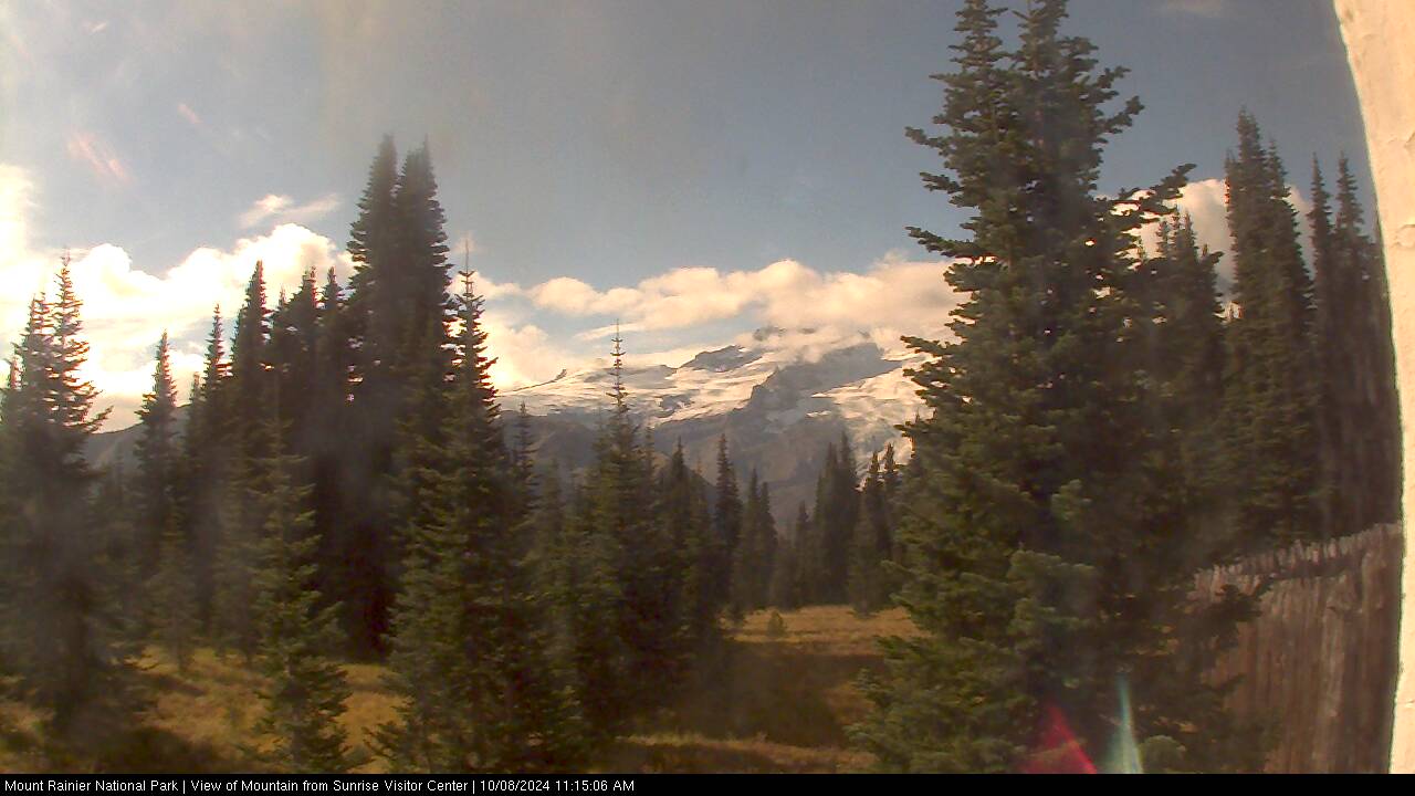
Mount Rainier
National Park Sunrise MountainCam (6400 ft)

Close-up view of Little Tahoma and Rainier
from 6 miles NE of the summit at Sunrise
Auburn Airport Cam
(100 ft) and
Auburn Holy Family School Cam
(100 ft)
Distant views of Rainier from Auburn (40 miles NW)
Rainier Computer Solutions Webcam
(300 ft)
Distant zoomed view of Rainier from Maury Island (50 miles NW)
Tacoma Weather Webcam
(400 ft)
Distant view of Rainier from Tacoma (40 miles NW)
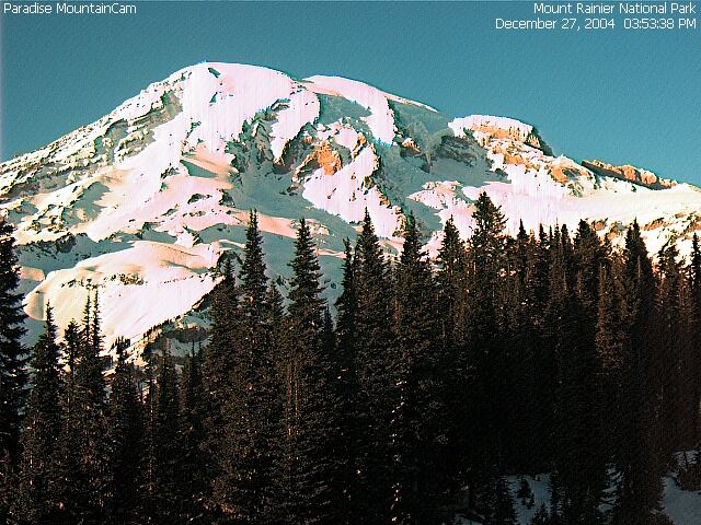
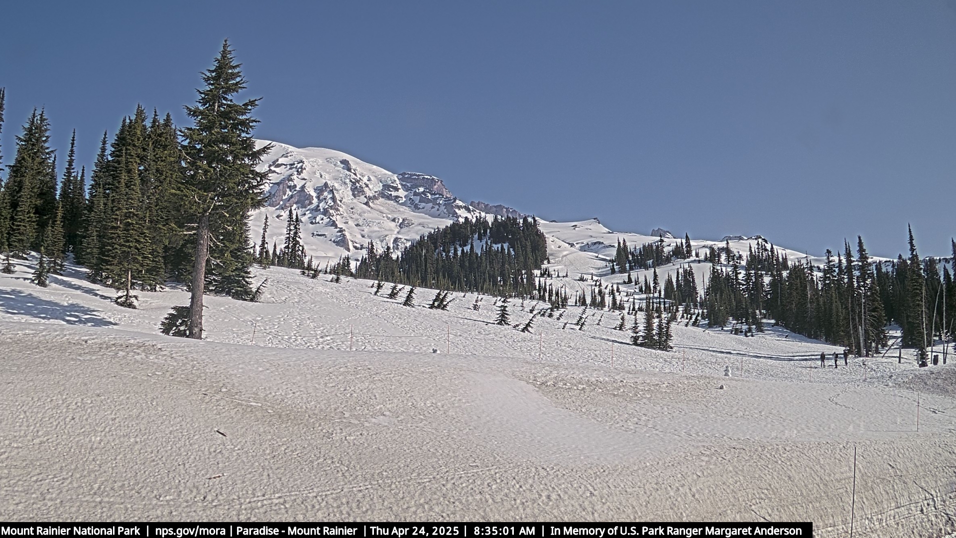
Mount Rainier
National Park Paradise MountainCam (5400 ft)
Close-up view from 5 miles south of the summit at Paradise
Mount Rainier WebCams
(5400 ft)
View 11 webcams at Mount Rainier National Park on a single page
Mount Rainier
National Park Air Quality Webcam (5400 ft)
Located 5 miles south of the summit at Paradise, looking
west down the Nisqually River valley (no view of Rainier)
Mount Rainier
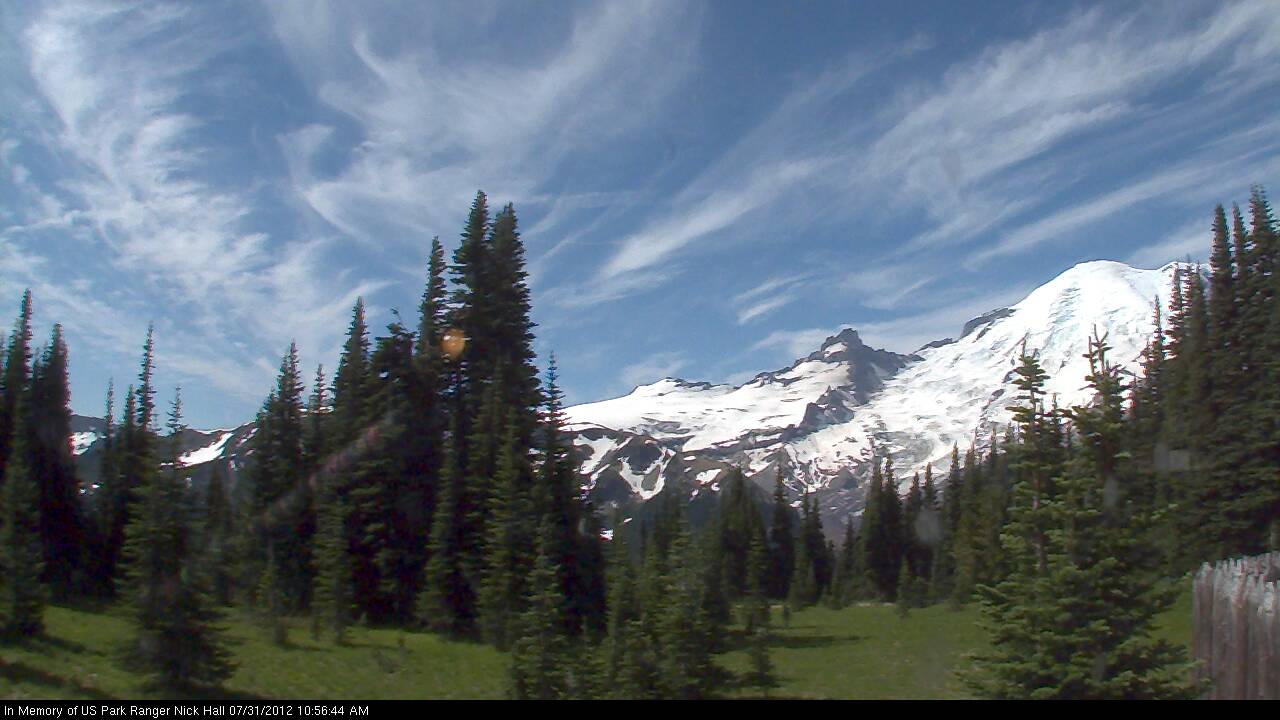
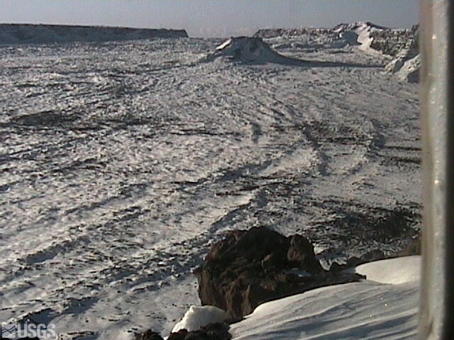
National Park Camp Muir Webcam (10100 ft)
Wide-angle view looking south from Camp Muir at Muir Snowfield
with Mounts Adams, Hood, and Saint Helens in the distance
|

|


|
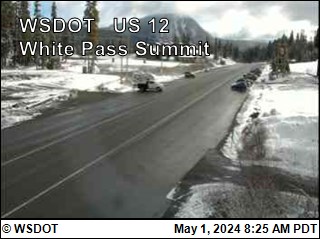
Goat Rocks
8184 ft / 2494 m
46.5° N, 121.5° W |
White Pass US 12 WebCam (WSDOT)
(4500 ft)
Located 10 miles north of Goat Rocks, looking east at the
small volcanic cone of Spiral Butte (no view of Goat Rocks)
|
|


|
Mount Adams
12276 ft / 3742 m
46.2° N, 121.5° W |
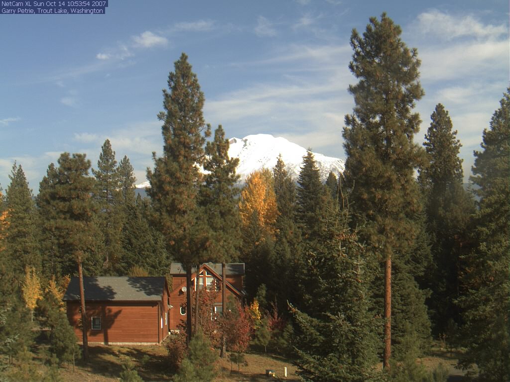
Mount Adams Trout Lake Ranger Station Webcam (1900 ft)
Apparently, a webcam was
installed here in October 1998, but it
was never online at any time since 2000; a new webcam was planned
to be installed in 2004 (see
archived FAQ), but that did not happen
Trout Lake Webcam
(1900 ft)
View of Mount Adams from 15 miles SSW in Trout Lake
Satus Pass US 97 WebCam (WSDOT)
(3100 ft)
Located 40 miles SE (no view of Adams)
KAPP-TV Yakima SkyCam
(1100 ft)
Distant view of the summit of Adams from 50 miles ENE
(see example; camera often points in other directions)
|
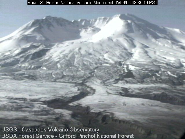
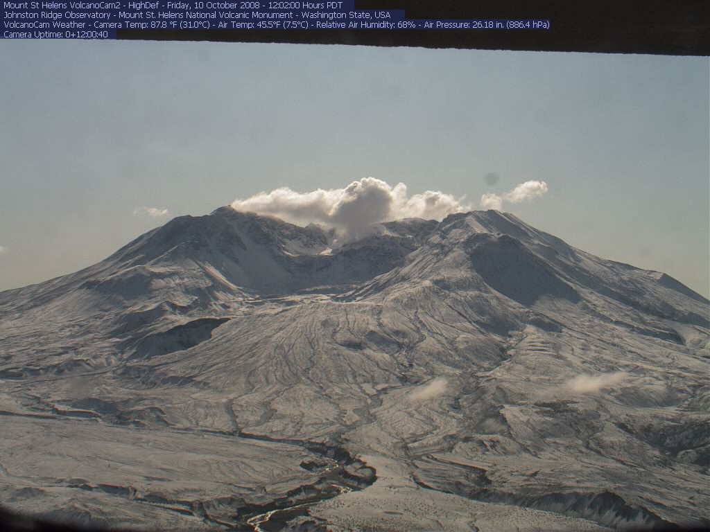
Mount Saint Helens
8365 ft / 2550 m
46.2° N, 122.2° W |
Forest Learning Rest Area WebCam (WSDOT)
(2700 ft)
Distant view of Mount Saint Helens from 12 miles NW on SR 504
USFS Mount Saint Helens VolcanoCam
(4200 ft)
Close-up high-definition view of the crater and lava dome
from 5 miles NNW at Johnston Ridge Observatory
USFS Mount Saint Helens VolcanoCam HD
(4200 ft)
Close-up high-definition view 2 of the crater and lava dome
from 5 miles NNW at Johnston Ridge Observatory
|
|
|
|
|
OREGON
Time Zone: PST (UTC-8)
Mar-Oct: PDT (UTC-7)
|
|
Oregon Department of Transportation (ODOT): Statewide Cameras,
or see my large Oregon Mountain WebCams page (170+ cameras)
|
|
|
|


|
|
|
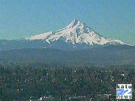
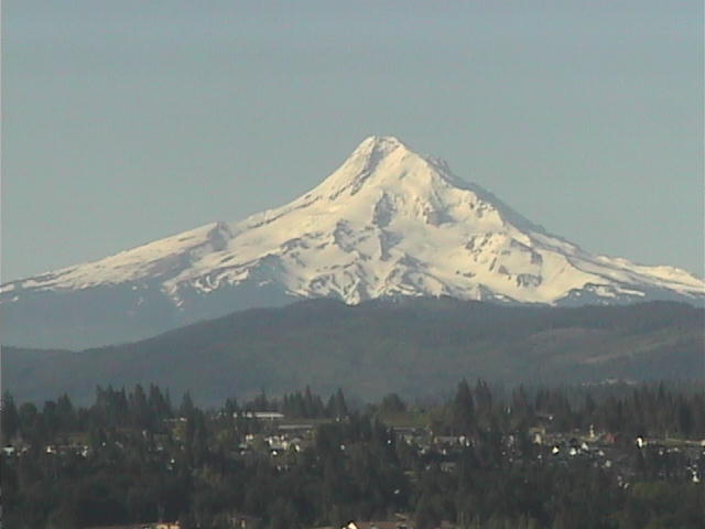
Mount Hood
11239 ft / 3426 m
45.4° N, 121.7° W |
KATU-TV Gorge Cam
(1000 ft)
Distant view of the north side of Mount Hood from 30 miles NNE,
across the Columbia River from the city of Hood River, but
sometimes aimed in other directions along the Columbia Gorge
Underwood Washington Webcam
(600 ft)
Distant view of the north side of Mount Hood from 30 miles NNE,
across the Columbia River in Underwood, WA
USFS Air Quality Camera: Columbia River Gorge
(400 ft)
Distant view of Mount Hood from 40 miles NE near Wishram, WA
KGW-TV Rose City SkyCam
(200 ft)
Occasionally shows Mount Hood from 45 miles WNW (see example),
or Mount Saint Helens from 50 miles SSW (see example)
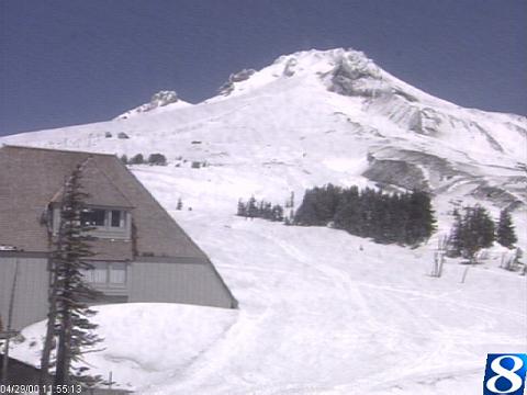
KGW-TV Timberline SkyCam
(5900 ft)
Close-up view of Timberline Lodge or the summit of Mount Hood
from 3 miles south at the ski area's Wy'East Day Lodge
Timberline Lodge Ski Area Cam
(5900 ft)
Close-up view of the summit from 3 miles south at the ski area
Government Camp US 26 Road Cam (ODOT)
(4000 ft)
Located on Mt Hood, 5 miles south of the summit (no view of Hood)
Blue Box Pass US 26 Road Cam (ODOT)
(4000 ft)
Located 10 miles south of Mt Hood (no view of Hood)
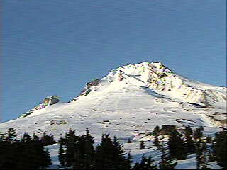
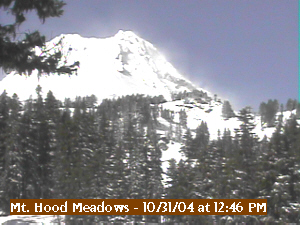
Mount Hood Meadows Cam
(5200 ft)
Close-up view of Wyeast Face from 3 miles SE at ski area,
or view of conditions at ski area base (with no view of Hood)
|
Mount Jefferson
10497 ft / 3199 m
44.7° N, 121.8° W |
KGW-TV Timberline SkyCam
(5900 ft) on Mount Hood occasionally
looks at Mount Jefferson from 45 miles north (see example)
USFS Air Quality Camera: Mount Hood
(5900 ft)
Distant view of Mount Jefferson from 45 miles north
at Timberline Lodge on Mount Hood
Hoodoo Ski Area Webcams
(5000 and 5400 ft)
Partial view of Mount Jefferson from 20 miles south
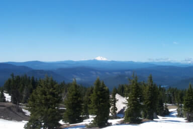
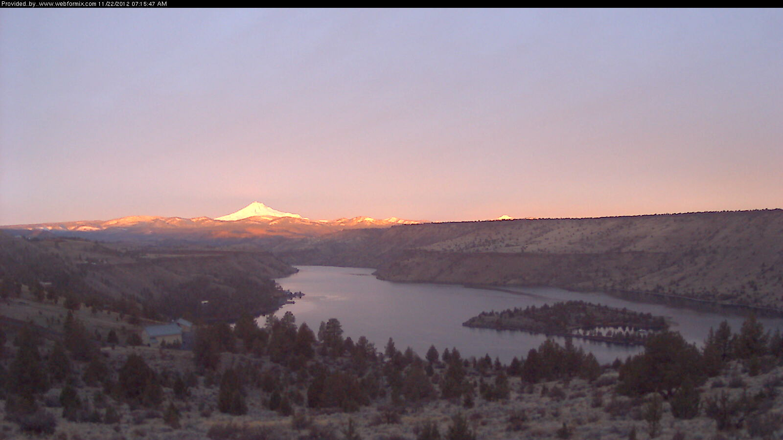
Lake Billy Chinook Webcam
(2500 ft)
View of Mt Jefferson from 22 miles east at Lake Billy Chinook,
with top of Olallie Butte also barely visible at right from 25 miles SE
|
 |


|
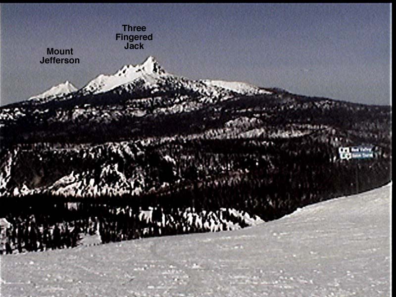
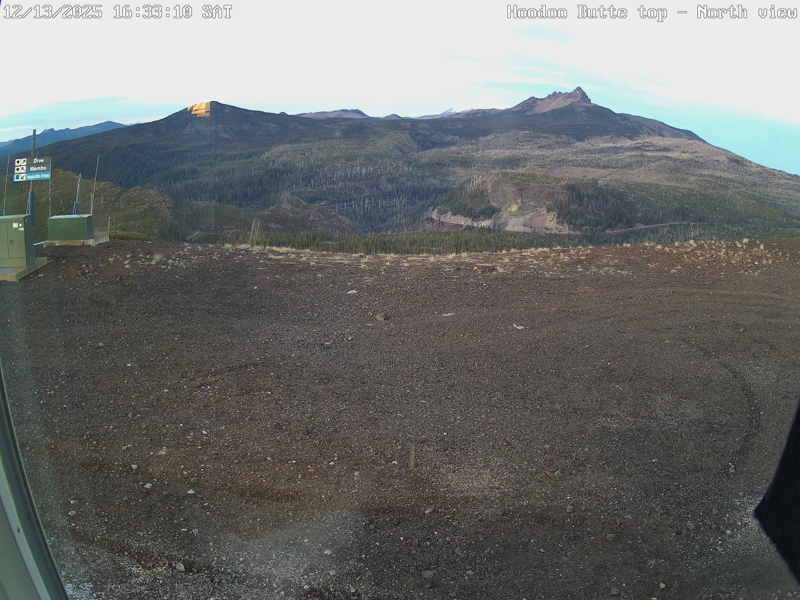
Three Fingered Jack
7841 ft / 2390 m
44.5° N, 121.8° W |
Hoodoo Ski Area Webcams
(5000 and 5400 ft)
View of Three Fingered Jack from 6 miles SSW, with
Mount Jefferson visible in the distance (20 miles)
Hoodoo Ski Area Webcams
(4700 ft)
Close-up view of lifts at Hoodoo Butte (a small volcanic cone)
and of Hayrick Butte (perfect example of a tuya, subglacial volcano)
|
|


|
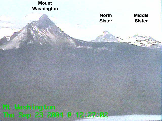
Mount Washington
7794 ft / 2376 m
44.3° N, 121.8° W |
Hoodoo Ski Area Webcams
(5700 ft)
View of Mount Washington from 5 miles NNW, with North Sister
and Middle Sister visible in the distance (15-20 miles)
Santiam Pass US 20 Road Cam (ODOT)
(4800 ft)
Located between Three Fingered Jack and Mt Washington (no view)
Black Butte Ranch Webcam
(3300 ft)
View of Mount Washington from 10 miles ENE,
sometimes reflected and mirrored in the pond
|
Three Sisters
10358 ft / 3157 m
44.1° N, 121.8° W |
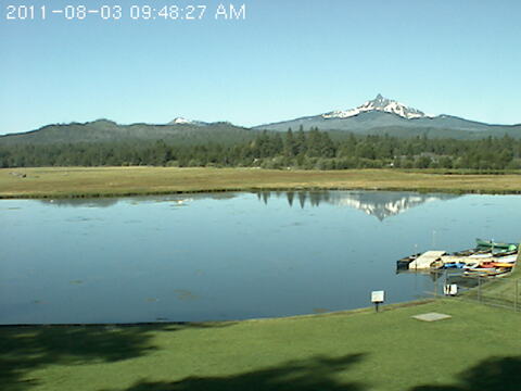
Lucas Ranch Webcam (3200 ft)
Nice view of the Three Sisters and Broken Top from 15 miles NE,
just SE of the town of Sisters; during winter, camera sometimes aimed
NW instead with view of Mt Washington and Three Fingered Jack
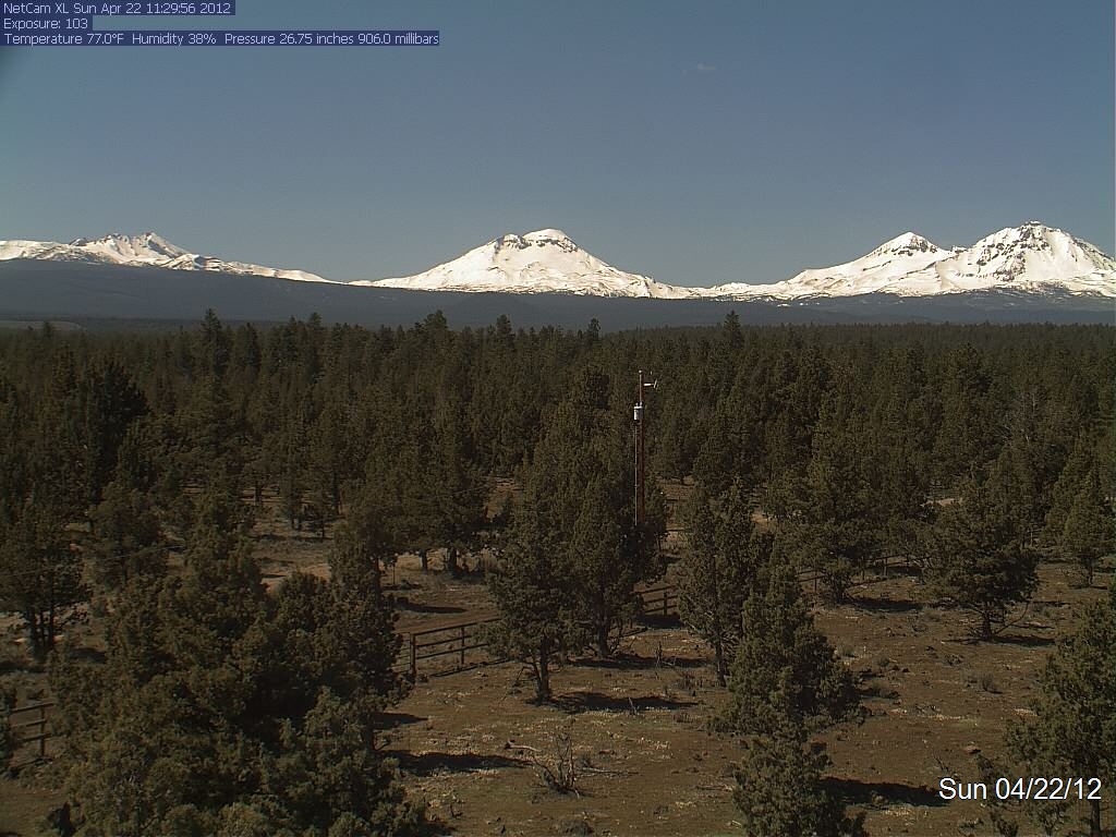
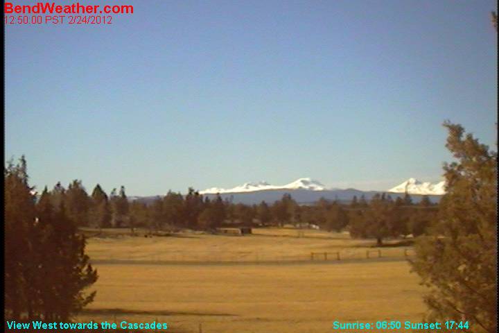
Bend Oregon Weather Cam (3500 ft)
Distant view of the Three Sisters and Broken Top
from 30 miles east between Bend and Alfalfa
Zip977 Live Cam on Overturf Butte in Bend
(3800 ft)
Live user-controlled camera with pan & zoom, with a distant view of
the summits of the Three Sisters and Broken Top from 20 miles east,
and a nice view of Mt Bachelor and Tumalo Mtn from 15 miles ENE
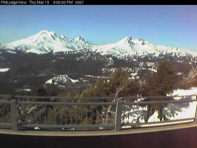
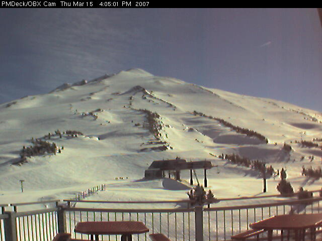
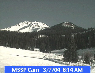
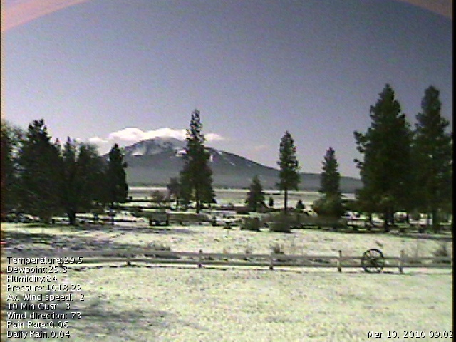
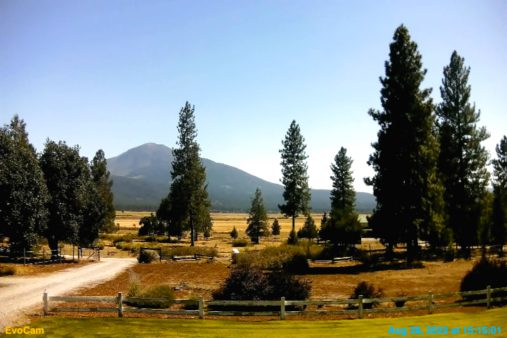
Mount Bachelor Pine Marten Lodge Cam (7700 ft)
View of South Sister, Middle Sister, North Sister, and Broken Top
from 5 miles SE at the Pine Marten Lodge on Mount Bachelor
(camera offline since Sept 2012)
Mount Bachelor South Sister Cam (6400 ft)
View of South Sister, Middle Sister, North Sister, and Broken Top
from 5 miles SE at West Village on Mount Bachelor
|
|


|
Broken Top
9175 ft / 2797 m
44.1° N, 121.7° W |
Mount Bachelor
9065 ft / 2763 m
44.0° N, 121.7° W |
Mount Bachelor Pine Marten Summit Cam (7700 ft)
Close-up view of the summit of Mount Bachelor
from Pine Marten Lodge, 1 mile north
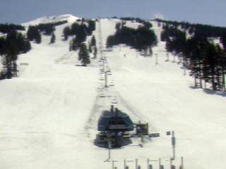
Mount Bachelor West Village Cam (6400 ft)
Close-up view of lifts at the ski area, with the summit visible above;
during the summer, this camera sometimes looks at South Sister,
Middle Sister, Broken Top from 5 miles SE (see example)
Sunriver Lodge Cam
(4200 ft)
Distant view of summit of Mount Bachelor from 15 miles SE
|
|


|
Newberry Volcano
7985 ft / 2434 m
43.7° N, 121.3° W |
Lava Butte US 97 Road Cam (ODOT)
(4500 ft)
Located on the Newberry shield, 15 miles NNW of the summit
Pine Mountain Observatory
(6300 ft)
Located atop an older volcanic mountain on the NE margin of the
Newberry shield, 15 miles ENE of the summit (no view of Newberry)
LaPine US 97 Road Cam (ODOT)
(4200 ft)
Located 10 miles west of the summit of Newberry (no view of it)
|
Diamond Peak
8744 ft / 2665 m
43.5° N, 122.2° W |
KEZI-TV Willamette Pass SkyCam
(6600 ft)
View of Diamond Peak from 10 miles NE atop the Willamette Pass
ski area (the camera sometimes points in other directions, too)
Willamette Pass ORE 58 Road Cam (ODOT)
(5100 ft)
Located 8 miles NE (no view of Diamond Peak)
|
Mount Bailey
8368 ft / 2551 m
43.2° N, 122.2° W |
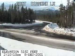
Diamond Lake Road Cam (ODOT)
(5200 ft)
Partial view of Mount Bailey from 5 miles SE
at the junction of ORE 138 and ORE 230
|
|


|
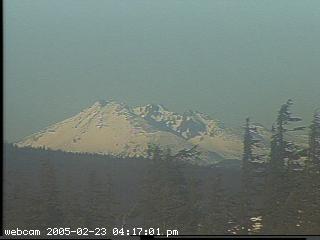
Mount Thielsen
9182 ft / 2799 m
43.2° N, 122.1° W |
Mount Thielsen was barely visible in the upper left of the old pre-2005
Crater Lake Crater Cam (see diagram), but is partially obscured by
trees and harder to see in the current Crater Cam 2; the new (in 2010)
Sinnott Memorial Overlook Cam offers a clearer view once again
|
Crater Lake
8926 ft / 2721 m
42.9° N, 122.1° W |
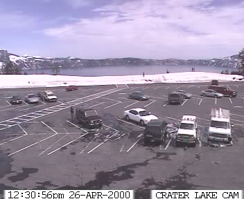
Crater Lake Crater Cam
(7100 ft)
View of the parking lot near the crater rim (this camera went
online in fall 2007, after a 2-year outage due to construction;
at first looking towards the lake, then re-aimed at parking lot)
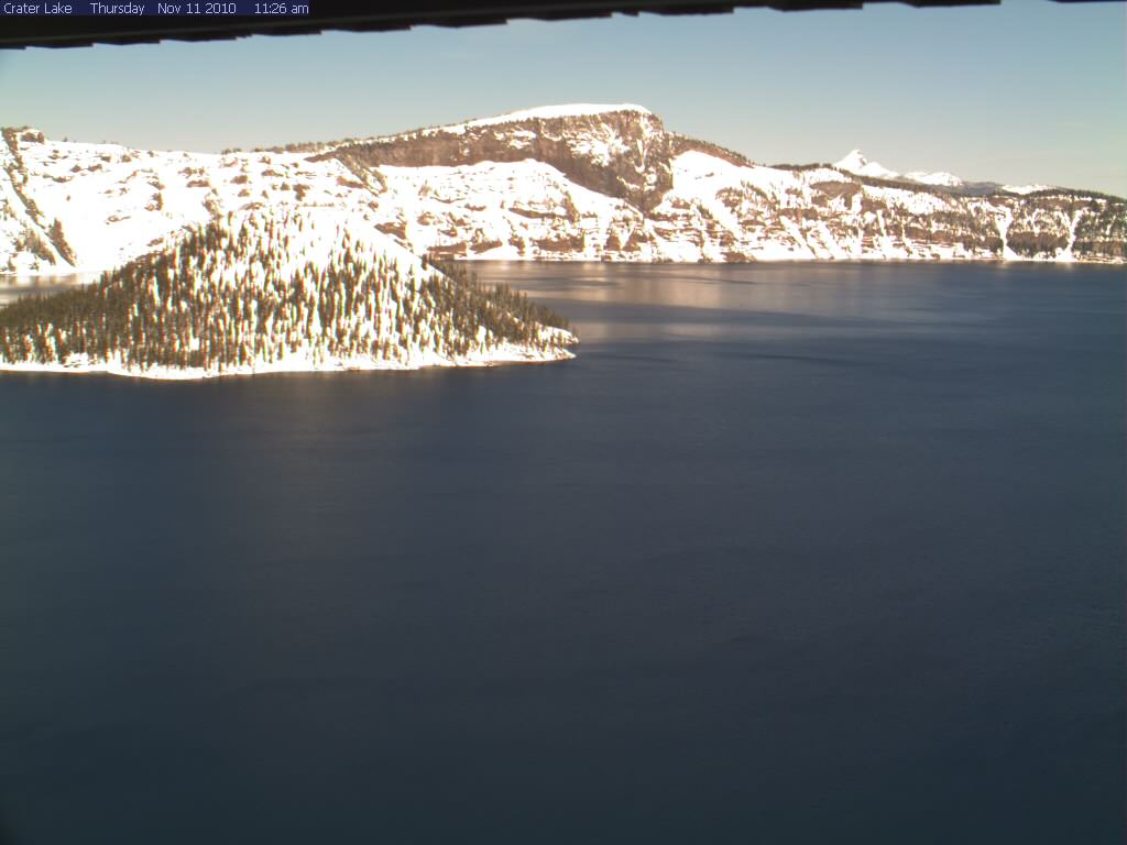
Crater Lake Crater Cam 2
(7100 ft)
View of the lake and Wizard Island from near the south crater rim
(this is a new higher-resolution camera, added in early 2009)
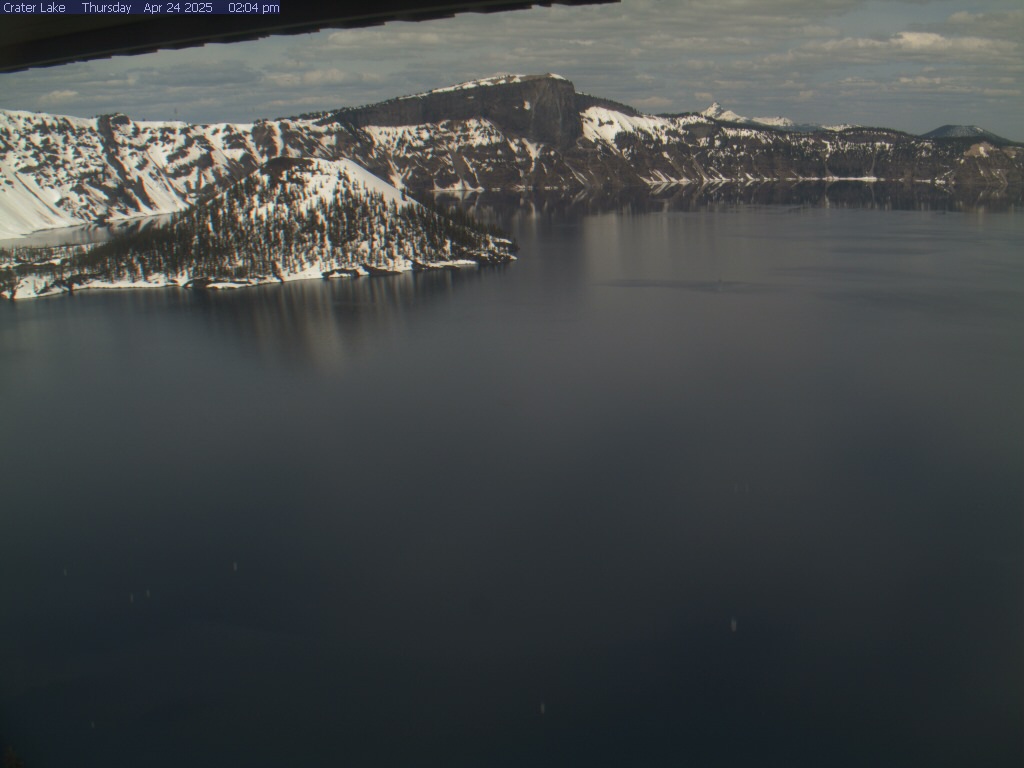
Crater Lake Sinnott Memorial Overlook Cam
(7100 ft)
Close-up view of the lake and Wizard Island from the
Sinnott Memorial Overlook on the south crater rim, plus a
distant view of the summit of Mount Thielsen from 17 miles south
(new high-resolution camera, added in late 2010)
|
Pelican Butte
8036 ft / 2449 m
42.5° N, 122.1° W |
Klamath Falls Kingsley Field Weathercam
(4100 ft) [offline for years?]
View looking west towards southernmost Oregon Cascades
from 30 miles SE of Pelican Butte (no view of volcano)
Doak Mountain ORE 140 Road Cam (ODOT)
(4700 ft)
Located 14 miles SE of Pelican Butte (no view of volcano)
|
Mount McLoughlin
9495 ft / 2894 m
42.4° N, 122.3° W |
Lake of the Woods ORE 140 Road Cam (ODOT)
(5000 ft)
Located 10 miles SW of Pelican Butte and
5 miles SE of Mount McLoughlin (no view of either)
Medford Oregon Weathercam
(1400 ft)
Distant view of Mount McLoughlin from 30 miles WSW
(McLoughlin is the white pyramid at right above a tall tree;
camera is back online in early 2009 after a long outage)
Siskiyou Summit I-5 Road Cams (2 cameras, ODOT) (4300 ft)
Located 30 miles SSW (no view of Mount McLoughlin)
|
|

|
|
|
|
|
CALIFORNIA
Time Zone: PST (UTC-8)
Mar-Oct: PDT (UTC-7)
|
|
Caltrans District 2: Clickable Map or
View All Cameras (50+ cameras),
or see my large N California Mountain WebCams page (110+ cams)
|
|
|
|

|
|
|
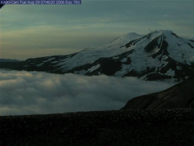
Medicine Lake Volcano
7913 ft / 2412 m
41.6° N, 121.6° W |
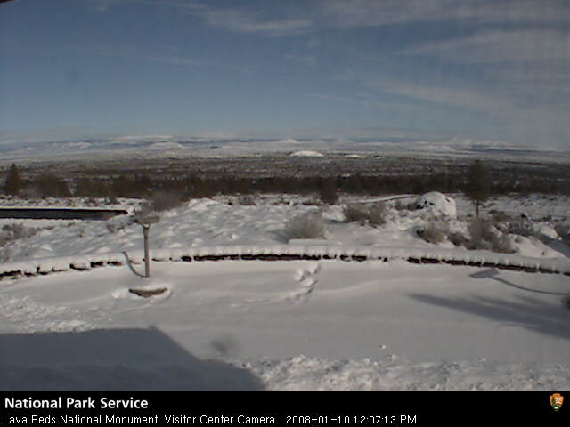
Lava Beds National Monument Webcam
(4800 ft)
View looking north from the visitor center across the flanks of
the Medicine Lake shield volcano, with several cinder cones visible
Dorris Hill US 97 Traffic Cam (Caltrans)
(4400 ft)
Located 30 miles NW of Medicine Lake (no view of volcano)
Mount Hebron US 97 Traffic Cam (Caltrans)
(4300 ft)
Located 25 miles WNW of Medicine Lake (no view of volcano)
|
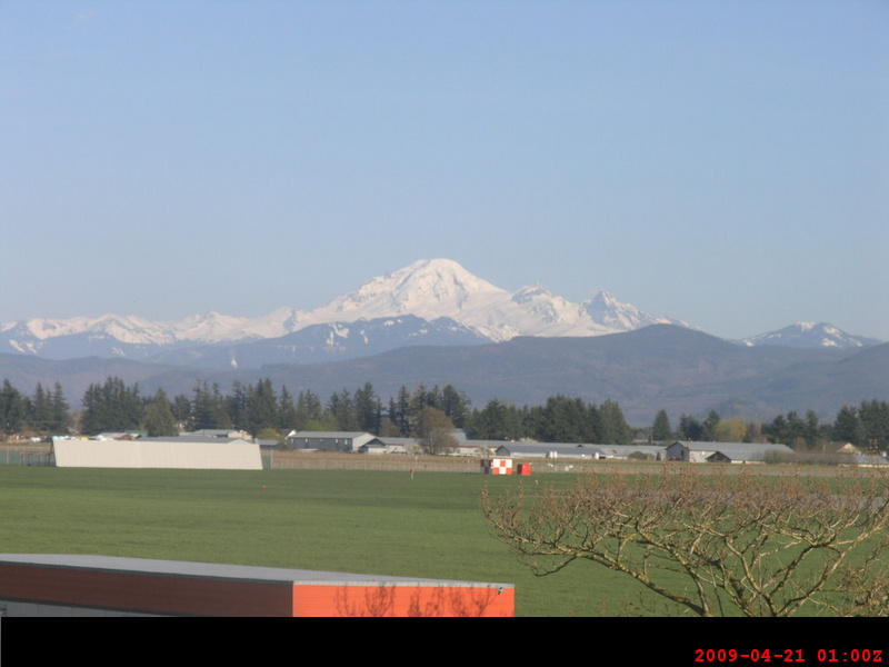
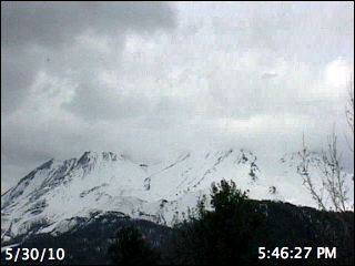
Mount Shasta
14162 ft / 4317 m
41.4° N, 122.2° W |
Grass Lake US 97 Traffic Cam (Caltrans)
(5100 ft)
Distant view of Shasta from 15 miles north, if camera points south
Weed Elementary School Webcam
(3600 ft)
View of Shastina and Diller Canyon from Weed, 8 miles west
Weed Airport I-5 Traffic Cam (Caltrans)
(2900 ft)
Located 15 miles WNW of Shasta (usually no direct view)
North Weed I-5 Traffic Cam (Caltrans)
(3200 ft)
Located 10 miles west of Shasta, occasional view
MacShasta Tree House Cam
(3800 ft)
Nice view of Shasta and its West Face from 10 miles WSW
Black Butte I-5 Traffic Cam (Caltrans)
(3900 ft)
and Abrams Lake I-5 Traffic Cam (Caltrans)
(3800 ft)
Located on the lower slopes of Shasta, 9 miles SW of summit
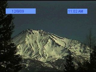
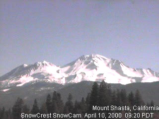
Mount Shasta SnowCam
(3500 ft)
Excellent wide-angle view of Shasta from 10 miles SW
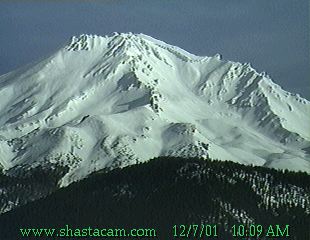
Amazing ShastaCam
(3500 ft)
View from 10 miles SW, usually zoomed-in on Avalanche Gulch
I-5/SR89 Traffic Cam (Caltrans)
(3500 ft)
and Snowman Hill SR 89 Traffic Cam (Caltrans)
(4500 ft)
Located on the lower slopes of Shasta, 10 miles S/SW of summit;
I-5/SR89 Cam has excellent view of Shasta if aimed NE
Mount Shasta Ski Park Cam
(5500 ft)
Partial view from 6 miles south of the summit
Central Dunsmuir I-5 Traffic Cam (Caltrans)
(2400 ft)
and Dunsmuir Rail Cam
(2300 ft)
Located 15 miles south of Shasta (no view of Shasta)
|

|


|
Burney Mountain
7863 ft / 2397 m
40.8° N, 121.6° W |
Burney Mountain Webcam
(3100 ft)
View of Burney Mtn from 8 miles north; by far the largest lava dome
in the entire Cascade Range, over 3 times the volume of Lassen Peak
(contrary to older info, see this recent comprehensive USGS paper)
Hat Creek Retreat Webcam
(3200 ft)
View of Burney Mountain from Cassel, 9 miles NE
Allen Telescope Array Webcam from Hat Creek
(3300 ft)
View of Burney Mtn from Hat Creek Radio Observatory, 8 miles east
|
|
|
Lassen Peak
10457 ft / 3187 m
40.5° N, 121.5° W |
Lassen Park SR 44 Traffic Cam (Caltrans)
(5800 ft)
Located 5 miles NW of Lassen Peak near Manzanita Lake (no view)
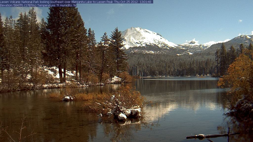
Lassen Manzanita Lake Webcam
(6700 ft)
Nice view of Lassen Peak from 5 miles NW at Manzanita Lake
Deschutes Road I-5 Traffic Cam (Caltrans)
(500 ft)
Located 40 miles west of Lassen Peak, with a possible distant view
of Lassen or Shasta (70 miles north) depending on camera direction
Lake Blvd SR 273 (Redding) Traffic Cam (Caltrans)
(700 ft)
Located 45 miles WNW of Lassen, distant view if camera points east
SR44 Bogard Rest Area Traffic Cam (Caltrans)
(5600 ft)
Located 25 miles NE of Lassen Peak, no view of Lassen, but shows
several smaller volcanoes (including Antelope Mtn) if aimed east
Fredonyer Pass SR 36 Traffic Cam (Caltrans)
(5700 ft)
Located 35 miles ESE of Lassen Peak (no view)
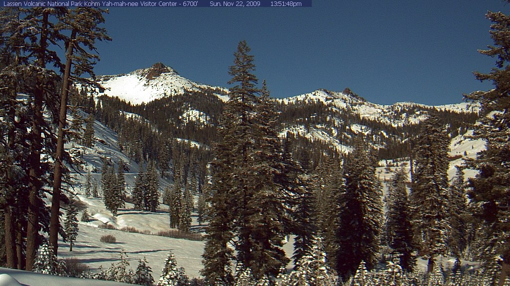
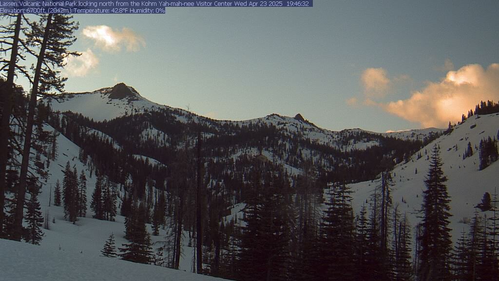
Kohm Yah-mah-nee Visitor Center Webcam
(6700 ft)
Located 4 miles SSW of Lassen Peak, looking north towards
Mount Diller and Pilot Pinnacle (no view of Lassen Peak)
|
|

|
|
|
|
|
|
Fair Weather Image |
|
Most Recent Image |
|
|
|
|
| (switch page to standard one-column mode) |
|
Fair Weather Image |
|
Most Recent Image |
|
| (click any image to enlarge in separate window) |
Bonus Section:
Webcams showing other skiable volcanoes in North America and Hawaii
(for more information about these peaks, see the Skiing the Ring of Fire section of this website)
|
|
|
|


|
|
CALIFORNIA
Time Zone: PST (UTC-8)
Mar-Oct: PDT (UTC-7)
|
|
California has many volcanoes beyond the Cascade Range, scattered
through the central, eastern, and southern parts of the state, most
notably the 20-mile-wide Long Valley Caldera in the Eastern Sierra;
see my large Sierra Nevada Mountain WebCams page (210+ cams)
|
|
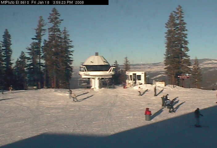
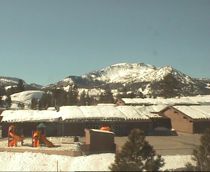
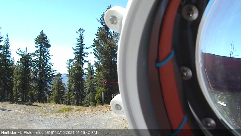
Mount Pluto
8617 ft / 2626 m
39.2° N, 120.1° W |
Northstar at Tahoe Mountain Cams
(8600 ft)
Several views from atop Mount Pluto, an old eroded volcano which
forms the lava dam impounding the waters of Lake Tahoe (more info);
the large Northstar at Tahoe ski area is located on its northern flanks
|
|
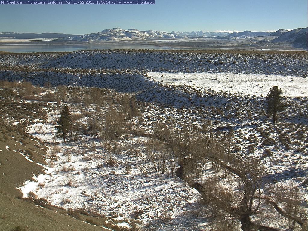
Mono Craters
9172 ft / 2796 m
37.9° N, 119.0° W |
Mono Lake Mill Creek WebCam
(6900 ft)
Nice view of Mono Lake and Mono Craters from 14 miles NW near
the junction of US 395 and SR 167; the Mono Craters are a chain of
rhyolite lava domes extending south of Mono Lake (more info)
|
|
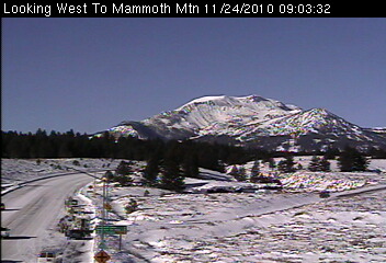
Mammoth Mountain
(Long Valley Caldera)
11053 ft / 3369 m
37.6° N, 119.0° W |
Camera at Junction of US 395 & SR 203 (Caltrans)
(7400 ft)
Nice view of Mammoth Mountain from 6 miles east
Mammoth Mountain: Lodge Cam
(8900 ft)
Close-up view of lifts at the ski area, from a live user-controlled
camera with pan & zoom; see also
Village Cam (8100 ft),
Canyon Lodge Cam (8300 ft), and
McCoy Station Cam (9600 ft)
Mammoth Lakes Webcam
(8200 ft)
Live streaming Java image, view of Mammoth Rock and the Sherwins
Footloose Sports Web Cam
(7900 ft)
View of Mammoth Mountain from the east
Snowcreek Resort Web Cam
(7900 ft)
View of Mammoth Mountain from the east
|
|
|
|
|
ARIZONA
Time Zone: MST (UTC-7)
Year-round, no DST
|
|
Arizona has numerous volcanoes, most of them in the vast San Francisco
Volcanic Field north of Flagstaff, with several more in eastern Arizona
|
|
|
|


|
|
|
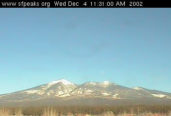
Humphreys Peak
(San Francisco Mtn)
12633 ft / 3851 m
35.3° N, 111.7° W |
San Francisco Peaks Webcam
(7100 ft)
View of San Francisco Peaks from Flagstaff, 15 miles south
Flagstaff Webcam.com
(6900 ft)
Live user-controlled camera with pan & zoom from Flagstaff
Rocky Mountain Research Station: The Peaks Cam
(6900 ft)
Northern Arizona University: Reilly Hall Web Cam
(6900 ft)
National Weather Service Flagstaff Web Cam
(6900 ft)
Three more views of San Francisco Peaks from Flagstaff
ABC 15: Lowell Observatory Web Cam
(7200 ft)
View of San Francisco Mountain from 15 miles SW
|
Mount Baldy
11420 ft / 3481 m
33.9° N, 109.6° W |
Sunrise Park Ski Resort Webcam
(9200 ft)
View of lifts at the ski area, located on the
flanks of an ancient eroded stratovolcano
|
|
|
|
|
NEW MEXICO
Time Zone: MST (UTC-7)
Mar-Oct: MDT (UTC-6)
|
|
New Mexico has dozens of volcanoes (see Volcanoes of New Mexico),
including the stratovolcano Mount Taylor and sizeable Valles Caldera
|
|
|
|


|
|
|
Mount Taylor
11301 ft / 3445 m
35.2° N, 107.6° W |
Mesa View Elementary School, Grants, NM Webcam
(6400 ft)
Partial view of the upper slopes of Mt Taylor from the town of Grants,
15 miles WSW; camera is sometimes aimed in other directions
Albuquerque International Sunport Webcam
(5400 ft)
Occasional distant view of Mount Taylor from 55 miles east
(see example), but camera is usually aimed in other directions
|
Valles Caldera
11561 ft / 3524 m
35.9° N, 106.6° W |
Pajarito Mountain Ski Area Webcam
(9000 ft)
View of slopes at the ski area, located on the caldera rim
Los Alamos National Laboratory Webcam
(7300 ft)
View looking west from Bradbury Science Museum in Los Alamos,
on the flanks of the caldera, view towards peaks of the caldera rim
|
|
|
|
|
WYOMING
Time Zone: MST (UTC-7)
Mar-Oct: MDT (UTC-6)
|
|
Wyoming is home to world-famous Yellowstone National Park,
which contains the huge 50-mile-wide Yellowstone Caldera
|
|
|
|

|
|
|
Yellowstone Caldera
10308 ft / 3142 m
44.4° N, 110.7° W |
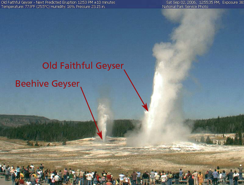
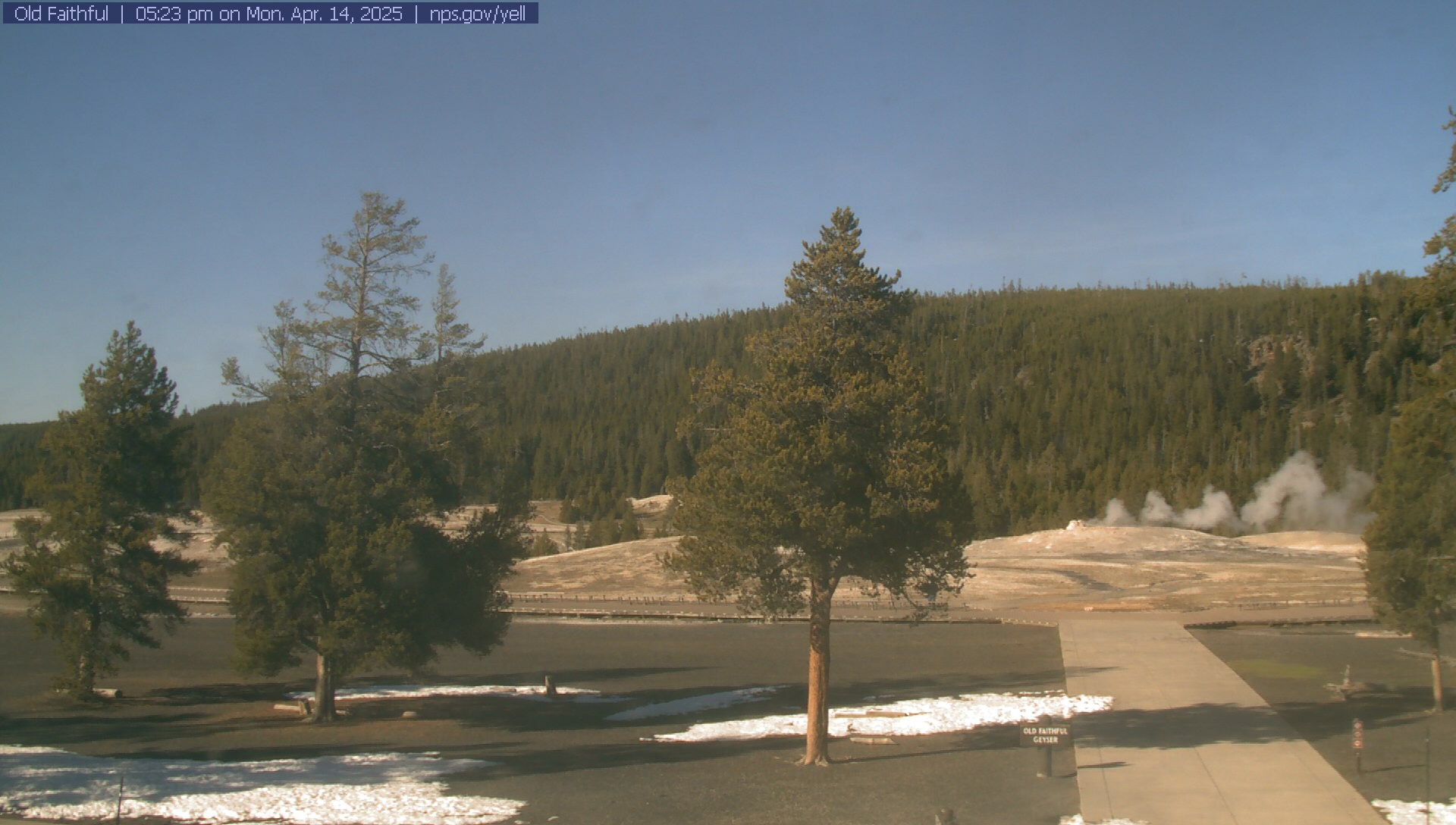
Old Faithful WebCam
(7400 ft)
Close-up view of Old Faithful Geyser within the caldera
Mammoth Hot Springs WebCam
(6300 ft)
View of hot springs within the caldera
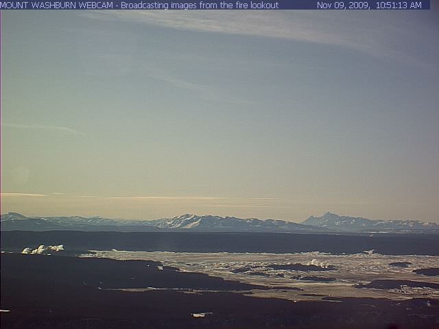
Mount Washburn Fire Lookout WebCam
(10300 ft)
View looking south across the caldera from a lookout tower atop
Mount Washburn, located on the northern edge of the caldera rim
Yellowstone National Park WebCams
(6300-10300 ft)
View all 8 webcams in Yellowstone National Park on a single page
|
|
|
|
|
IDAHO
Time Zone: MST (UTC-7)
Mar-Oct: MDT (UTC-6)
|
|
The best known volcanoes in Idaho are the numerous
cinder cones in Craters of the Moon National Monument
|
|
|
|

|
|
|
Craters of the Moon
6515 ft / 1986 m
43.4° N, 113.5° W |
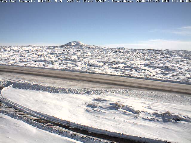
Tom Cat Summit Highway Cam 1 (IDOT)
(5800 ft)
View looking east across US 20 towards Craters of the Moon National
Monument and Big Cinder Butte, along with extensive lava flows
Tom Cat Summit Highway Cam 2 (IDOT)
(5800 ft)
View looking south along US 20 towards cinder cones and lava flows
|
|
|
|
|
BRITISH COLUMBIA
Time Zone: PST (UTC-8)
Mar-Oct: PDT (UTC-7)
|
|
There are dozens of other volcanoes in British Columbia beyond the
few Cascade Volcanoes which cross the border; however, most are quite
remote and relatively obscure, and few are visible on any webcam
|
|
|
|
|
|
|
Rainbow Range
8130 ft / 2478 m
52.7° N, 125.8° W |
Anahim Lake Highway Cam (BCMOT)
(3600 ft)
View looking west from Anahim Lake on Hwy 20 towards the
eroded shield volcano of the Rainbow Range about 25 miles away
|
|
|
|
|
ALASKA
Time Zone: AKST (UTC-9)
Mar-Oct: AKDT (UTC-8)
|
|
Alaska has most of the skiable volcanoes in the US, well over 50 of them;
although only a few are visible on any webcams currently online, the
Alaska Volcano Observatory continues to expand its
webcam network
|
|
|
|

|
|
|
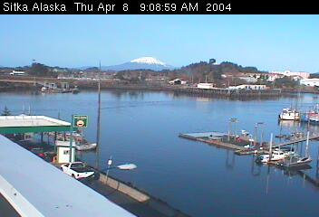
Mount Edgecumbe
3201 ft / 976 m
57.1° N, 135.8° W |
City of Sitka West Cam
(100 ft)
Distant view from 15 miles east, looking across Sitka Harbor
|
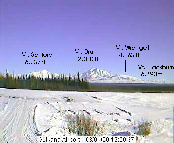
Mount Blackburn
16390 ft / 4996 m
61.7° N, 143.4° W
Mount Wrangell
14163 ft / 4317 m
62.0° N, 144.0° W
Mount Sanford
16237 ft / 4949 m
62.2° N, 144.1° W
Mount Drum
12010 ft / 3661 m
62.1° N, 144.6° W
|
High Frequency Active Auroral Research Program Cam
(1900 ft)

Nice view of Mount Sanford from 35 miles WNW, with the northern
flank of Mount Wrangell at right, from 8 miles north of Gakona
Glenn Hwy 1 @ MP 176.6 Road Weather Cam (AKDOT)
(2000 ft)
Distant telephoto view of Mt Sanford and Mt Drum from
40 miles west, along the Glenn Hwy 10 miles west of Glennallen
Richardson Hwy 4 @ MP 83 Road Weather Cam (AKDOT)
(2050 ft)
Distant view of Mt Blackburn from 50 miles west,
at junction of Richardson Hwy 4 and Edgerton Hwy 10
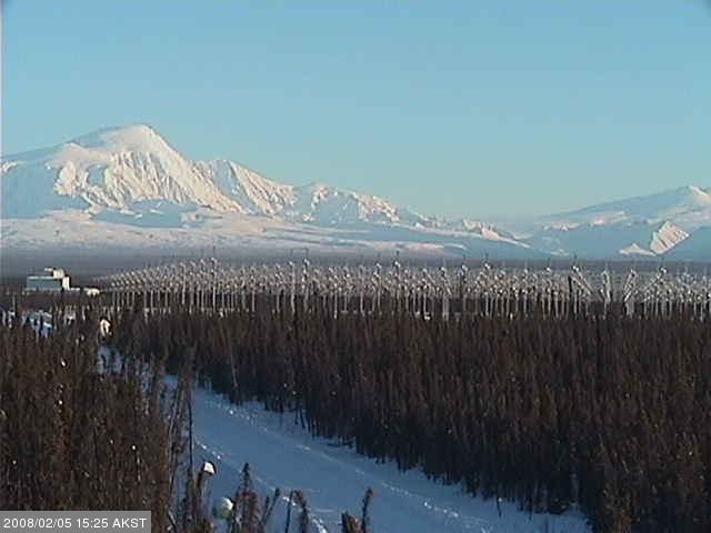
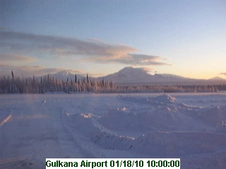
Gulkana Airport Weather Cam
(1600 ft)
View looking east at Mounts Sanford, Drum, Wrangell, and Blackburn,
located 30-80 miles away in Wrangell - Saint Elias National Park;
this webcam has been offline since 2010, but a new FAA Weather Cam
was installed in March 2011, with a view of only Mount Sanford
|
|

|
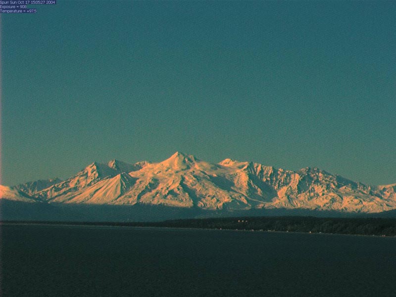
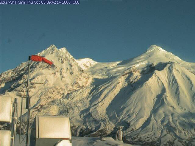
Mount Spurr
11070 ft / 3374 m
61.3° N, 152.3° W |
Alaska Volcano Observatory: Mount Spurr Cam
(100 ft)
View from 38 miles SE on an oil platform in Cook Inlet
(this camera was re-aimed towards Redoubt in late January 2008)
Alaska Volcano Observatory: Mount Spurr CKT Cam
(3400 ft)
Close-up view of Mount Spurr and Crater Peak from the
CKT seismic station, located on a ridge about 5 miles south
|
|


|
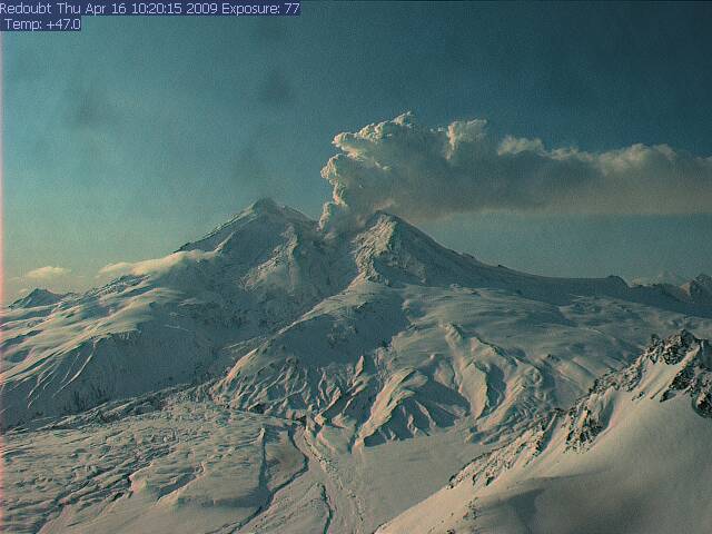
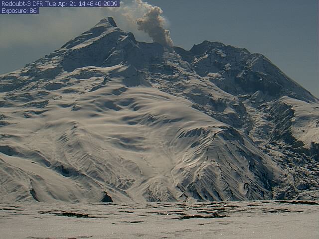
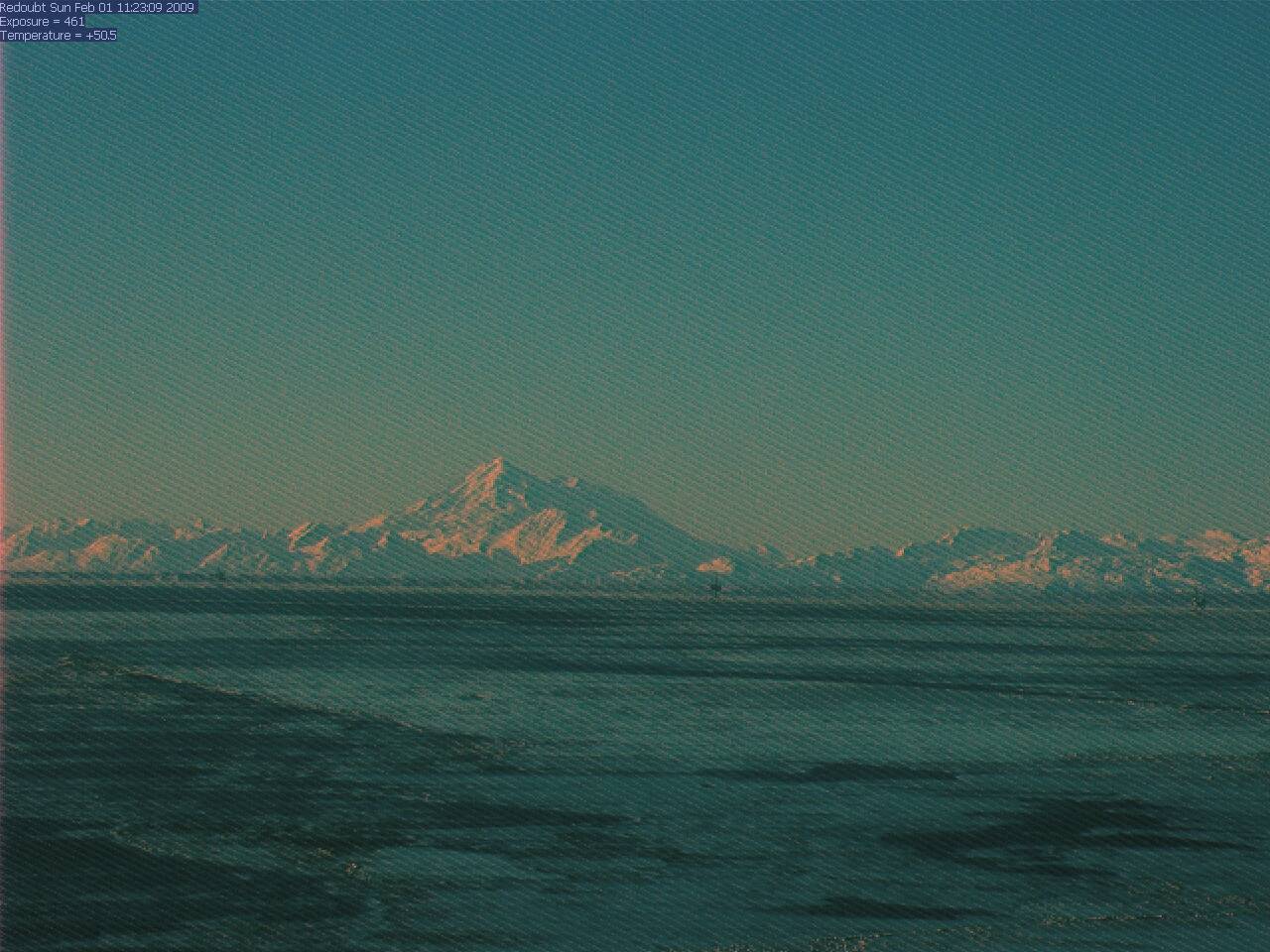
Redoubt Volcano
10198 ft / 3108 m
60.5° N, 152.7° W |
Alaska Volcano Observatory: Redoubt Hut Cam
(5000 ??? ft)
View of the north flank from 7.5 miles away
at the AVO's Redoubt Hut
Alaska Volcano Observatory: Redoubt DFR Cam
(3600 ft)
View of the NE flank from 7.6 miles away
at seismic station DFR
Anchorage Weather Cam
(200 ft)
Distant zoomed view across Cook Inlet from 100 miles NE
Alaska Volcano Observatory: Redoubt CI Cam
(100 ft)
View from about 60 miles NE on an oil platform in Cook Inlet,
repositioned in March 2012 to show both Redoubt and Iliamna at left
(this camera was originally aimed at Mount Spurr before 2008)
|
|


|
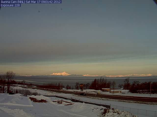
Iliamna Volcano
10016 ft / 3053 m
60.0° N, 153.1° W |
Alaska Volcano Observatory: Iliamna Cam
(200 ft)
Distant view from 50 miles east across Cook Inlet from Ninilchik
Alaska Log Haven B&B Cam
(200 ft)
User-controlled camera, looking across Cook Inlet from Clam Gulch at
Iliamna from 60 miles ENE & Redoubt from 50 miles ESE (example);
pan far left to see Augustine from 90 miles NE, barely above horizon
|
|

|
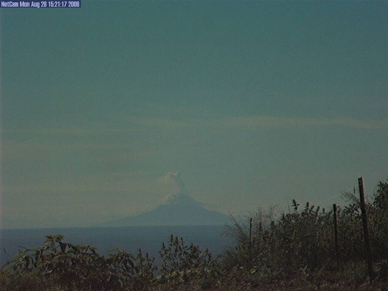
Augustine Volcano
4108 ft / 1252 m
59.4° N, 153.4° W |
Alaska Volcano Observatory: Augustine Homer Cam
(100 ft ?)
Distant view from Homer, about 75 miles NE,
and often obscured by clouds
Alaska Volcano Observatory: Augustine Low-Light Cam
(100 ft ?)
Co-located with the daylight camera in Homer, about 75 miles NE,
extremely light-sensitive with a range extending to the near-infrared
Alaska Volcano Observatory: Augustine Island Cam
(350 ft)
Close-up view from a small hilltop on the east side
of the island, about 3 miles from the summit
Alaska Volcano Observatory: Augustine Lagoon Cam
(100 ft)
Close-up view from the lagoon on the west side of the island,
about 4 miles from the summit
|
|


|
Mount Douglas
7005 ft / 2135 m
58.9° N, 153.5° W
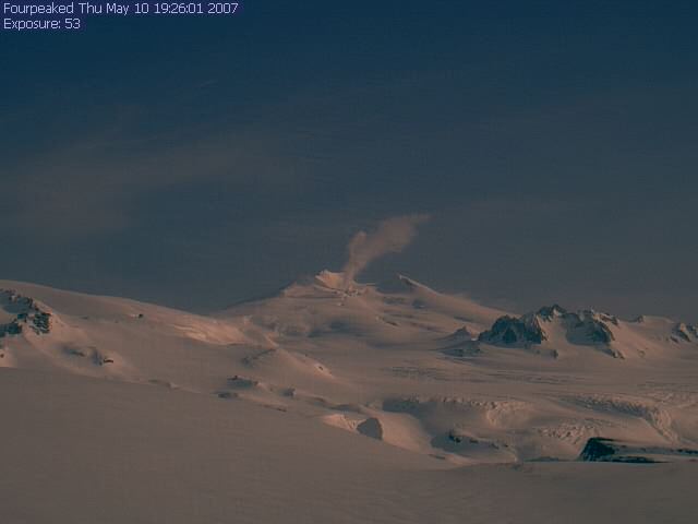
Fourpeaked Mountain
6906 ft / 2105 m
58.8° N, 153.7° W
|
Alaska Volcano Observatory: Fourpeaked Cam
(2500 ft ?)
View of Fourpeaked Mountain from 10 miles north,
with the west flank of Mount Douglas partially visible at left
|
|

|
Mount Katmai
6716 ft / 2047 m
58.3° N, 155.0° W
Mount Mageik
7103 ft / 2165 m
58.2° N, 155.3° W
|
Alaska Volcano Observatory: Katmai Cam
(3500 ft)
View of Mount Mageik from 5 miles north atop the Buttress Range,
with the Valley of Ten Thousand Smokes and Katmai Pass below;
Mount Katmai is well out of the frame to the left
|
|

|
Mount Peulik
4835 ft / 1474 m
57.8° N, 156.4° W
Mount Chiginagak
7287 ft / 2221 m
57.1° N, 157.0° W
|
Alaska Volcano Observatory: Peulik Cam
(1900 ft)
View of Mount Peulik from 20 miles north on Whale Mtn,
on the north side of Becharof Lake; in very clear weather,
also views Mount Chiginagak from 65 miles NNE
|
|

|
Mount Veniaminof
8225 ft / 2507 m
56.2° N, 159.4° W |
Alaska Volcano Observatory: Veniaminof Cam
(200 ft)
View of the rim of this ice-filled caldera
from 22 miles south at Perryville
|
|

|
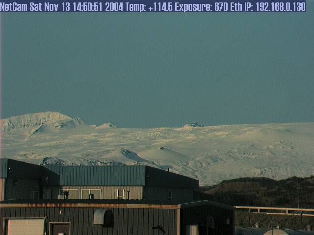
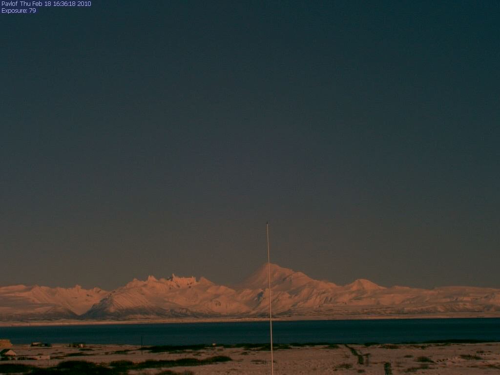
Pavlof Volcano
8261 ft / 2518 m
55.4° N, 161.9° W |
Alaska Volcano Observatory: Pavlof Cam
(100 ft)
Distant view of the Pavlof volcanic group
from 37 miles southwest at Cold Bay
|
|

|
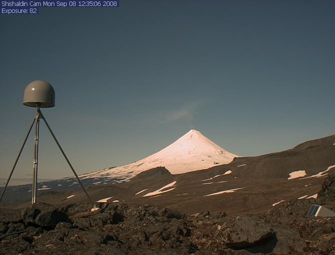
Shishaldin Volcano
9372 ft / 2857 m
54.8° N, 164.0° W |
Alaska Volcano Observatory: Shishaldin Cam
(2000 ft ???)
View of Shishaldin from the east (camera location unknown)
|
|

|
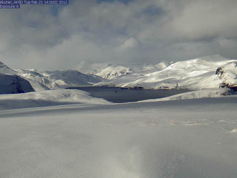
Akutan Volcano
4275 ft / 1303 m
54.1° N, 166.0° W |
Alaska Volcano Observatory: Akutan AKSD Cam
(??? ft)
Closeup view of the upper slopes of Akutan Volcano
from seismic station AKSD
Alaska Volcano Observatory: Akutan Cam
(600 ft)
Distant view of Akutan Island from 25 miles southwest
at Eider Point on Unalaska Island
|
|

|
Makushin Volcano
5905 ft / 1800 m
53.9° N, 166.9° W |
Alaska Volcano Observatory: Makushin Cam
(2600 ft)
Closeup view of the upper slopes of Makushin Volcano
from 9 miles southeast at seismic station MREP
|
|

|
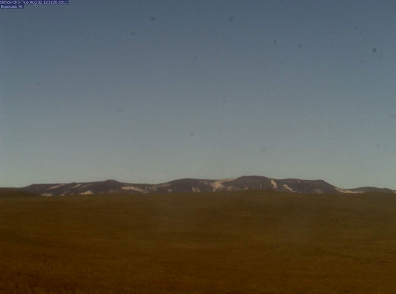
Okmok Volcano
3519 ft / 1073 m
53.4° N, 168.1° W |
Alaska Volcano Observatory: Okmok OKIF Cam
(??? ft)
Closeup view of the upper slopes of Okmok Volcano
from seismic station OKIF
|
|

|
Time Zone: HAST (UTC-10)
Mar-Oct: HADT (UTC-9)
|
Aleutian Islands west of 169.5° W:
|
|

|
|
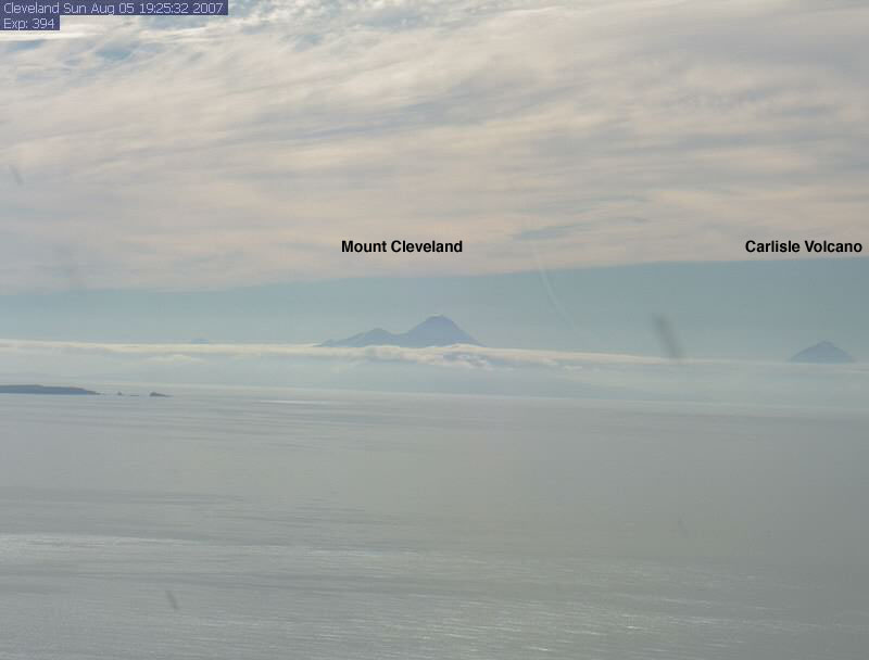
Mount Cleveland
5675 ft / 1730 m
52.8° N, 169.9° W
Carlisle Volcano
5315 ft / 1620 m
52.9° N, 170.1° W
|
Alaska Volcano Observatory: Cleveland Cam
(600 ft)
Distant view of Mount Cleveland (center) and Carlisle Volcano (right)
from 45-50 miles east on High Hill, north of Nikolski on Umnak Island
For numerous other webcams throughout Alaska, see my large
webcam pages: Alaska Mountain WebCams (200+ cameras) and
SE Alaska, Yukon, & Northern BC Mountain WebCams (140+)
|
|
|
|
|
HAWAII
Time Zone: HAST (UTC-10)
Year-round, no DST
|
|
Hawaii has two skiable volcanoes, Mauna Kea and Mauna Loa,
and possibly a third, Haleakala; there are numerous webcams viewing
their upper slopes, see Mauna Kea Weather Center all webcams or
my large Hawaii Mountain WebCams page (70+ cameras)
|
|
|
|

|
|
|
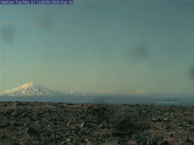
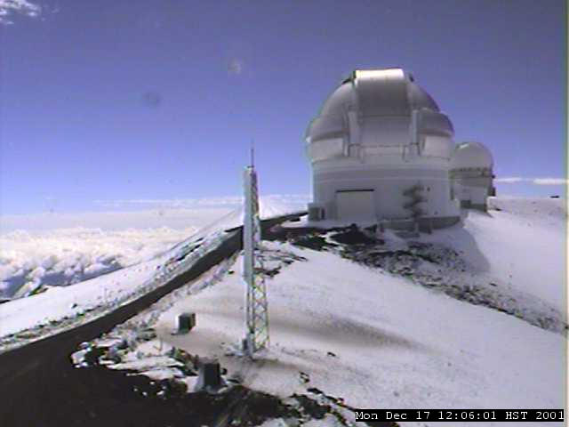
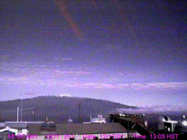
Mauna Kea
13796 ft / 4205 m
19.8° N, 155.5° W |
United Kingdom Infra-Red Telescope (UKIRT)
(13750 ft)
View looking SW across road at the summit of Mauna Kea,
with the flank of Mauna Loa visible in the distance
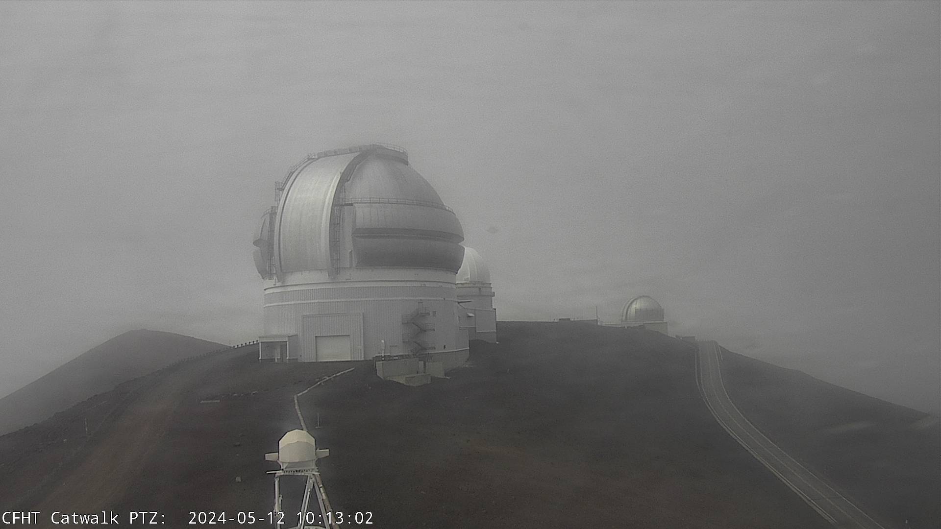
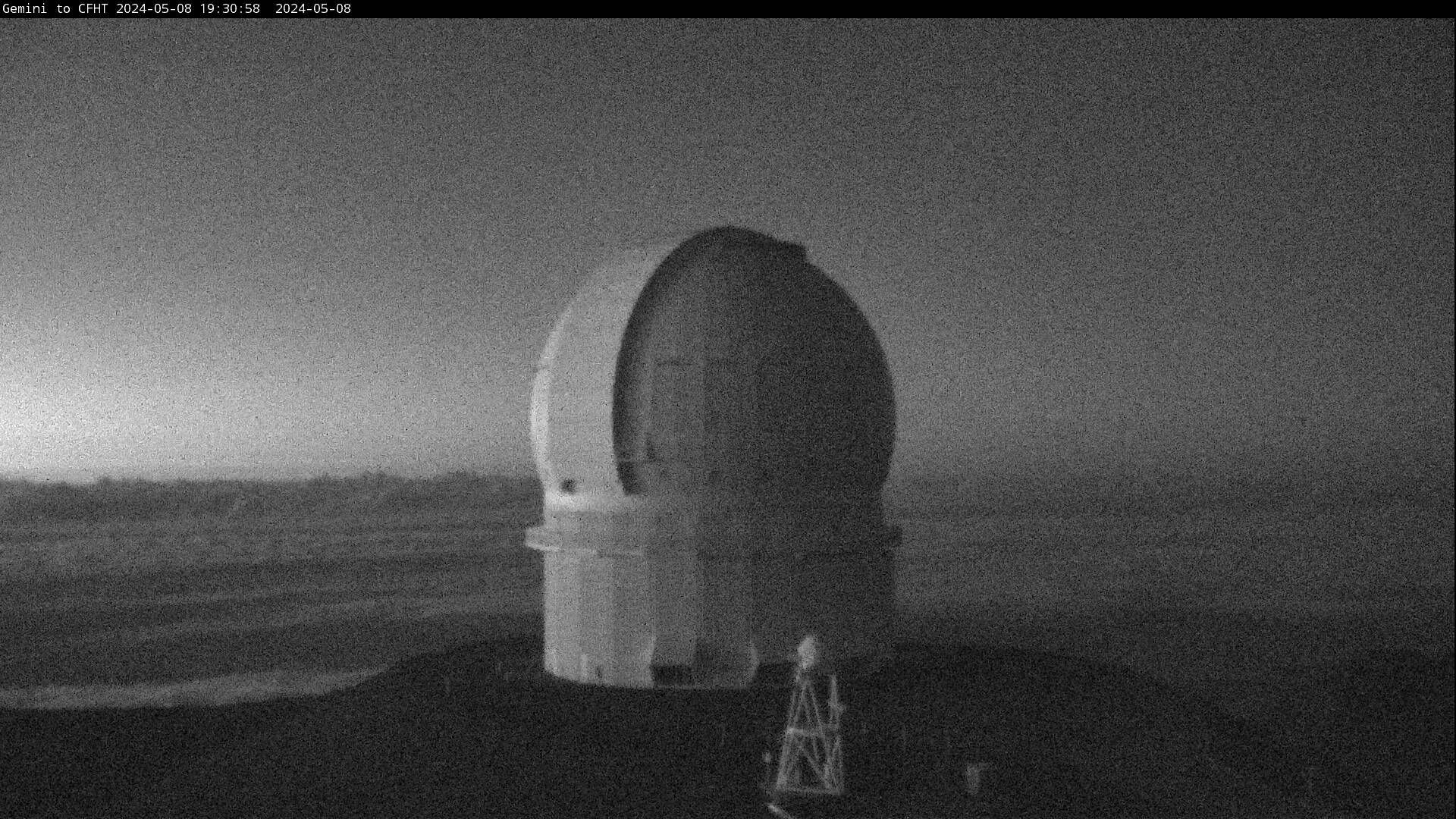
Canada France Hawaii Telescope (CFHT)
(13700 ft)
View looking south at the Gemini Telescope
atop a cinder cone at the summit of Mauna Kea
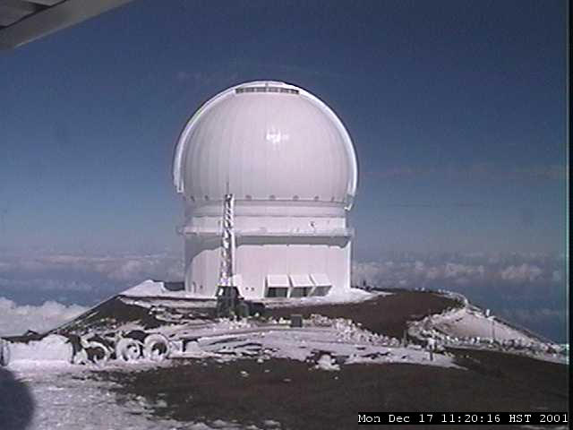
Canada France Hawaii Telescope (CFHT)
(13700 ft)
View looking north at the Canada France Hawaii Telescope
atop a cinder cone at the summit of Mauna Kea
James Clerk Maxwell Telescope (JCMT)
(13400 ft)
View looking east towards the summit of Mauna Kea
Subaru Telescope Catwalk Cameras
(13500 ft)
Four webcams looking in various directions, with views of the summit
cinder cones and other telescopes, plus a distant view of Mauna Loa
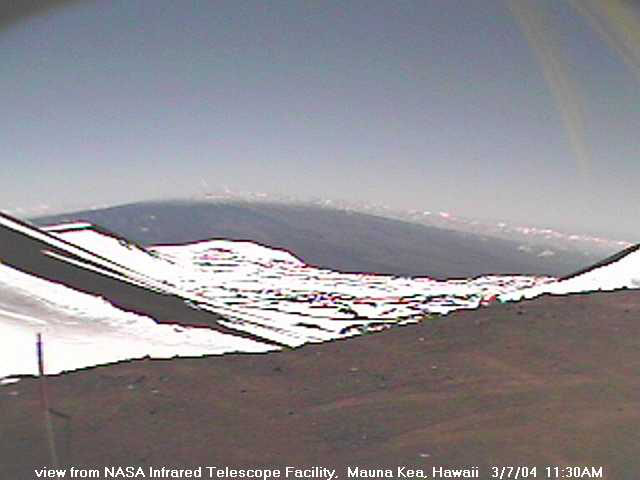
NASA Infrared Telescope Facility (IRTF)
(13600 ft)
Four webcams looking in various directions, with views of the summit
cinder cones and other telescopes, plus a distant view of Mauna Loa
Very Long Baseline Array (VLBA)
(12200 ft)
View of cinder cones and the radio telescope
located 3 miles below the summit of Mauna Kea
|
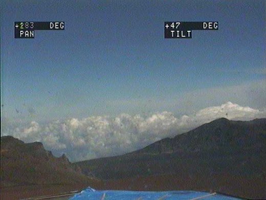
Mauna Loa
13680 ft / 4170 m
19.5° N, 155.6° W |
Hawaiian Volcano Observatory: Mokuaweoweo Cam
(13650 ft)

Panoramic view of Mokuaweoweo, the summit caldera of Mauna Loa,
from a research camera positioned on the north caldera rim
Mauna Loa Observatory: Southwest Camera
(11100 ft)
View towards summit of Mauna Loa from 5 miles NE
Mauna Loa Observatory: Tower Camera
(11200 ft)
View looking east of observatory and high slopes of Mauna Loa
Mauna Loa Observatory: North Camera
(11100 ft)
View of Mauna Kea from 20 miles SW, high on Mauna Loa
|
|


|
Haleakala
10023 ft / 3055 m
20.7° N, 156.3° W |
Haleakala Crater Live Camera
(9800 ft)
View of Haleakala Crater from the crater rim
Haleakala Observatories Camera
(10000 ft)
View of several telecope domes near the summit of Haleakala
|
|

|
|
|
|
|
MEXICO
Time Zone: CST (UTC-6)
Apr-Oct: CDT (UTC-5)
|
|
Mexico is home to numerous volcanoes, the highest of which are skiable
occasionally; only a few have any webcams viewing them
|
|
|
|

|
|
|
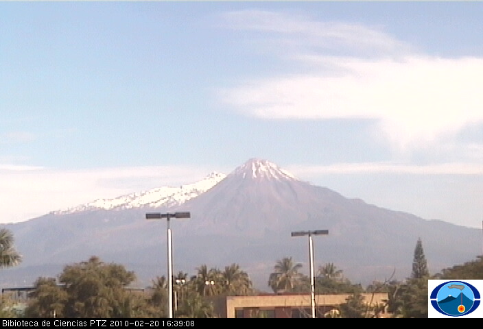
Nevado de Colima
14240 ft / 4340 m
Volcán de Colima
12660 ft / 3860 m
19.6° N, 103.6° W
|
Observatorio Vulcanologico: BC Cam
(1800 ft)
View of Volcán de Colima, with Nevado de Colima just behind at left,
from 20 miles south at the Library of Science, University of Colima
Observatorio Vulcanologico: Naranjal Cam
(4000 ft)
View of the active Volcán de Colima from 9 miles south
Observatorio Vulcanologico: Nevado Cam
(13000 ft)
View of Volcán de Colima from 3 miles north on slopes of dormant
Nevado de Colima (NOTE: offline since 2006, see 2004 eruption image)
|
Tancitaro
12615 ft / 3845 m
19.4° N, 102.3° W |
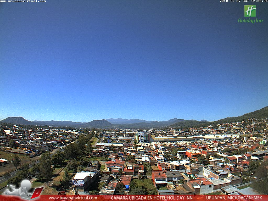
Uruapan Virtual Panoramic Webcam
(5400 ft)
View from 18 miles east atop a hotel in Uruapan of Tancitaro, an old
eroded stratovolcano (occasionally snow-capped), highest point of the
vast Michoacán-Guanajuato volcanic field which includes over 1400
vents, mostly cinder cones like Paricutin at right (formed in 1943)
Webcams de México Pátzcuaro Webcam
(7200 ft)
View from a hotel in Pátzcuaro of Lake Pátzcuaro and several
volcanoes in the Michoacán-Guanajuato volcanic field, including
Cerro el Bosque (2960+ m / 9700+ ft) at center from 10 miles south
|
Volcán Ajusco
12894 ft / 3930 m
19.2° N, 99.3° W |
Webcams de México Torre Latinoamericana Sur Webcam
(7800 ft)
View of Ajusco (right center), Volcán Tlaloc (12106 ft / 3690 m,
left center), and several other volcanoes over 10000 ft / 3000 m in
the Sierra del Ajusco-Chichinauhtzin range, from 18-25 miles north
on the 41st floor of the Torre Latinoamericana in Mexico City
|
Iztaccihuatl
17160 ft / 5230 m
19.2° N, 98.6° W |
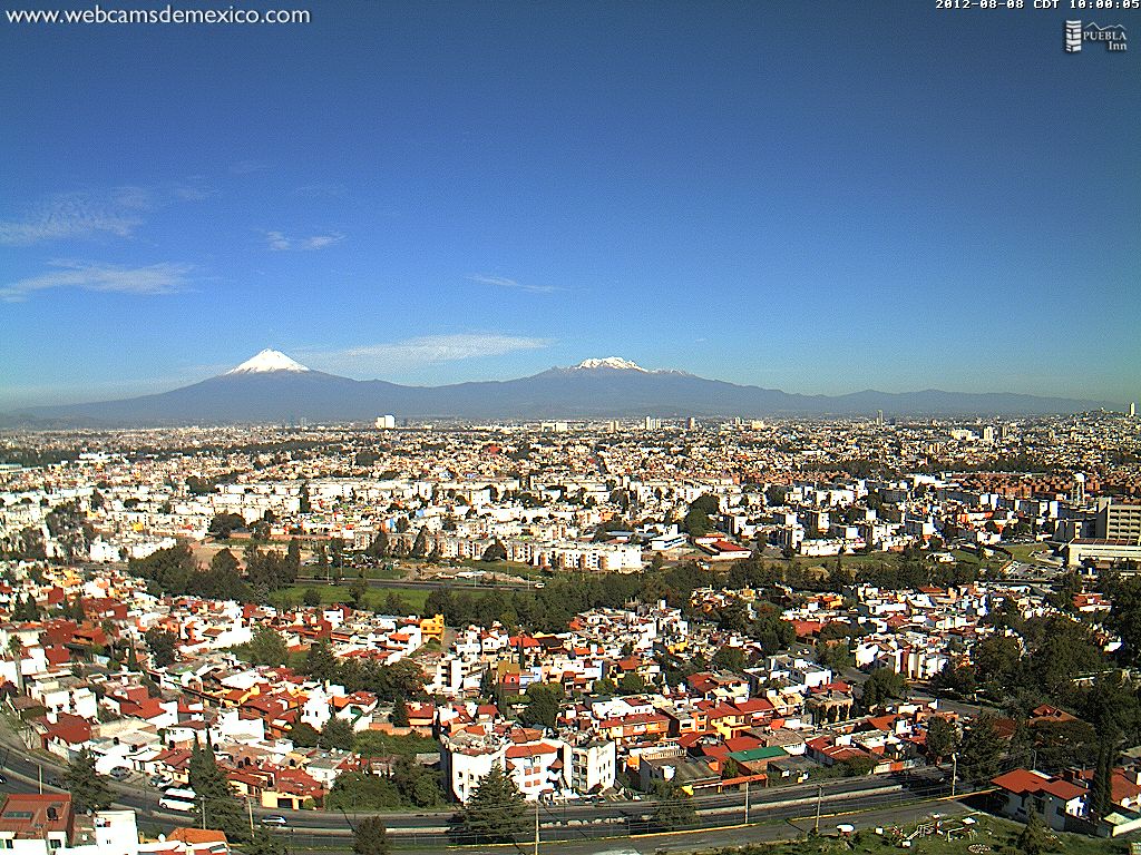
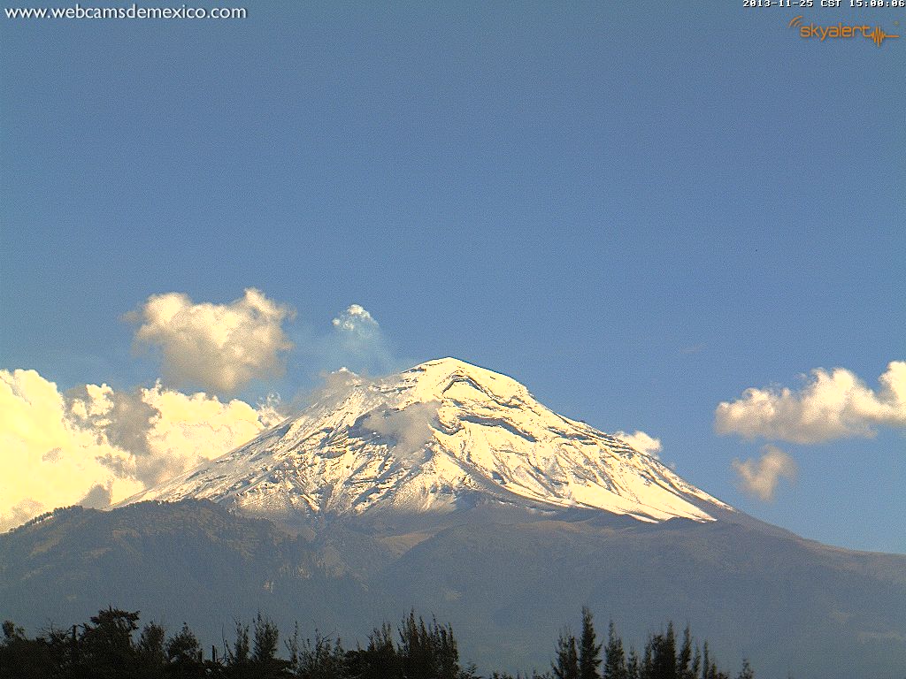
Webcams de México Puebla Webcam
(7200 ft)
Nice panoramic view of Iztaccihuatl from 35 miles SE and
Popocatépetl from 30 miles east atop a hotel in Puebla
Webcams de México Torre Latinoamericana Este Webcam
(7800 ft)
Distant view of Iztaccihuatl (right center) from 38 miles NW and
Popocatépetl (right) from 45 miles NW on the 41st floor of the
Torre Latinoamericana in Mexico City, with the old eroded strato-
volcanoes of Cerro Tlaloc (13533 ft / 4125 m) and Cerro Telapon
(13337 ft / 4065 m) at left center from 25 miles west (see example)
|
|


|
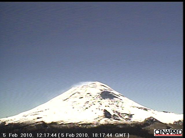
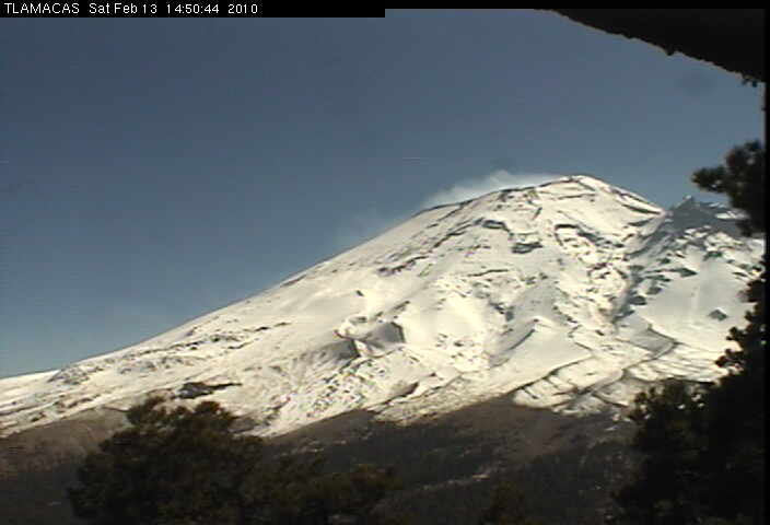
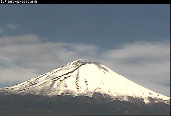
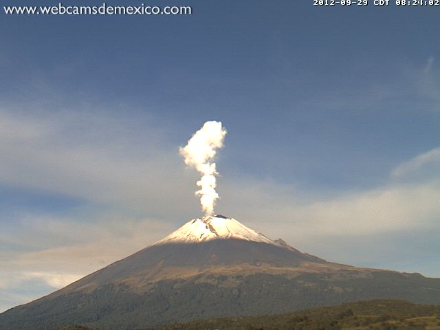
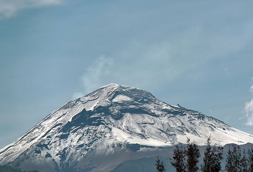
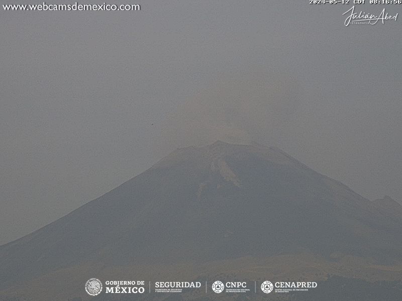
Popocatépetl
17930 ft / 5465 m
19.0° N, 98.6° W |
CENAPRED Popocatépetl Altzomoni Webcam
(13200 ft)
Nice view from 7 miles to the north at Altzomoni lodge
on the neighboring volcano of Iztaccihuatl
CENAPRED Popocatépetl Tlamacas Webcam
(13000 ft)
Close-up, foreshortened view from Tlamacas on the north flank,
about 4 miles from the summit
TELMEX Popocatépetl Webcams
(13000 ft, 13200 ft)
Choice of three views, two from Tlamacas and one from Altzomoni,
as continuously-updated Flash images
Webcams de México Popocatépetl Amecameca Webcam
(8100 ft)
Nice view from 13 miles NW at Amecameca
CENAPRED Popocatépetl Tianguismanalco Webcam
(7100 ft)
Nice view from 12 miles SE at Tianguismanalco
CENAPRED Popocatépetl Tochimilco Webcam
(6800 ft)
Nice HD view from 10 miles south at Tochimilco
Webcams de México Popocatépetl Webcam
(8000 ft)
Nice view from 9 miles ENE at San Nicolás de los Ranchos
|
Sierra Negra
15030 ft / 4580 m
18.9° N, 97.4° W
La Malinche
14636 ft / 4461 m
19.2° N, 98.0° W
|
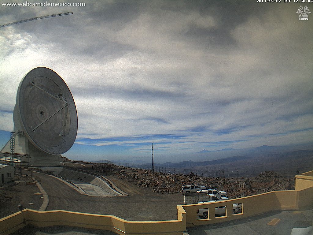
Webcams de México GTM Webcam
(15000 ft)
Nice panoramic view of the Large Millimeter Telescope
(Gran Telescopio Milimétrico) site atop Sierra Negra, with
La Malinche (50 miles WNW) along with Popocatépetl and
Iztaccihuatl (85 miles west) visible on the horizon at right
|
|


|
Pico de Orizaba
18410 ft / 5611 m
19.0° N, 97.3° W
Cofre de Perote
14408 ft / 4282 m
19.5° N, 97.2° W
|
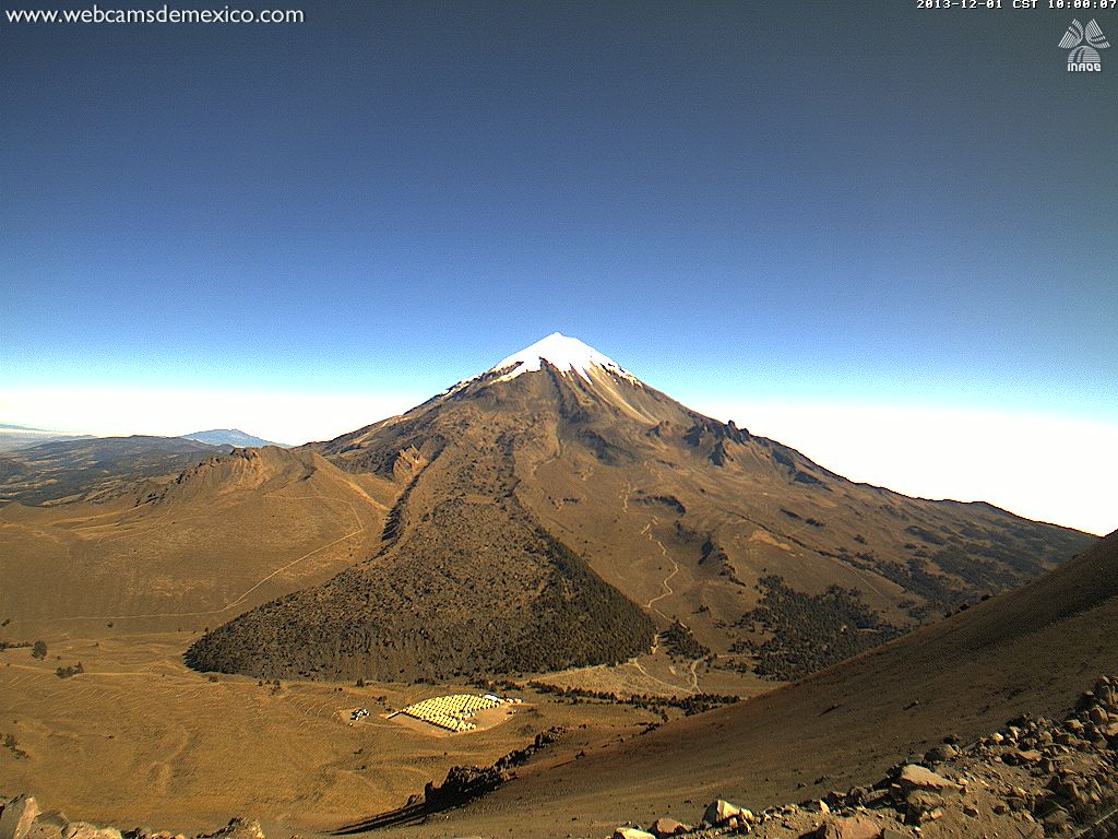
Webcams de México Pico de Orizaba Webcam
(15000 ft)
Excellent closeup view of Pico de Orizaba from 4 miles SW at the
Large Millimeter Telescope (Gran Telescopio Milimétrico) site atop
Sierra Negra, showing a massive lava flow extending almost to the
HAWC Gamma-Ray Observatory in the valley below; the shield of
Cofre de Perote is also visible from 35 miles SSW on horizon at left
|
|
|
|
|
| Image Size:
Large (150 px high)
Normal (110 px high)
Small (80 px high)
|
Fair Weather Image |
|
Most Recent Image |
|
|
Current Global Map of Day and Night:. |
|

|
|

|
|
|

|
|
|
|
|
|
|
Time Zones used on this page:
|
|
Time Offset |
|
Center
Longitude |
|
Current Time and Date |
|
Standard Time Zones |
|
Daylight Saving / Summer
Time Zones |
| UTC-10 | 150° | W |
2:21 PM | 18Jun2026 |
HAST Hawaii, Aleutians | |
| UTC-9 | 135° | W |
3:21 PM | 18Jun2026 |
AKST Alaska | HADT Aleutians |
| UTC-8 | 120° | W |
4:21 PM | 18Jun2026 |
PST BC, WA, OR, CA | AKDT Alaska |
| UTC-7 | 105° | W |
5:21 PM | 18Jun2026 |
MST ID, WY, AZ, NM | PDT BC, WA, OR, CA |
| UTC-6 | 90° | W |
6:21 PM | 18Jun2026 |
CST Mexico | MDT ID, WY, NM |
| UTC-5 | 75° | W |
7:21 PM | 18Jun2026 |
| CDT Mexico |
|
|
|
Many thanks to those who have set up and maintained these various webcams. This page would be quite empty without their time and effort!
If you know of any other webcams showing Cascade volcanoes or nearby weather conditions, please email me (thanks).
|
Click here to show the page history below for the Cascade Volcano WebCams page.
|
|